News
![]()
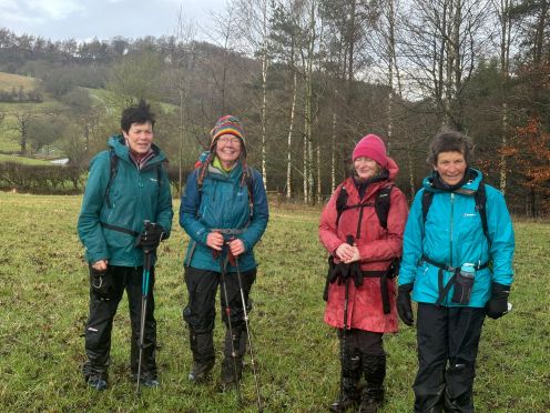
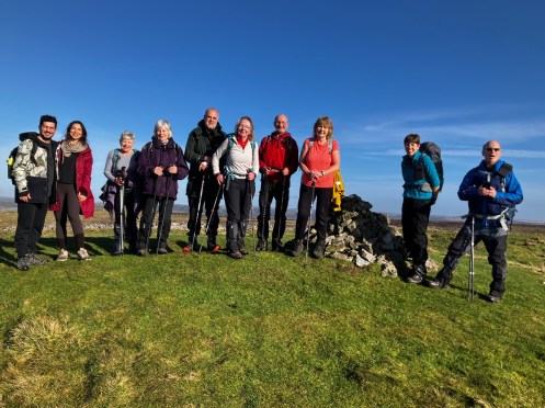
Wednesday 11th March
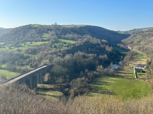
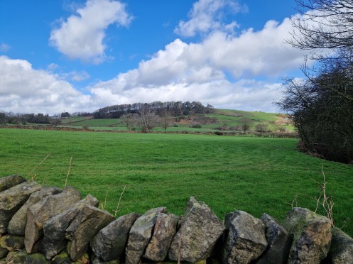
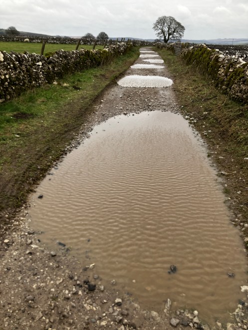
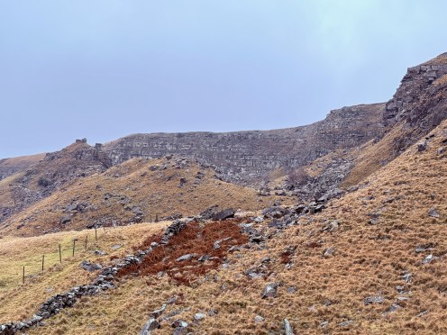
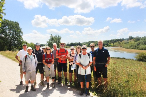
Great Dales
Leader, Report & Photos: Natasha
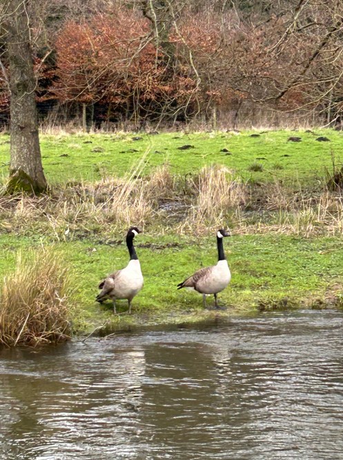
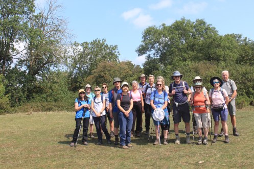
10.5 miles from Monsal Head enjoying the spring sunshine, views and local wildlife along the River Wye and over the hills from Bakewell to Great Longstone
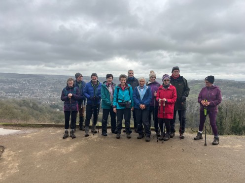
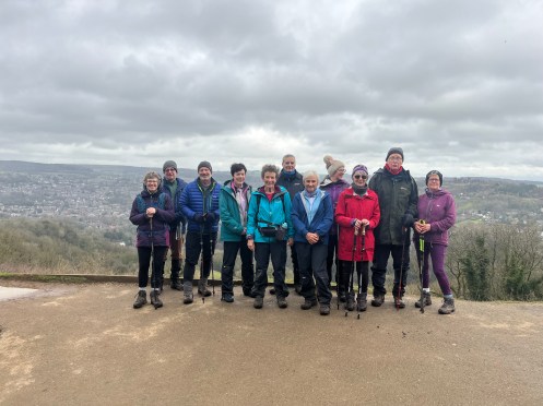
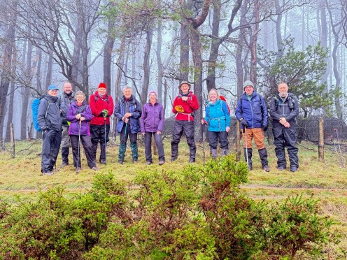
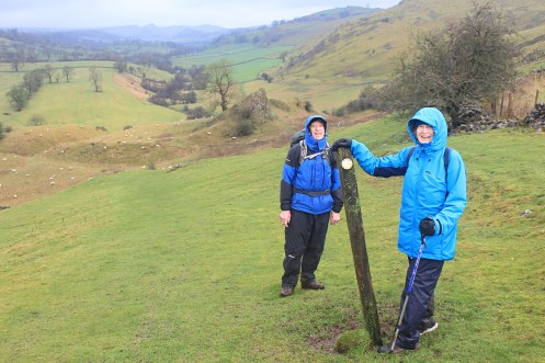
Wednesday 11th March
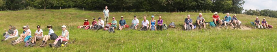
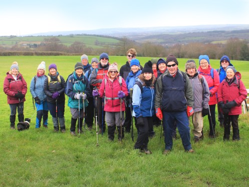
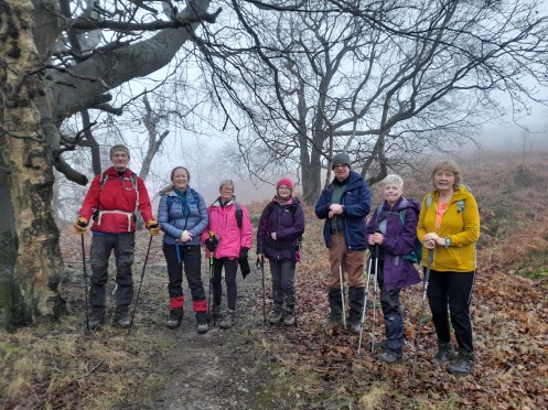
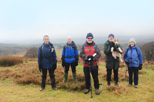
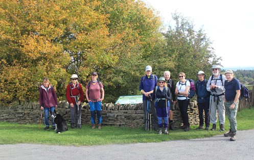
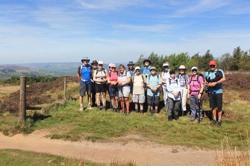
Wingerworth
Leader: Mike S Photos: Mel H
…
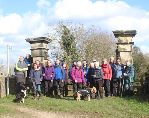
Todays group at Harpour Hill
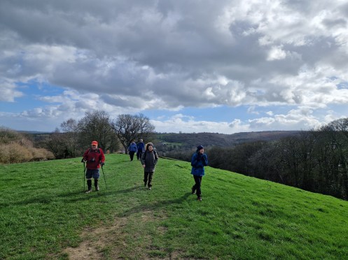
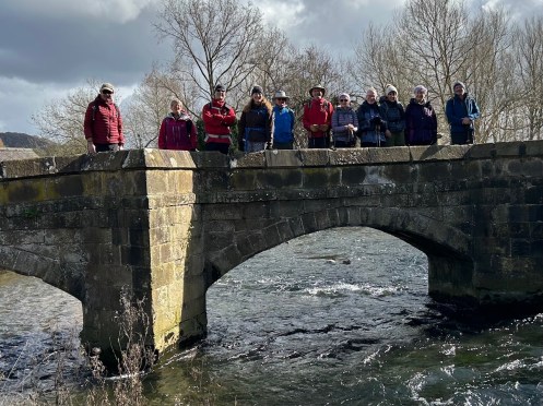
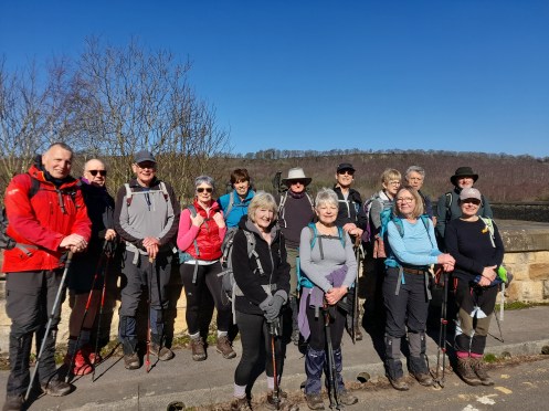
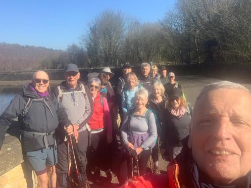
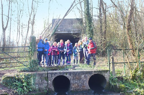
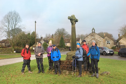
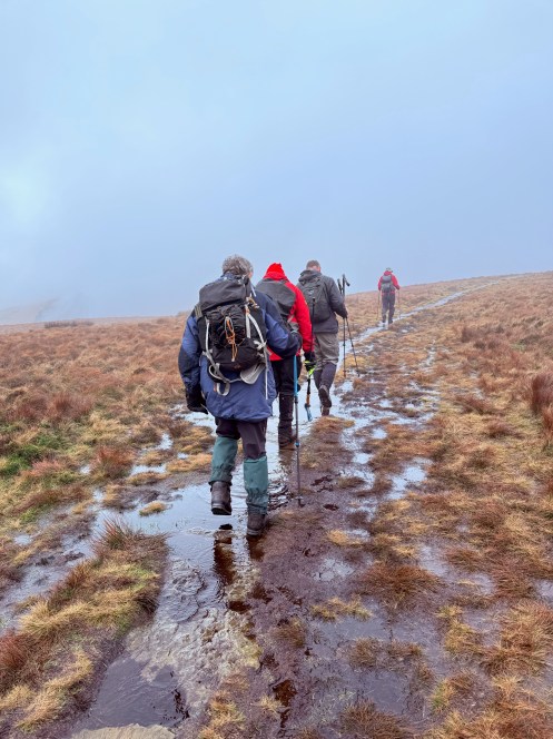
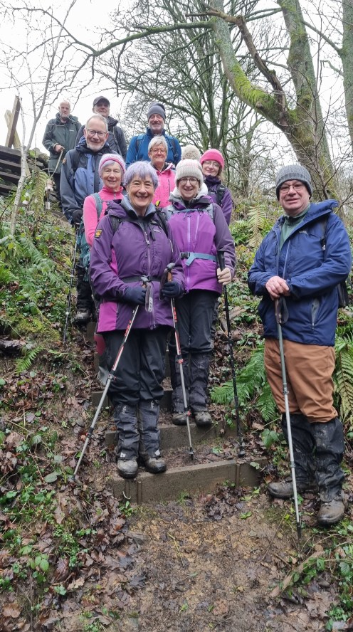
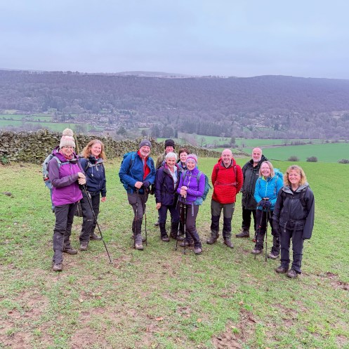
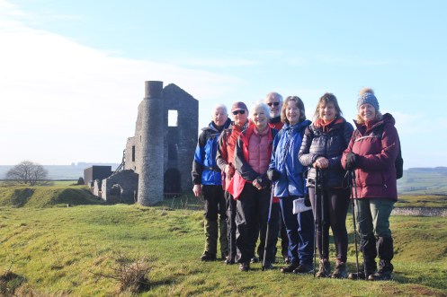
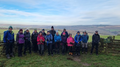
Sunday 8th March
Eyam
Leader, Report & Photos: Terry & Eileen
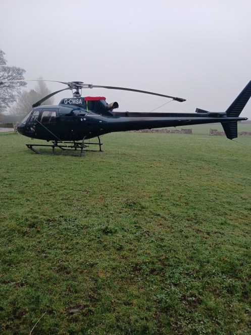
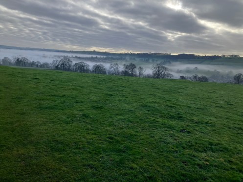
There were 16 ramblers on the 10 mile round walk from Eyam taking in Stoke Ford, Gt Hucklow, Stanley Moor and Tideswell Lane. The walk had added interest as there was a parked helicopter at Brosterfield farm. The walkers enjoyed delicious cherry and almond cake supplied very generously by Eileen even though she is unable to walk with the group as she is waiting for a knee replacement. The weather was mild with no wind but the wonderful views were obscured by a heavy mist that persisted all day. The photo was taken just below the Barrel Inn at Bretton.
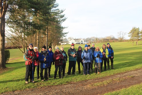
Wednesday 4th March
Limb Valley and Porter Valley Circular
Leader & Report: Sue G Photos: Sue G & Dermot
15 ramblers, including 2 visitors, enjoyed an eleven and a half mile round walk from Whirlow Brook Park. During the day, we soaked up the glorious sunshine and admired the views of Sheffield, the moors and more distant landmarks such as the Emley Moor Mast.Our route was varied, passing through parks and woods, across moorland, along conduits and lanes and through residential areas. Spring was in the air and we heard the bubbling calls of curlews, the songs of skylarks high in the clear blue sky, and, in sharp contrast, the screeches of parakeets in the Porter Valley.Thanks to all for an enjoyable day.
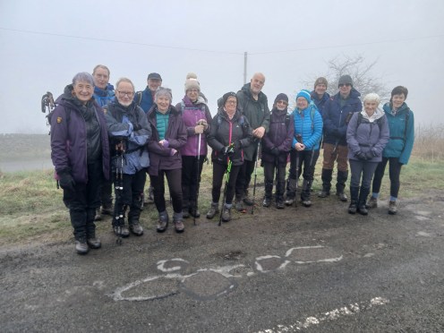
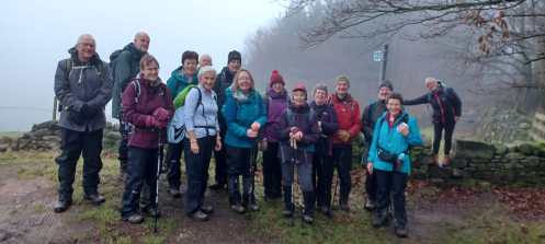
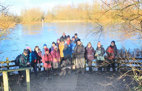
Wednesday 4th March
Creswell
Leader & Report: John R Photos: Mel H
A group of 16 walkers set off from Cresswell Craggs in dry but slightly misty conditions for this 8 mile walk. Our route took us around Whitwell Quarry and down to the edge of Cresswell for our morning break after about 2.5 miles. We then set off to enter Markland Grips and the local Nature Reserve. By this time the sun had appeared and was with us for the rest of the walk. Lunch was taken at the Church in Elmton, after which we headed off across some muddy fields to Cresswell Model Village and finally back through the “Craggs”.
Todays group – pic taken at the north eastern end of the site of the long abandoned Markland Grips Viaduct
Sunday 1st March
Bonsall
Leader & Photos: Lesley M
…
Wednesday 25th February
Monsal Head
Leader, Report: Mel H Photo: Vanessa
Commencing from the roadside just below Monsal Head the Wednesday Medium Car walkers proceeded to Little Longstone before turning north for the long steady climb to Chertpit Plantation and Longstone Edge. A turn here to head east along the lower reaches of the Edge then north again skirting the site of the now defunct Crossdale Head Mine Opencast workings before proceeding to the stand of trees at Water Rake for a coffee stop enhanced by Vanessa’s delicious apple bake. A short stop was made prior to the break for a group photo opportunity at the Kern.
From here way was made across a surprisingly dry underfoot Longstone more to follow the track alongside High Rake to reach Bleaklow. Turning south a steady descent was made to Rowland for lunch with an additional short stop made for “marmalade bagging”. On then to Great Longstone and Little Longstone finishing the wander with a very steady climb back to Monsal Head.
At the Kern Longstone Edge, photograph by Vanessa, (David Bailey eat your heart out).
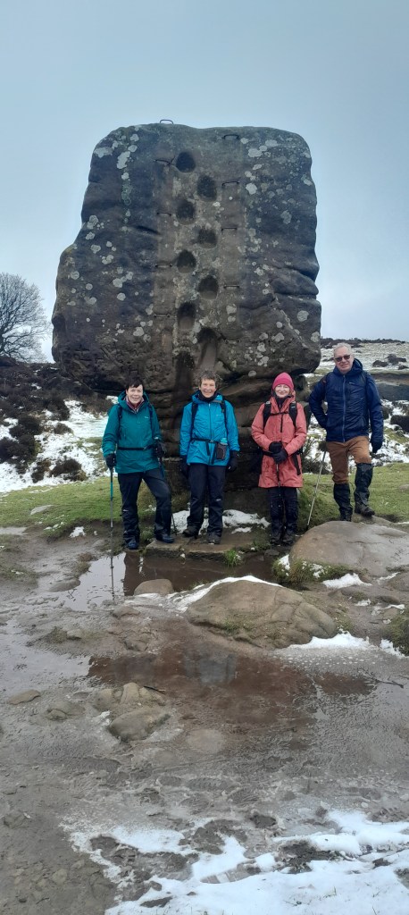
Saturday 21st February
Eyam – The Three Lows
Leader, Report: Mike B Photos: Mike B & Mel H
Foolow, Grindlow, Hucklow Edge, Great Hucklow, Stanley House, Tideswell Lane.
A group of 8 walkers met and set off from the free car park in Eyam. It was a calm still morning, damp underfoot with the forecast being a dry sunny day.
We made our way from the car park and headed through Townend to follow the footpath to Foolow. The route took the group through many fields and stiles, passing by the very small dale called Linen Dale. At the duck pond at Foolow the group took a coffee break, this was supplemented by homemade flapjack provided by Vanessa and chocolate teacakes provided by the walk leader. A group photo was taken at this location.
From Foolow, the group proceeded onwards through fields and on tracks to reach the tiny hamlet of Grindlow. Here excessive muddy conditions in a couple of fields at Rose Farm prevented the group following the original route up onto Hucklow Edge. So, the group continued to follow the narrow lane into Great Hucklow.
From this quiet village the group continued along the lane going away from the village to follow the farm track to Stanleymoor Farm. At last the promised sunshine and blue sky made a welcome appearance and remained so for the rest of the walk. After negotiating a series of difficult wall stiles and muddy fields the group proceeded to Stanley House for lunch in the adjacent field. After which, the group continued on the footpath through more fields and stiles to Brosterfield Farm to emerge in to Housley. From this hamlet the group picked up and followed the rough track ‘Tideswell Lane’ back into Eyam. This old bridleway was populated with many deep puddles to keep the walkers entertained!.
A fairly gentle walk and was enjoyed by the group. The dry sunny weather throughout made a pleasant change.
Distance: 7.1 miles
Elevation: 630 ft
Just fooling around in Foolow; just had extra goodies kindly provided by Vanessa and Mike.
Wednesday 18th February
Unstone
Leader: Hilary Photos: Mel H
…
Taken at Apperknowle sports ground; the smiles are due to them having just been fed.
Sunday 15th February
Winster
Leader, Report & Photos: Joan D
Despite a very sleety, wet and cold morning, 4 people decided to join me for the walk. I had rerouted and shortened the walk in view of the conditions. The descent down and then up to Birchover was absolutely lethal and progress was slow and cautious. However a circumnavigation of Stanton Moor was almost enjoyable and homemade biscuit eating was mandatory. The route continued back through Birchover and Elton to pick up the Limestone Way – 7.5 miles and an early 1.30 finish in almost dry conditions.
Wednesday 11th February
Alport Castles
Leader, Report & Photos: John G
11 walkers braved the weather forecast to make their way to Alport Castles via Crookhill Farm and Bellhag Tor. On the way a White Hare was seen scampering across the moors. The return route was via Alport Farm, Rowlee Bridge and the War Memorial on the banks of Ladybower. For once the forecast was completely wrong as there was a small amount of hill fog and no rain until we returned to the cars. The views were fabulous.
Treking across the moor
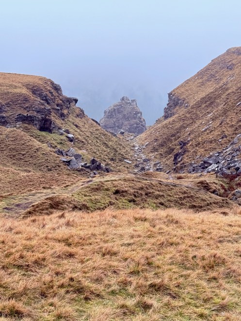
Alport Castles
Alport Castles
Wednesday 11th February
Hartington
Photos: Mel H
..
Pilsbury Castle as a backdrop
Sunday 8th February
Loxley Common
Leader & Photos: Kath P
..
Wednesday 4th February
Plague, Ford & River
Leader, Report & Photos: Sue G
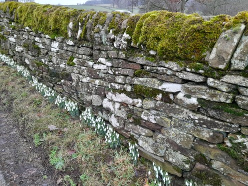
On a cold foggy morning, 8 of us set off from Eyam for a 10 mile round walk, taking in Froggatt, Grindleford, Leadmill Bridge, Hog Hall and Eyam Moor, but on this occasion, no ford. We decided to do the walk in reverse in the hope of the fog and lying snow clearing from Eyam Moor by the afternoon.
Negotiating muddy, slippery tracks and paths, we passed through atmospheric woodland dripping with moisture and scattered with moss-covered rocks and fallen tree trunks. From Grindleford, the Derwent Valley Way took us along the river to Leadmill Bridge, from where we began the ascent towards Eyam Moor. Wisps of fog were visible over the moor and we were optimistic that it would clear, but it was not to be and the ghostly shapes of our fellow walkers loomed ahead of and behind us.
In spite of the uninspiring weather, we saw encouraging signs of Spring: trees heavy with catkins, walls lined with snowdrops and birds searching for mates.
Wednesday 4th February
Heath Church
Leader, Report & Photos: Mel H
Using a diverted route, due to a damaged foot bridge, the Wednesday medium car group set out on an 8.5 mile walk from Heath Church accompanied by two visitors and not forgetting pipa and mini. Skirting the motorway junction, using the underpasses, a short steady descent led the group past the historic mining villages of Doe Lea and Bramley Vale to reach Hollingworth Wood. Here among the course grasses, left exposed as a result of extensive tree felling, small patches of rapidly melting snow adorned the edges of the footpath through Hucknall Wood. Following a brief discussions of the name Ault Hucknall the group took a leisurely coffee break in the Church cemetery. Across then to the Grange to enter Hardwick Park at Broadoak Hill and thence the steady descent via Blingsby Gate to Millers Pond. After skirting the pond a short stop was made at the visitors centre before continuing on to the ancient farming hamlet of Astwith for lunch. Following lunch a short section of road and field edge walking led to a section of the five pits trail. The trail was then used to skirt around the village of Holmewood and join with a short section of the Chesterfield Round walk for the return Heath.
Sunday 1st February
Calver Sough
Leader, Report & Photos: John G
The forecast was for some rain – the reality was fog which eventually cleared, so unfortunately the best views which would have been during the first half of the walk were not seen. Climbing out of Calver Sough to Deep Rake, Black Harry Gate and onto Housley was all in mist and fog. Arriving at Cavendish Mill the weather had started to clear and you could see that some of the buildings were becoming the worse for wear. By the time we had descended the lane to the A623 in Middleton Dale and ascended through the woods to Eyam there were views to be had. The walk back to Calver Sough via the Riley Graves was a great improvement so the 11 walkers which included guests from Northampton and Stockport were very happy
The view of Froggatt Edge
Cavendish Mill
Wednesday 28th January
Moors and Edges
Leader, Report & Photos: Mike B
Route – Ashford in the Water, Little Longstone, Longstone Moor and Edge, Rowland, Great Longstone, Cracknowl Wood, Lumford Mill.
A group of 11 walkers met at the bandstand in Ashford in the Water.
The group included a member from Glossop and a young couple from Nottingham who wanted to join the walk as ‘guests’. They being interested in joining the `Ramblers and wanting to try out and experience a group walk. The route of this walk had been recently amended by the leader, from the original published version, to avoid the closed sections of the Monsal Trail.
It was a cold dry frosty start, with the village being shrouded in low cloud. The weather forecast was for this cloud to lift mid morning and sunny conditions in the afternoon. Thankfully no rain in the forecast and we did enjoy sunshine and blue skies for most of the walk
The group set off and followed the footpath passing Highfield Farm and onto the boggy path through the fields behind Thornbridge Hall and onto the Monsal Trail. The recent heavy wet weather making most fields on this walk muddy underfoot.
The group crossed the trail and followed the footpath through fields to reach Little Longstone. From here we made the steady climb up Chertpit Lane to come out of the low cloud to reach a sunny Longstone Moor. The views below us of the cloud inversions were much admired. See photos.
A welcome coffee break for the group was taken and some of the leaders home made flapjack consumed.
On reaching the Tumulus as the highest point of the walk at 1300 ft, we had opportunity to admire the great 360 views of the Peak District and a group photo was taken – see photo. The group then continued on the path for 1.5 miles along the Moor and the along Edge to reach the narrow track to descend into the hamlet of Rowland. From here the group followed the footpath through many fields to reach the village of Great Longstone. Lunch was taken at the cricket ground as it has many convenient bench seats.
After negotiating the back streets of Longstone to emerge onto fields again, the group headed towards the A6020 and to go under the Monsal Trail. After a short walk along the road the group followed the path up and through Cracknowl Wood to emerge past Cracknowl House and on to the hill overlooking Bakewell. The group descended down the bridleway past the old chert mine and onto Holme Hall.
The leader gave the group a short history about Holmebank Mine. Opened in 1865 and operating for nearly 100 years. It produced the very hard stone called ‘chert’, used for the grinding of pottery glazes. The flooded sections are now employed to train groups of cave divers.
After a short section of pavement walking at Lumford Mill the group then followed the footpath for a mile through fields towards Ashford in the Water and back to the start. The River Wye and its various weirs being evident for most of this section.
A varied circular walk with a nice amount of climb with good views was enjoyed and appreciated by all the group.
Distance: 10.3 miles
Elevation: 1300 ft
Wednesday 28th January
Over Haddon
Leader: Gavin Photos: Mel H
..
Wednesday 21st January
Chatsworth
Leader, Report & Photo: Vanessa & David
16 walkers braved the wet weather. Had the company of three visiting walkers. Lunch was taken along with a friendly cow at Baslow Edge quarry.
Distance: 8 miles


Wednesday 21st January
Along the Edge
Leader, Report & Photo: Jane & Nigel
12 hardy ramblers (or ramblers who had not thought this through!) turned up at Redmires to walk along Stanage Edge and onwards. The car park was slightly misty but we could still see one another. Up to Stanage Pole and onwards where the weather got wetter, mistier and colder. With nowhere to shelter for coffee we soldiered on for an early lunch break, where everyone was made to smile for the photo so that we looked as though we were enjoying the experience. After a quick lunch the decision was made to abandon ship and we headed back as quickly as we could so that leaky boots could be emptied and clothes could be stripped off. The walk, however, made the record books for the earliest finish at 2 o’clock clock. Well done to the heroic dozen for the 7 and a half miles covered.

Sunday 18th January
Eyam
Leader & Photo: Naomi
…
Sunday 18th January
Round Walk 2026
To commemorate the 21st anniversary of the Chesterfield Round Walk (RW), the Chesterfield and NE Derbyshire (CNED) Group Ramblers’ committee will be holding
a set of walks over four Bank Holiday Mondays. These walks will cover the route of the RW for those walkers who cannot complete the whole RW in one go. Please
contact one of the leaders below to join any or all of the walks. At the end of the last walk, we will be having a celebration meal at the White Hart for anybody who wants
to come – let one of the leaders know.Full walk information including start points, routes, contact details are available to download here
Saturday 17th January
Totley
Leader: Gavin Photos: Mel H
…
Longshaw looking West towards Sir William Hill.
Wednesday 14th January
It’s going to be Muddy!
Leader & Photos: Kath P
…
Wednesday 14th January
Beauchief Abbey
Leader: Rhona Photo: Mel H
…
At Beauchief Golf Course
Saturday 10th January
Poolsbrook Country Park
Leader, Report: Mel H Photos: Mel H & Vanessa
Brilliant winter sunshine accompanied the Saturday group as the set of on a walk from Poolsbrook Country Park. Skirting the end of the lake, and dodging the many water birds, some skating on the ice covered lake surface whilst others took advantage of the small areas of ice free pools. Thanks to a little research by Dave K I can report that the large and rather striking ducks we saw on the lake were Muscovy Ducks; the gentle giants of the duck world.
Once around the lake the path through the Nature Reserve was used to reach Tom Lane. A short section of road walking led to the crossing for Staveley Road and the entrance to the footpath leading to Bower Plantation. Skirting the plantation the group continued past the site of the long since defunct Adelphi Mine to reach the track for the former LNER line where a short coffee break was taken.
Crossing the track bed the next section of the walk led to Calow where the route of a section of the Chesterfield Round Walk was used to reach and pass through Westwood. After passing through Ringwood lunch was taken at the Hub before using the canal side path to reach the Staveley Basin. A short detour was made around the canal restoration works to cross the new TPT trail bridge. The trail was then used to return to Poolsbrook Country Park.


Wednesday 7th January
Grassmoor Country Park
Leader: Mike S Photo: Mel H
…
Wenesday medium walk group at Wolfie Ponds
Wednesday 7th January
Hope
Leader: Elaine Report: John Photo: Tricia
11 sturdy walkers arrived to ascend the heights around Hope but the extreme winds and cold temperatures resulted in the walk being amended to a low level route around the valley. A wise decision which resulted in an early finish.

Sunday 4th January
Mytham Bridge
Leader, Report & Photos: Kath P
A small group of 10 braved the freezing temperatures taking us over Win Hill.


Thursday 1st January
New Years Day – wishing all members a very happy 2026!
Leader & Report: Mel H Photos: Mel H & Joan D
In order to get things moving for 2026 a group of members met at Hope for the now traditional New Year’s Day walk. Following Peakshole Water to reach Castleton an extended coffee break was taken in the village where we all but overwhelmed the cafe taking up both floors. Refreshed and enthused by the weather a decision was taken to do the extended version of the walk commencing with a gentle ascent to the bottom of the ridge at Woodseats just east of Mam Farm. From here the path below the ridge was taken, leading to Only Grange Farm, before descending to the Hollowford Road. We then turned east for Lose Hill Hall, Spring House Farm and the lower slopes of Lose Hill for the gentle descent to Hope. The majority of the group then assembled in the Grasshopper Cafe for tea, cakes and bacon butties to round off the day.


Wednesday 31st December
Baslow
Leader, Report & Photo: Mike
It might be New Year’s Eve but it was also a Wednesday, and 20, including 2 guests from Lincolnshire & Sheffield 40s , defied the time of year to ‘end the year on a high[ke]’. After meeting in Baslow, the route took us through Chatsworth Park to Edensor, then on to Ball Cross Farm, Coombs Rd, Manners Wood and the Russian House. 11.5 miles walked in 5 hours with glorious Winter sunshine throughout. Thanks to all who attended
")

Wednesday 17th December
Whirlow
Leader, Report & Photo: Clive & Pauline
13 Ramblers assembled on a grey day in Whirlow Park Sheffield for an exploration of the Porter and Limb valleys. We walked through all 3 sections of the beautiful Ecclesall Woods and visited the Wood Colliers Grave (as sung about by Richard Hawley). After some festive flapjack and other treats we walked through Whirlow and down to Forge Dam cafe. At this point a heavy shower blew through and we took shelter in the cafe’s marquee! After more festive food we ascended the Porter Valley, passed the Alpaca farm and reached Ringinglow. A quick descent took us back to the car park and, for some, a welcome cuppa in the cafe.

Wednesday 17th December
Bamford & Christmas Dinner Walk – Harthill
Leader, Report & Photo: Vanessa & David
18 walkers today on our short 5.7mile walk before the Christmas Meal. We could have done with a walk afterward to work off some of the very generous servings.
Merry Christmas all.

Saturday 13th December
Bamford & Stanage
Leader: Gavin Photos: Mel H
…


Sunday 7th December
Ashover
Leader: John & Tricia G Report & Photos: John G
16 determined walkers (including both past and present Group Chair) enjoyed the walk around Ashover in wet conditions. Even though people were soaked it was an enjoyable Sunday.

Saturday 6th December
Shillito Wood
Leader & Report: Barbara M Photos: Sue G
Totley Moor, Big Moor and Ramsley Moor from Shillito Woods.
Six intrepid walkers set off for a nine mile walk over the Eastern Moors from Shillito Woods on a very soggy day. The route went out along the footpath towards Smeekly Wood and then up towards the eastern edge of Big Moor before crossing over to Totley Moor, onto Big Moor via White Lodge and finally Ramsley Moor. A lot of the views from the moors were lost to low cloud but the weather cleared to give us lovely views of the winter landscape towards Curbar Gap and Chatsworth when we reached Ramsley Moor. It was lovely to see Isobel who joined us for the walk.

Wednesday 3rd December
Monsal Head
Leader: John & Tricia G Report & Photos: John G
A group of 14 walkers set off from Monsal Head along the trail and over the tunnels taking in the fantastic views of Cressbrook and the dale below to have a break at Litton Mill. The route then progressed towards Litton via Slackside and Cressbrook Woods and then back to Monsal Head across the flooded Cressbrook Dale at the base of Tansley Dale, Wardlow and Longstone Moor. 11 miles completed on a good mostly clear Winter’s day.

Rucksack in need of a new home
A member has a 50ltr rucksack available, free to a good home. If any of our members are in need of a good piece of kit, please contact via the website (or Mel H directly) and we can put you in touch. Thankyou.

Wednesday 3rd December
Winster
Leader & Report: Mel H
Ethereal mist enveloped the Wednesday medium car group as they left Winster for a 7.5 mile walk taking in Luntor Rocks, Brightgate, Upper Town and sections of the Limestone Way. Coffee was taken overlooking Wensley Dale and lunch near Whitelow Farm. The route included passing through the remains of the Led Rakes dotted around the area of the now defunct Bonsal Mines. The return to Winster was accompanied by a watery sun creating a surreal effect over the village.
Rucksack in need of a new home
A member has a 50ltr rucksack available, free to a good home. If any of our members are in need of a good piece of kit, please contact via the website (or Mel H directly) and we can put you in touch. Thankyou.
Sunday 30th November
Rowsley
Leader & Report: Peter S Photos: Kath P
…

Wednesday 26th November
Lets Get Giddy
Leader & Report: Jane & Nigel Photos: Clive
On a sunny day, when we thought it might rain, 21 intrepid ramblers turned up to Matlock ready for Giddy Edge. Despite any initial concerns the brave group traversed Giddy Edge with smiles all the way – a first for everyone. On to Matlock Bath for a break and toilet stop before the steep ascent out of the village to the welcome flat at the top. Great views all the way to Winster. With time running away from us a shorter, lowland route was taken back to Matlock – for some reason people seemed to be pleased that they didn’t have to climb the last steep hill! An enjoyable day and a giddy reprise will be held in the summer with the full route.
")
Wednesday 26th November
Ashopton
Leader: Gavin K Photos: Mel H
…


Wednesday 19th November
Harthill
Leader & Report: John R Photos: Mel H
17 walkers set off from Harthill on a cold and breezy day, but otherwise dry. The only significant ascent was for a few hundred metres out of Harthill, thereafter the route could genuinely be described as “leisurely”. Our first stop for a short break and refreshments was at the delightful church in Thorpe Salvin with its historic wooden Tudor Arched porch protecting the magnificent Norman Arched carved stone doorway. Our route then took us through the village before heading off across fields and woodland to join the Chesterfield canal where we followed the towpath heading in the direction of Kiverton. This section was a pleasant stroll as we were sheltered from the icy wind for most of the time. We finally had a shortened lunch break on a rather exposed part of Kiverton Lakes, but at least we had seating on benches and some well placed large stones. That left approximately 45 mins back to our starting point in Harthill. The total distance was 8 miles and we were back any the start at 13.30, illustrating that we did not “hang around” in the cold wind. My thanks to the members who came out on a cold wintery day.

There is light at the end of the Tunnel (at least there will be when it is re-opened); Entrance to Norwood Tunnel.
Wednesday 12th November
Quarry Vistas
Leader, Report & Photos: Joan D
Despite the weather forecast, 5 brave souls donned full waterproofs to enjoy a walk circumnavigating the many quarries surrounding Wirksworth. However the weather was fairly kind and the morning proved dry, but the views from Middleton Moor were only in the imagination. A heavy shower followed lunch but at least we finished in the dry.
Distance: 10.5 miles


Wednesday 12th November
Holmefield
Leader, Report & Photos: Vanessa & David
10 walkers today. Rain kept off until near end of the walk. Managed to walk a few paths we had not walked on before.

Wednesday 5th November
Fox House
Leader: Hilary P Photos: Mel H
…


Wednesday 5th November
The Lady is Hopeful
Leader: Natasha Photos: Natasha & Mike
…


Monday 3rd November
Walk Update for 3rd December
from Mel Hardy
Just a quick update for any walkers interested in the Winster Walk on 3rd December. Due to lack of clarification regarding accessibility of the footpath through Jughole Wood, the walk has now been rerouted and will instead be 7 miles with 800ft ascent. We realise this is a significant change from the programme but do not want to risk problems at this time of year. Sorry for the late change.
Sunday 2nd November
Cutthorpe
Leader: Naomi & Chris Photos: Mike & Simon
…


Saturday 1st November
Monsal and Bakewell Circular
Leader, Report & Photos: Mike B
Route – Little Longstone, Great Longstone, Bakewell, Ashford in the Water, Monsal Trail
A group of 7 walkers met at Longstone Road at Monsal Head. The group included two members from Worksop Rambers. The weather forecast was for early odd showers and it clearing up before lunch.This remained so for the duration of the walk and the group were treated to blue skies.
The group set off and followed the road down past the Pack Horse Inn to pick up the footpath across 5 fields towards Great Longstone. After negotiating the back streets of Longstone to emerge onto fields again and joined the Monsal Trail for a short section. Then came off and headed towards the A6020 and to go under the Monsal Trail. After a short walk along the road the group followed the path up and through Cracknowl Wood to emerge past Cracknowl House and on to the hill overlooking Bakewell and a suitable place for a coffee stop. Good views across towards Longstone Edge and Rowland.
After this break the group descended down the bridleway past the old chert mine and onto Holme Hall. A group photo opportunity was taken at the bridge here. After which the group followed the River Wye into Bakewell and around the busy town centre to find the footpath through the churchyard at the All Saints Church, Bakewell and on to the footpath that heads East behind the church. This section was a steady climb and after crossing Stanedge Road the group dropped down to very boggy section before Crowhill Lane. A bit of nifty footwork was required here to avoid having boots full of mud but all was well. After which the group continued across uphill across fields to reach Lower Cowden Farm and lunch was taken here.
The group followed the lane for 1/2 mile going past Dirtlow Farm to then take the footpath down past the mast and the steady descent into Ashford in the Water. An opportunity use the toilets here was taken before the group moved on through the village passing Highfield Farm and onto the boggy path behind Thornbridge Hall and onto the Monsal Trail. The group crossed the trail and followed the footpath trough fields to reach Little Longstone and returned to the start.
A varied circular walk with a nice amount of climb and was enjoyed and appreciated by the group.
Distance: 8.6 miles
Elevation: 1300 ft


Wednesday 29th October
Redmires
Leader: Elaine Report & Photos: John G
12 walkers including three visitors enjoyed a lovely 11 mile walk from Wyming Brook to Stanedge Pole, Stanage Edge, Moscar Cross, Crawshaw Head and Wyming Brook Drive. The views, as ever, were marvelous and it is a shame that the trees have lost some of their gloriously coloured leaves in the recent high winds.


Wednesday 29th October
Pleasley Country Park
Leader, Report: John R Photos: Mel H
18 walkers joined this walk today. The weather was mild and overcast, however, we had had some heavy overnight rain, but that said the ground conditions were generally good on the route, which was essentially well known trails and tracks. So, from Pleasley we headed off through Rowthorne and on to the Church at Ault Hucknall for our morning break. Then into Hardwick Hall Park and it was at this point that we split into two groups with a few members heading straight to The Stable Yard at The Hall while the remainder took a longer and more demanding route down to the bottom lakes and then back up the hill to join our colleagues in The Stable Yard for lunch. After lunch it was a nice gentle ‘wander’ round the back of the Hall and out of the grounds passing Norwood Lodge before joining the Teversal Trail back to Pleasley. The sun even joined us on the latter part of the walk. My thanks to all who supported the walk.
8.5 miles walked.

Millers Pond Hardwick in Autumn colour.
Saturday 25th October
Limb Valley & Porter Valley Circular
Leader, Report: Sue G Photos: Mel H
7 ramblers, including 2 visitors, met at Whirlow Brook Park on a beautiful sunny morning to begin the climb up the Limb Valley to Ringinglow. The lovely blue sky was the perfect backdrop to the many-coloured leaves of the autumnal trees.
From Ringinglow, we headed through Lady Cannings Plantation to the Oxstones. We had intended to take our coffee break here, but the wind was bitingly cold, so we continued for a while and found a sheltered hollow amongst the disused workings at Brown Edge Quarries.
Arriving at Clough Hollow, we had a magnificent view of distant landmarks, including Holme Moss transmitter, & possibly Lincoln Cathedral. Our route then took us into Porter Clough, and along Porter Brook to Forge Dam & Greystones. We returned in the direction of Ringinglow via Wiremill Dam, where we were treated to the sight of a heron perching on a half-submerged branch.
The field paths we then took towards Ringinglow Road, climbed out of the Porter Valley & afforded wonderful views of Sheffield. Finally, an easy descent along Coit Lane took us back to Whirlow Brook Park.
9.5 miles walked


Wednesday 22nd October
To the Woods
Leaders & Report: Jane & Keith Photo: Jane
15 ramblers, including 2 from East Staffordshire Ramblers and Mavis, the dog, met at Holmesfield for a 10 mile walk across Totley moor and to Cordwell Valley and Barlow. The weather was sunny and warm, apart from a bit of rain on the moorland. We spotted a stag and does near Gillfield wood. The views were wonderful, especially looking towards Cordwell Valley.

Wednesday 22nd October
Cutthorpe
Leader: Graham Photos: Mel H
…

Holmebrook Valley Park the team in colour.
Sunday 19th October
Teversal
Leader, Report & Photos: Peter S
Eight walkers and one dog set out from Teversal visitor centre on a lovely sunny autumn morning. We headed towards Pleasley Pit enjoying a coffee break on the way, which was supplemented with a slice of homemade Spiced American carrot cake. We carried on along Rowthorne Trail and on to Hardwick where we took lunch. After lunch the rain began and continued until the end of the walk. We walked through Lady Spencer’s wood and along to Norwood. After walking along the Teversal Trail we went into Silverhill county park and up to the Miners statue. Then headed back to Teversal.


Saturday 18th October
Back Tor and Derwent Edge
Leader: Barbara M Photos: Mel H
…
")
")
Wednesday 15th October
Grouse Inn
Leader: Kath K Photos: Mel H
…


Saturday 11th October
Holymoorside Circular
Photos: Mel H
…
At the interpretation panel at Hollins.
Wednesday 8th October
Autumnal Splendour
Leader, Report & Photos: Dermot T
14 walkers, including one visitor from Loughborough, took part in a very pleasant walk from Hathersage and up onto Stanage Edge.
We began the walk from Hathersage Station on a cool, dull morning half expecting some rain to fall at some point. We made our way up the path to Dennis Knoll and stopped for coffee to take in the views on the path leading to Stanage Edge. After enjoying the freshly prepared rocky road and flapjacks we made our way up to the Trig Point for the obligatory photo shoot where the weather brightened up and as you can see the smiles were in abundance. From there we began our descent to Burbage for lunch and then onto Longshaw and down to Padley. We then had a very pleasant walk by the River Derwent along to Leadmill Bridge and then the short journey back up the road to the Station.We kept up a really good pace finishing the walk at 15.15. No rainfall and some lovely views of the stunning scenery in this part of the Peak District.Mileage 11.3mAscent 1257ft


Wednesday 8th October
Poolsbrook
Leader, Report & Photos: Mel H
With an excellent turnout the Wednesday medium car group set out from Poolsbrook Country Park using the path alongside Pools Brook and through the restored wetlands to reach Tom lane. Here the group turned west heading for Bower Plantation with a short stop to reflect on the route of the long lost Adelphi canal. Just before reaching Bower Plantation the group turned south to walk through the area where the Adelphi Ironworks were once located. Coffee was taken at the junction with now defunct rail bed for what was the midland railway line. From here a steady rise led to the White Hart public house at Calow and the junction with the Chesterfield Round Walk. The line of the round walk was followed through the ancient and delightful West Wood to reach Ringwo0od Park for lunch in ever increasing sunshine. Passing through Troughbrook, a short stop was made at the Hub before turning on to the Cuckoo Way for a stretch of canal side walking. At Mill Bridge Staveley the oportunity for a group photo was taken before we turned south for the return journey to Poolsbrook.


Saturday 4th October
Rowsley & Stanton Moor
Leader: Graham W Photos: Mel H
…


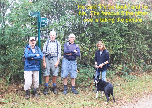
Wednesday 1st October
Chandler Hill Lane
Leader & Report: Terry & Eileen Photos: Mel H
Todays walk was attended by 11 members , including 2 visitors from the Amber Valley walking group.The distance covered was 8.5 miles
The weather was warm but overcast. The walk started by Ladywood garage opposite Chander Hill Road and proceeded through Birkinshaw Wood and Back Wood up to Upper Loads and continued to Longside Moor, which offered stunning views over Chesterfield and Holymoorside. Holymoorside was reached after passing through Harewood Road , Nab Quarry and Nab Plantation. The walk was completed after passing through Brookside and Lead hill Farm. The walk was enhanced by the impromptu lessons, given by Mel Hardy on all the different fungi that were encountered.


Wednesday 24th September
Derwent Edge Circular
Leader, Report & Photos: Sue G
A beautiful day for a walk taking in Derwent Edge, Abbey Brook, Bamford House, Briery Side, Grindle Clough and Whintone Lee Tor. Several steep ascents enabled us to take a route that gave us fantastic views of reservoirs and moors. The panorama before us from Lost Lad of Bleaklow, brought back memories of a walk earlier in the summer, that took us to Grinah & Bleaklow Stones; whilst from Abbey Bank, the view of Derwent & Howden Dams reassured us that the recent rain was improving the water levels, although there is still a long way to go.
An enjoyable walk with an enthusiastic group.
13 miles & 2100 ft of ascent.


Wednesday 24th September
Odin Mine
Leader: Gavin J Photos: Mel H
…
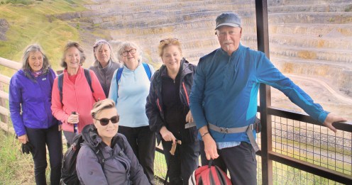
View from viewing platform Hope Cement Works quarry
Sunday 21st September
Monsal Head
Leader, Report & Photos: Terry & Eileen
12 ramblers on today’s walk (apologies for missing out Mike on the photo) Monsal Head enjoying the sunshine overlooking Longstone Moor and a recently blowndown tree providing an obstacle on the Monsal Trail.


Wednesday 17th September
Totley Tramp
Leader, Report & Photos: Natasha W
Photo on Totley Moor with a surprise guest!

Wednesday 17th September
Ashover
Leader & Report: John R
A small band of four walkers braved the inclement weather for this walk from Ashover. We started with the hardest part of the walk by ascending Farhill where we were briefly five as Neil joined us for a short time. Our route then took us around to Handley and the morning break for light refreshments. We then headed off to Ogston Reservoir for the highlight of the walk – an interesting “discussion” with a farmer about “Rights of Way”. However, we parted on amicable terms, if not quite agreeing on some of the finer points discussed. Lunch was taken at Ashover Hay Farm before finally heading back to Ashover, passing by Overton Hall.
Sunday 14th September
Out on a limb
Leader, Report & Photos: Mike B
10 met at Whirlow Brook Hall for a 13 mile Circular Walk, ever mindful that Storm Amy was forecast we didn’t waste any time. After walking up the Limb Valley, Houndkirk and Green Lane took us to Padley Gorge then Grindleford Station. Lunch on the edge of the Longshaw Estate gave us views over the Hope Valley, but by the time we had reached Fox House , Amy was making her presence known and Waterproofs were donned. On the return along Houndkirk, we met a group of Birdwatchers, who were patiently viewing and photographing a rare Dotterel, weather and time prevented us from staying too long , but we were shown Photos. Damp but not disheartened we arrived back at the Car Park in just under 6 hours.
")

Wednesday 10th September
Mytham Bridge
Leader: Gavin J Photos: Mel H
…

At Aston Hall – Aston; built around 1578
Wednesday 3rd September
Tibshelf Ponds
Leaders, Report & Photos: Mel H
A short stretch of the Phoenix trail and a couple of field paths led the group to the edge of Newton Green and Littlemoor. From here the walk headed south, basically parallel with the M1 motorway, using field paths to reach the village of Blackwell with a short stop to read up on the history of Jedediah Strutt who was born of farming stock in South Normanton in 1726. Strutt and his brother-in-law William Woollat developed an attachment to the stocking frame that allowed the production of ribbed stockings. Moving on the group walked past Hilcote Hall then turned east using the Blackwell Trail, (part of the Phoenix Trail), to reach the southern edge of Huthwaite with a coffee stop near the Trout ponds created for Hilcote Hall. Turning north a gentle climb led to the entrance to Brierley Forest Park where a leisurely lunch was taken at the Visitors Centre. The excellent trails through the park were used to reach another of the tracks, created from the many colliery connecting rail beds, to return to the ponds at Tibshelf.
Sunday 31st August
Hartington
Leaders, Report & Photos: Clive & Pauline
16 ramblers set off from Hartington on a walk exploring the highs and lows of the Upper Dove and Manifold rivers valleys. Coffee was taken on the summit of Carder Low before walking up the Dove Valley. Lunch was in Longnor market square and then the group returned through pleasant fields bordering the Manifold. A short climb brought us to Sheen and a return to Hartington. 11 miles

Saturday 30th August
Robins Forest
Leaders: Chris & Jill Photos: Mel H
…


Wednesday 27th August
Winners and Losers
Leader & Report: Joan D Photos: Joan D & Kath P
11 intrepid walkers bravely joined me in a walk of the battle of the giants. From Hope the spirited team reached Lose Hill in under an hour and were rewarded with an an early coffee break and chocolate biscuits. The pace was kept up down Back Tor to Hollins Cross and then down to the Edale Valley. Onward and upward we made our way towards Edale YHA. I suggested an early lunch before the rain but within moments the raindrops arrived. After a quick lunch we marched onto Jaggers Clough before heading up the Roman Road. Despite being wet and bedraggled, the stalwart bunch reached Winn Hill just as the the sun came out. Everyone then dried out on the downward route back to Hope. Great appreciation of the A team who all made it a great walking day.


Wednesday 27th August
Beauchief Abbey
Leader: Rhona Photos: Mel H


Monday 25th August
Round Walk – Final Section

The last section of Round Walk, at West Handley, we tried kissing the frog but it would not turn into a prince.
Saturday 23rd August
Exploring South Yorkshire
Leader, Report & Photos: David B
After plums and pearl tomatoes were shared around, 7 of us set of on a warm and pleasant day from Kiveton Community Woodland for our 10 mile walk. We walked to the Eastern Portal of the Norwood Tunnel on the Chesterfield Canal and took a path out of sight of the actual canal which forms part of the Rotherham Ringway. At Kiveton Park Station we went up through the old quarry and across a very large field where fortunately the corn had been harvested. At the farmyard, an eagle eyed member of out group spotted the engraving high up on a very large stone barn showing it had been built in just 135 days by a former prisoner of war, August Schleusener
We continued to Todwick and had our coffee break in the churchyard – where the church dates back the 11th century and appears to be thriving today. We followed a long and very pleasant track to South Anston, past another fine church and continued on around the well screened fringe of a another,large, quarry, where we had our lunch break. Our route then took us on to the Chesterfield Canal towpath and alongside the Summit Pound- the highest point on the whole 46 mile length. We continued to Kiveton Park, where we looked at the information board relating to the time when huge quantities of locally quarried stone was taken down the canal , transhipped into larger boats and sailed down the east coast and up the Thames to the Houses of Parliament. The stone was then used to rebuild Parliament following the huge fire in 1834.


Wednesday 20th August
Beauchief Abbey
Photos: Mel H


Sunday 17th August
Tideswell
Leader, Report & Photos: Terry & Eileen
15 Ramblers turned out at Tideswell for a 11.5 mile around Wormhill with superb views. The photo is taken at the top of Cheedale nature reserve

Saturday 16th August
Fox House Circular
Leader & Report: Sue G Photos: Mel H
10 ramblers and 2 dogs set off from Fox House along Houndkirk Road and crossed Burbage moor to reach Burbage Edge, accompanied by the sweet smell of the heather that was beginning to flower. Although it was overcast, there were good views of Karl Wark, Higger Tor and Stanage Edge.
We cut our mid-morning break at Upper Burbage Bridge short, as the midges were out in force, and soon headed towards Higger Tor along a wide rocky path, before ascending onto the summit plateau. A contouring path on the western edge took us down to Hathersage Moor and onto a path beneath Millstone Edge.
At Lawrence Field Quarry we had an early lunch and watched the intrepid climbers tackling impossible looking routes up the rock face. As we sat there, a herd of cows crossed amongst us, heading for the pool of water at the foot of the cliff. They were completely unfazed by our presence or the dogs, intent only on a drink of water.
Leaving this tranquil scene, we walked through the remnants of ancient birch and oak woodland to Padley Gorge, Longshaw and back to Fox House, where, appropriately, we enjoyed “Wainwright’s Rambler” beer.
8 miles walked


Wednesday 13th August
Crook Hills
Leader & Photos: Kath P
…


Wednesday 13th August
Ashford in the Water
Leader: Vanessa & David Photos: Mel H
…


Wednesday 6th August
Ethel and the Dragon
Leader, Report & Photos: Clive & Pauline
13 ramblers set off from Longnor for a 10 mile walk around the headwaters of the Dove and Manifold rivers. We walked up the Dove , via Dowel Dale, to the base of Chrome Hill. Often named the Dragon’s Back, it offered a stiff climb to the summit(photo). The summit traverse involved a tricky steep descent. After lunch an even stiffer climb saw us bag our second Ethel of the day, Hollins Hill. A long gentle descent of the summit ridge gave outstanding views of the Dragon. After a short break at Hollinsclough another up and down saw us into the Manifold valley where we crossed the fields and made our way back to Longnor. One happy rambler described the walk as “Epic”!

Wednesday 6th August
Whaley Thorns
Leader: John R Photos: Mel H
…
Just Above Creswell Crags and what a picture.
Sunday 3rd August
Shillito Wood
Leader, Report & Photos: Clive & Pauline
15 Ramblers set off from Shillito Woods for a 10 mile walk. We traversed the Barbrook valley via two stone circles after several evasive actions to avoid competitors in an equestrian endurance event. The route then descended into Smeekly Woods and then across fields to Cartledge. The return to Shillito Woods was then made via Rumbling Street and Barlow Wood seats.

Saturday 2nd August
Youlgreave Dales
Leader: Barbara M Photo: Sue G
…

Tuesday 1st July
Notice regarding footpath Closures
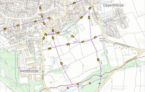
The following footpaths will be temporarily closed. No end date has been confirmed as the closures are intended to facilitate the building of an extensive housing project. Members with walks planned using these footpaths will need to reroute.
Killamarsh Footpaths 39, 40, 41, 43 & 88
Please see image below for maps highlighting these paths.
Wednesday 30th July
Ogston
Leader, Report & Photos: Mel H
Ogston West car park was the starting point for today’s medium car walk where regular members were joined by visitors and a new member. Leaving the car park the group made their way via Whitecarr Farm to Ashover Hay for a coffee stop, extra goodies provided by Vanessa, with a view along the Amber Valley and Ravensnest Tor as a backdrop. Gin Lane was then used to reach the historic Overton and Goss Hall. After a short history of Goss hall, given by Barbara Milton, the group descended to Butts, crossed the River Amber and then proceeded on to Ashover church for Lunch in the church grounds. The remains of Eastwood Hall was the next stopping point before climbing gently to Edges Farm where the wooded section below the Ashover road was used to reach the edge of Fallgate. A short section of minor road and track walking then allowed the group to return to Ogston via Smithy cottage.


Wednesday 30th July
Revidge
Leader, Report & Photos: Clive & Pauline
14 ramblers set off from Hartington to explore what would be ,for many, relatively new terrain. The 11 mile route passed through Sheen and Brund followed by the ascent of Revidge, a 400m “Ethel”. The view from this was outstanding – a 360 degree panorama. After lunch we descended to Warslow and then contoured around the slopes of Ecton Hill. A brief climb gave us another outstanding view before we descended to the ford in Beresford Dale and climbed back to Hartington.
Thanks to John Graham who planned the walk.


Saturday 26th July
Offerton & Bradwell
Leader: Graham Photos: Mel H
..

Todays group at Upper Shatton looking over the Hope Valley
Wednesday 23rd July
Roam around Ripley
Codnor Castle, Cromford Canal, Codnor reservoir and Butterley reservoir.
Leader, Report & Photos: Joan D
A band of 11 happy wanderers gathered in Waingroves for a tour of some of the historical heritage sites dotted around Ripley. We passed by the ruins of 13C Codnor Castle, sitting in a very prominent position with widespread views across the Erewash Valley. After dropping down through woodland and nature reserves we made our way along a pretty but overgrown section of the Cromford canal, displaying many bulrushes and other water loving wild flowers.
We visited the site of Codnor Park Ironworks – established in 1790 by Benjamin Outram, 3 years before the Cromford canal was opened. With the wealth of coal, iron ore and lime in the area, the canal provided the water not only for running the furnaces and forges but also as a means of transporting the mineral wealth and iron products far and wide. Lunch was an all seated affair overlooking Codnor Reservoir.
After lunch we continued along the Cromford canal until it disappeared underground. We wandered through Butterley nature reserve taking in the woodland burial ground – where one can hire a train for one’s last journey from Butterley to the cemetery. Eventually we came to Butterley Midland Station where the group were treated to the miniature railway in action. After a walk around the reservoir we made our way along the Greenway back to Waingroves where tea and cake was provided to end a lovely walk.


Calver Sough
Leader: Hilary P Photos: Mel H
..
The A-Team at the boundary stone on the way between Eyam and Stoney Middleton.
Wednesday 16th July
Baslow
Leader & Report: John R Photos: Mel H
..
Looking towards Hassop Common and Longstone Edge from Handley Lane
Sunday 13th July
Wingfield
South Wingfield, Wheatcroft, Crich, and South Wingfield Manor
Leader, Report & Photos: Joan D
A hardy band of 7 turned out to potentially walk in temperatures up to 27C. However we were fortunate to have some breeze and high cloud to offset this. This was a very convoluted route, overgrown in places but I had brought 2 sets of secateurs. A couple of interesting ‘detours’ were taken to add to the fun of the day but we were rewarded by some excellent views and a close up of Wingfield Manor. But the highlight of the day was at the end of the walk where we visited Wingfield Station which has recently been restored and is now a railway heritage site and lovely cafe. The Station was commissioned by the Stephenson brothers and built in 1840, and is possibly one of the oldest stations in the world still in its original state – a beautiful, classically designed tiny station. It is a charitable trust, very interesting and is open Wednesday through to Sunday.
Distance: 11 miles


Saturday 12th July
Hope
Twitchill Farm, Hope Brink, Win Hill Pike, Aston, Navio Roman Fort.
Leader, Report & Photos: Mike B
A smaller than normal group of 3 walkers met at the car park and toilets in Hope. The weather was fine, dry and warm with lots of wall to wall sunshine forecast for all day. Lightweight walking gear being the appropriate option. There appeared to be orienteering event happening around Hope and throughout the walk we came across many red faced individuals with maps in hand making their way to the various check points.The group set off and followed the Edale Road towards Killhill Bridge. From here the group made the steady climb up the tarmac track to reach Twitchill Farm. Behind this holiday complex the group made the final steep but short climb to reach the bridleway that leads along Hope Brink. Excellent views could be seen here of the Hope Valley and Vale of Edale, with Lose Hill standing proud in the sunshine. A suitable place along this section was found to sit and have a coffee break and admire the views and appreciate the glorious landscape arounds us. Groups of paragliders could be seen launching off Mam Tor and making most of the warm conditions.After this break, the group continued on this bridleway to make the steady climb along Thornhill Brink to reach the rocky summit of Win Hill Pike. A slight breeze was found welcome and it did help to cool down our efforts As ever this summit was popular location for many groups of walkers and runners taking advantage of the fabulous views on offer, A 360 degree panoramic feast for the eyes. Visibility was really at its best, with all the landmarks of the Dark Peak and beyond being easy to identify. See group photo and others at the Trig Point.The group made a careful descent of this rocky summit and made their way down to reach the footpath in the direction of Aston. During this descent our resident ‘lepidopterist’ Mel was able to point out and identify the various butterflies flying around the moorland, bracken and heather.It was decided to take the lunch stop here and take in the views of Hope and Bamford below. After lunch, the group descended further down the path through fields and over stiles to reach the hamlet of Aston. After a short road section, the group took the footpaths through the many fields to reach Hope Station, a very pleasant section to walk through. Over the footbridge at the Station, the group continued to the crossroads to enter Brough. After the old water Mill, the group took the footpath through the remains of the Navio Roman Fort and continued climbing slowly through fields and returned to the start point in Hope.Although, it was one of the shortest walks in the Saturday programme it packed a punch in terms of the views on offer. The steady climb to Win Hill and the gentle paths back through fields was much appreciated by those in the group.Distance: 7.2 milesElevation: 1300 ft


Wednesday 9th July
Highs and Lows From Hayfield
Leader, Report & Photos: Kath

Wednesday 9th July
Ashover
Photos: Mel H
The team between Ogston and Ashover Hay
Saturday 5th July
The Queen that nevcr was
Photos: Mel H

At Rufford Abbey
Wednesday 2nd July
Half a Skyline – Part 1
Leader: John H Report & Photos: Dermot T
11 walkers took part in a very pleasant walk around part of the Edale Sklyline Route.We began the walk from the main car park in Edale in dull and damp condtions and began our steady ascent up Grindslow Knoll to get up onto the top of the ridge. After a welcome coffee break near Crowden Tower we continued to Kinder Low for the obligatory team photograph before joining a short section of the Pennine Way to Edale Cross where we had lunch. After lunch the weather improved to provide spectacular views in every direction as we headed towards Rushop Edge via Brown Knoll. From there we headed up to Mam Tor where we were subjected to what seemed like gale force winds coming from the south west. We quickly descended to Edale where the wind subsided and the sun shone. We kept up a really good pace finishing the walk at 15.45.Distance: 11.3 miles
Ascent: 2618ft


Wednesday 2nd July
Carsington
Leader: John C Photos: Mel H
…
The team looking East North East just below Shiningford Farm
Wednesday 25th June
Sheffield Round Walk
Leader, Report & Photos: Dermot T
9 walkers participated in an anti-clockwise circular walk around South Sheffield on a beautiful summer’s day, in near perfect walking conditions, with sunshine and plenty of opportunities for shade provided by some of the 4.5 miliion trees in Sheffield.We began the walk from Graves Park and then followed the standard route through Gleadless Valley and on towards Meersbrook Park for our coffee stop. Our first photo of the day was taken from near the spot where Turner painted the watercolour “View of Sheffield from Derbyshire Lane c1797.” From there we climbed up to Brincliffe and onward to Chelsea Park before dropping down to Endcliffe Park. After a brief stop at the Mi Amigo War memorial we then walked up Porter Brook stopping at Forge Dam for lunch. After lunch we continued further up Porter Brook and then dropped through Ringinglow and Whirlow Brook Hall towards Dore. From Dore we did our final climb of the day through Ladies Spring Wood and then around Beauchief Golf Course and Chancet Wood and then back to Graves Park.A lovely walk, with lots of opportunities for public conveniences, no stiles and lovely broad paths enabling the conversation to flow freely within the group as we traversed around the Greenest City in the UK.We kept up a really good pace finishing the walk at 16.30.Mileage 15.5Ascent 2060ft


Wednesday 25th June
Coal Aston
Leader: Gavin Photos: Mel H

Ryalls Wood above Greer Lane Farm
Sunday 22nd June
Hathersage
Leaders: Hilary & Lesley Photos: John G
A big thank you to our regular guests, Hilary and Lesley, from Nottingham who led Sundays 11 mile walk from Hathersage to Padley Gorge, Higger Tor, Stanage Edge and Dennis Knoll. The weather wasn’t what we expected with rain, strong winds and not much sun until we had a cup of tea at the open air swimming pool cafe.

Saturday 21st June
Litton Village
Leader & Report: Mike B Photos: Mike B and David & Vanessa
Route – Creesbrook Dale, Water-cum-Jolly, Monsal Trail, Litton Mill, Millers Dale, Limestone Way, Tideswell Dale.A group of 4 walkers met in the shade at the village shop in Litton. It is Litton Well Dressing and Maypole Dancing is provided by the local school children daily through the coming week. The walk had been amended from the original version in the programme to reduce the amount of climb. The reduction of 800ft of elevation was most welcome by all in the group on one of the hottest days of the year.The group set off down Tansley Dale towards Cressbrook Dale in very sunny and hot conditions. It became overcast and humid later but the threat of heavy rain and thunder later never materialised and we remained dry. The recent spell of very warm weather and lack of any rainfall had made thisdale very dry. The abundance of various types and sizes of butterflies throughout this walk was much appreciated by the group.The group followed the winding footpath through this ancient woodland and nature reserve to eventually go past the two rows of cottages at Ravensdale and to drop down to Water-cum-Jolly. 2.1/2 miles completed and we made use of the bench seat provided to have our coffee stop. A nice idyllic setting, made even better by the delicious date slice provided by Vanessa.The group used the newly installed footbridge over the River Wye to take the path up to join the Monsal Trail. The group proceeded through both Cressbrook and Litton Tunnels, avoiding the many cyclists who were doing the same. Even these normally chilly tunnels felt warm . The group took the path down to cross the footbridge at Litton Mill and followed the river upstream for about a mile to reach the Anglers Rest pub. A steep but short climb up a rocky path brought us back onto the trail again and the group made their way to Millers Dale Station.Lunch break and toilet stop was taken here at this very popular spot and use of the facilities taken, especially the ice cream kiosk. Mel was able to indulge with his favourite Rum and Raisin ice cream, that good he had to have a double portion – see photo.From here the group made the steady and very humid climb past Monksdale Farm and along the Limestone Way. After a mile the group left the bridleway to follow the walled track and footpath to reach the tumbled down Meadow Farm and continued to Tideswell Dale. From here, they took the path parallel to the road and eventually back into start point in Litton.Here the group joined the many folk enjoying the ongoing beer festival at the Red Lion pub to enjoy a well earned drink.An interesting varied walk and the hot weather did not hamper the spirits of the group and they all enjoyed it.Distance: 9.1 milesElevation: 1000 ft


Wednesday 18th June
Cut throat
Leader, Report & Photos: Natasha
Todays walk was from Cut Throat Bridge via Strines Reservoir to Derwent Edge. Pictures taken at Back Tor


Wednesday 18th May
Wingerworth
Leader: Mike S Photos: Mel H
…

Draped over Ashover Fabric
Wednesday 18th May
Stockley Trail
Leaders: Ann & Joyce Report / Photos: David M
A relatively short walk for seven on a very warm day – exploring the northern part of the Stockley Trail from Bramley Vale to the Bolsover Gateway Business Park – with interesting deviations on the way.

View todays route by clicking below

Saturday 14th June
Odin Mine
Leader, Report & Photos: Mel H
Commencing at a very busy Odin Mine the Saturday group made their way up to Mam Farm to turn east to follow the path along the lower reaches of the Great Ridge to Only Grange Farm. Here the way turned north to angle gently across Barker Bank to reach the foot of Back Tor for a coffee break accompanied by homemade Rhubarb cake. After more than a little “lip smacking” the middle route along the shoulder of Lose Hill was followed before descending to Lose Hill Farm via the main route from Hope to Lose Hill. Continuing on down through Hope the route then turned West to basically follow the course of Peakshole Water into Castleton. Lunch was taken along this section of the route with excellent views allowing the completed section of the walk to be viewed at leisure. After passing through Castleton the group made their way past Goosehill Hall to the base of Winnats Pass before returning to Odin Mine via Knowlegate Farm.


Wednesday 11th June
Pleasley
Leader, Report & Photos: Mel H
On a beautiful summers day Pleasley Pit Country Park was the start point for the medium car walkers Wednesday jaunt. After crossing the river Meden the group made the gentle climb to Wren Farm before dropping to the rail bed of the now defunct Pleasley line. This delightful tree lined track runs along Pleasley Vale with occasional sightings on the North Side of the remains of the Viela Cotton Mills. At this stage the magnificent houses of Top Row Pleasley Vale were used as an opportunity for a group photograph followed by a coffee stop at the Church of St Chad. Here the River Meden was re-crossed before taking a section of path leading through a limestone gorge, broad open meadows and leafy copses to reach Stonewell House for the turn northwards to reach the Archaeological Way. A short section of the way was followed to reach the northern most tip of Pleasley Park followed by Green Lane, Balkham Lane and Water Lane to reach Stony Houghton for a leisurely Lunch. On then through Houghton Basset and Houghton Felley to reach and cross the Mansfield Chesterfield road for entry to Longhedge Lane and access to paths over the parkland created out of the thoughtful restoration of the Colliery waste tips.


Click here to view todays route
Wednesday 11th June
From Low to High
Leader, Report & Photos: Jane & Nigel
On a scorching hot day our merry group of 11 set off from Low Bradfield. After a 2 mile steady climb we settled down for our morning G&T cake and homemade shortbread with a great view over Agden Resevoir and on to Strines before wending our way onwards. A saunter through the fields and woods and after 6 miles lunch on the beach at Moor Hall Resevoir..only Kath and Joan had managed to fall over by this point. Once full of lunch off up the next long ascent!! And then after a bit of flat always the steep descent. Final walk along Agden Resevoir before landing back at base. A great day with great views and excellent company.


Wednesday 4th June
Monyash
Leader: Terry & Eileen Photos: Mel H
..

Leaving Monyash to wander among the stone walls just above Horse Lane.
Tuesday 20th May
Chair update
I hope that you are all enjoying the lovely weather and making the most of all the walks on offer, ranging from 5 miles to 15 miles – choose one that suits you best. Please remember plenty of water and some food as the sun can be energy zapping. We still have some opportunities for people to lead walks over our summer season – if you can, please offer to lead a walk as without our volunteer walk leaders our lovely group would cease to exist.
We are proposing to offer a basic first aid course to anyone who would like to come along. We have already had some good interest shown. The date is still to be decided but will be around mid September. I would encourage as many people as possible to come along – it’s around 90 minutes and there is no test. Remember that someone with some basic training might save your life so it would be good if you could also reciprocate that gesture.
And one last reminder to our dog owning members. It is ground nesting season for birds and it is the law that dogs must be kept on a short lead on open access areas. Please be considerate to all of our nature.
Your Chair,
Joan Dalton
Saturday 31st May
Walking the Boundaries
Leader: Barbara M Photos: Mel H
..


Wednesday 28th May
Holymoorside
Leader: Dawn Photos: Mel H
..


Monday 26th May
Chesterfield Round Walk (RW) – 20th Anniversary Walk 3
Leader: Gavin J Photos: Mel H
..


Saturday 24th May
Dales, Moors and Rakes
Leader: Gavin J Photos: Mel H
..


Friday 23rd May
WALK REPORT FROM A RAMBLER IN EXILE
Report & Photos: Isobel M
I would belatedly like to thank the Ramblers who came to my goodbye meal and to Lorraine for organising, at such short notice. Apologies to anybody who didn’t know about it and would have liked to have come (if there were any.)
I would also like to thank everyone who has led walks that I have been on over the last few years. I have seen places and paths that I otherwise wouldn’t have known. Also thank you for your support when I was Chair particularly during Covid and for helping me keep positive when I was diagnosed with cancer. I will miss my regular Wednesday walks and your company and wish you more happy rambling.
The weather here in Northumberland has been amazing, since we moved here, two weeks ago, The Cheviot has a reputation for being a boggy mountain and as we have had a long dry spell, we decided it was time to climb it.
Martin and I set off from the Harthope Valley and ascended by the side of Hawsen Burn to reach a col between Broadhope Hill and Scald Hill. On the way up Scald Hill (549m) there were hazy views towards the Lammermuirs and the coast. After coffee on Scald Hill the final ascent to the Cheviot, at 815m Northumberland’s highest point, started. It continued initially on a stony path before flattening out onto a paved path. The usually boggy plateau was dry. Finally, the trig point was reached, which stands on a concrete plinth, previous ones having sunk into the bog.
The route then briefly descended before a short gentle ascent to Cairn Hill, where there was a convenient shelter for lunch, before the start of the descent. The descent was initially steep, stony and slithery and then just stony and slithery, following the banks of Harthope Burn and passing Harthope Linn. Eventually the walk ended with a flat section from Langleeford Hope to the start point.
Distance 9 miles
Ascent 2000ft

Wednesday 21st May
Bleaklow
Leaders, Report & Photos: Clive & Pauline
11 ramblers set off from Kings Tree in beautiful weather to explore Bleaklow. We ascended Linch Clough and made our way to Bleaklow Stones via Round Hill and Barrow Stones. After lunch we walked down The Ridge to Alport Castles. From there we descended into the Westend Valley and walked back along the road. A grand day out in perfect conditions. Wildlife highlights included a Golden Plover plus Red Admiral and Painted Lady butterflies.


Wednesday 21st May
Ambergate
Leaders: Bob & John Phots: Mel H
..


Sunday 18th May
Alstonefield
Leader, Report & Photos: Peter S
9 Walkers started out from Alstonefield on this 12.5 mile walk. The weather was excellent for a walk, neither too hot or too cold.
This walk combined 6 dales together. Hall Dale, Dove Dale, Mill Dale, Biggin Dale, Beresford Dale and Wolfscote Dale each having its own charm.
A steep climb up Gipsy Bank led us bank to Alstonefield.


Saturday 17th May
White Edge & Froggatt Edge Circular
Leader & Report: Sue G
7 walkers, including a visitor who had recently moved to Sheffield, completed this 9 mile circular route.
For the walk out along White Edge, it remained cool, cloudy & breezy. For our mid-morning break we found a sheltered spot below a rocky outcrop & were rewarded by the repeated calls of a cuckoo.
At Curbar Gap, we turned onto Curbar Edge & then Froggatt Edge & were soon enjoying warm sunshine. We sat on the rocky Edge to eat our lunch, enjoying good views across the valley to Stokehall Quarry. We could even see the fountain at Chatsworth.
The previous afternoon, there had been a wild fire on a part of Froggatt Edge, which fortunately had quickly been brought under control. As we walked past the charred remains of last year’s dead bracken, we came across some workmen inspecting the area. They had a water bowser and were using a drone with thermal imaging equipment to detect any remaining hot spots, which a tractor then doused. They told us they had not discovered the cause of the fire and had only found a couple of glass bottles.
Leaving Froggatt Edge, we dropped down into Hay Wood & crossed several wild flower meadows, where there was a group of young red deer, before continuing past the Grouse Inn into the Longshaw Estate & back to Fox House.


Saturday 10th May
Grindleford
Leader, Report & Photos: David B
8 of us, including 2 Ramblers from Nottinghamshire and one from Wakefield, set off on a nine and a half mile walk from Grindleford Parish Church in perfect conditions -sunny, but not too hot.
The walk was in 4 distinct quarters . The first took us a down the Derwent Valley Heritage Way to Froggatt, from where the next section included all the 1350ft of climbing through the edge of Eyam and up the steep path to top of Sir William Hill ,where we stopped for our lunch break (though 2 of the group decided they had not had quite enough climbing so made the short detour up to the trig point) . Magnificent views all around on this perfectly clear day
Occasional Cuckoo calls had accompanied up to this point and from here the terrain changed to heather and bilberry moorland ,where we saw several different birds including Skylarks and had Meadow Pipits running ahead of us along the path. Our climbing was over now and we descended steadily down the rocky path to Leam and onto Leadmill Bridge.
Here we rejoined the (very low) River Derwent for the final part of the walk along the easy path back to Grindleford. The little community shop and cafe at the church was open, so we rounded off our efforts with coffee and cakes ( delicious and amazing low prices – recommended!)


Saturday 10th May
Chesterfield Walking Festival
…

Festival Walk Thorns but not Prickley; taken above Cresswell Crags
Wednesday 7th May
Coal Aston to Unstone
Leader: William E Report & Photo: David M
A fine five mile mainly woodland walk from Coal Aston to Unstone via the Whinacre, Owler Car and Frith Woods, finishing along the Unstone Line (a nature reserve once used to carry coal from the Unstone mines) – with quite a few seasonal bluebells in view. A fine bench was available for lunch.

View todays walking route at:
Wednesday 7th May
Part of Dronfield 2000 Rotary Walk
Leader, Report & Photos: Vanessa & David
15 walkers and 2 dogs took the opportunity to enjoy half of the Dronfield 2000 Rotary Walk today. The complete walk is 14 miles that circles the beautiful green belt that surrounds Dronfield and Coal Aston. This year it is the 25th Anniversary of the route that launched in July 2000 after all the hard work to upgrade paths stiles and signage at the expense of £50,000 which came from grants and private donations. The weather was lovely and clear allowing us to appreciate the many viewpoints along the way.
Distance: 8.5 miles


Wednesday 7th May
A Purple Haze
Leader & Report: Clive & Pauline Photos: Clive, Mike & Simon
…


Saturday 3rd May
Barlow and Millthorpe Circular
Leader & Report: Mel H (on behalf of Mike B) Photo: Colin C
With Bluebells interspersed with contrasting stitchwort lining the field edges the Saturday group left rumbling street to walk down to the lower reaches of the Cordwell Valley. Crossing Bradley Lane and Dunstone brook the group them made their way up to Cartledge Hall, currently enhanced by a prolific display of Wisteria, to enjoy a coffee stop just below Holmesfield. After a short traverse along the valley side the route then descended to Millthorpe to cross Millthorpe Brook before walking along the valley to reach Unthank. A steady climb through Meekfield Woods led the group to Moorhall for a leisurely lunch stop overlooking Grange Wood. A short descent and climb through the secluded valley in Grange Wood was followed by a steady climb to Barlow Grange and then on to Grange Hill. From here the bridleway through Oxton Rakes was used to reach Bole Hill before turning North West for the return to Rumbling Street.

Wisteria on Cartlidge Hall
Thursday 1st May
Chesterfield Walking Festival
Chesterfield and North East Derbyshire ramblers are pleased to be contributing a selection of walks to the Chesterfield Walking Festival for 2025.
Members and Non-members alike are welcome to book onto any of the walking festival activites taking place between 10th & 18th May, and the vast majority are completely free of charge.
For more details of the walks available, and how to register for them online, just visit https://chesterfieldtheatres.co.uk/shows/chesterfield-area-walking-festival-2025/
Wednesday 30th April
The Dales
Report & Photo: Clive W
10 ramblers completed a 11 mile circular walk from Monyash visiting Flagg, Taddington and Monsal Dale. Fabulous weather, beautiful scenery and a lovely route. Highlights included a great display of cowslips and a hare

Wednesday 30th April
Owler Bar
Leader: Hilary P Report & Photos: Hilary P & Mel H
16 of us set out from Owler Bar lay by uphill over Totley Moss and on to White Edge moor where we were treated to the sight of several deer munching on the coarse moor grasses. We walked onto Longshaw for lunch at Fox house where ice creams were very welcome. We then walked over Totley moor and observed a solitary Buzzard being chased by a Rook and a magnificent sighting of a Kestrel framed against a clear blue sky. On then to Wimble Holme Hill to turn South for the walk under Brown Edge. Here several of the group were treated to the clear call of the first Cuckoo of the season before returning to the car. A very warm but excellent walk on exposed moorland hardly a tree in sight.
Taken from White Edge Moor.
Monday 28th April
All the Munros
Congratulations to Ann Wilson who recently completed her final Munro summit in Scotland along with 10 family and friends including Pauline, Clive, Tricia and John from our rambling group. The 282 peaks were completed in 10 years a great achievement.


Sunday 27th April
Hope
Leader: Kath P
…


Wednesday 23rd April
Baslow
Leader: Barbara M Photos: Mel H
…


Sunday 20th April
Winster
Leader: Joan D
…


Wednesday 16th April
North Lees
Leader, Report & Photos: Jane H
10 walkers and Mavis, the dog, met at Hollin Bank car park for an 11 mile walk towards Bamford Edge, Moscar and Stanedge Edge. The weather was dull, rainy and blustery but we still managed some magnificent views towards Win Hill, Loose Hill, Mam Tor and Ladybower. Due to gale force conditions, we took the lower path on Stanedge Edge on the return to Hollin Bank.

Sunday 13th April
Eyam
Leader: Kath Photos: Kath P & Simon T
…


Saturday 12th April
Tibshelf Circular
Leader, Report & Photos: Mel H
Enticed by brilliant morning sunshine the medium car walkers set of from Tibshelf ponds for an 8 and a half mile walk taking in the villages of Pilsley and Morton.
Leaving the car park the first section of the walk was through the woods with the trees now exhibiting fresh new and vibrantly green cloaks. Skirting the northern end of Tibshelf the group moved on to Cocktop for a coffee stop before pressing on to the site of what was Pilsley Station.
Padley Wood lane formed the next section of the walk passing through Pilsley common to then reach Morton where lunch was taken in the Church grounds. Skirting the eastern edge of Stonebroom a single track lane was used to join the Silverhill trail, for the return to Tibshelf, with a short photo opportunity taken at the pond just north of Westhouses.
Along the way the group were treated to sightings on a number of Orange Tip, Small Tortoiseshell, large White and Comma butterflies, topped with several groups of early bluebells sheltering in the old rail bed cuttings.


Wednesday 9th April
Bakewell Circular
Leader: Basil Photos: David M
Two walks for the price of one today with one morning Bakewell circular immediately followed by another in the afternoon. The photos below are from the first 5.67 mile route (full route available below), which included Haddon Hall and quite a few lambs. All walkers had the choice of one or both walks.


Wednesday 9th April
Let’s Rock Around Hathersage
Leader: John & Tricia G Photos: John G
The weather turned a bit odd today. Really cold as we set off before the heat of the mid-day sun made lunch very pleasant but as the walk finished it became cloudy and cooler. Fortunately everyone enjoyed a stunning walk from Fox House to Hathersage and then climbing up to Carhead Rocks and Stanage Edge returning via Burbage Edge.
Distance 10.5 Miles


Wednesday 9th April
Calver
Leader & Report: David & Vanessa Photos: Mel H
Lovely day for a 7 mile walk under Curbar and Baslow Edge. 19 walkers 3 dogs (and an extra walker joined us half way round). Great views of the ER planting to commemorate the golden jubilee of Queen Elizabeth ll in 2002. Lots of comments on whether it would be changed to CR.


Sunday 6th April
Rowsley
Leader: John & Tricia G Photos: John G
Another glorious Spring day saw a group 15 walkers complete 11.5 miles starting in Rowsley and taking in Stanton in the Peak, Shining Bank Quarry, Conksbury Bridge, Over Haddon, a very busy Bakewell and Coombs Farm.


Wednesday 2nd April
Avenue Washlands
Leader: Fred Report & Photos: David M
Another variation of the popular Avenue Washlands walk, this time via the South Chesterfield Golf Club and Grassmoor Country Park
A beautiful spring day brought out a dozen takers and one dog on a 6 mile circular.

View todays route by clicking
Wednesday 2nd April
A Bakewell Round
Leader: John & Tricia G Report & Phtos: John G
It couldn’t have been a more perfect day! Starting from Ashford in the Water the walk took in magnificent views all the way on this Bakewell circular.Visiting Monsal Head, Great Longstone, Bakewell, Over Haddon and Sheldon the walk just kept on giving the reason for being out on such a sunny day


Wednesday 2nd April
Tibshelf
Leader, Report & Phtos: Mel H
Fantastic spring sunshine and the Idyllic Tibshelf ponds started the Wednesday Medium Car group walk today with the first section of the route crossing over the motorway near the Tibshelf Service station to reach a point just short of the Hamlet of Stanley. Here we turned North West to re-cross the motorway, this time under it, to reach first Biggin then Cedar Farm. Here a short stop was made for refreshments before proceeding north to reach Oil Well Nursery, the site of Britain’s first inland oil well. Turning west then to reach Pilsley Station where a short stop was made to discuss the connection between the breaking of the 4 minute mile and Tom Hullat who used sections of the trail for training. Upper Pilsley was then encircled culminating in a leisurely lunch stop at the Pilsley children’s playground adjacent to the Morton road. Following lunch the broad and easy to use track to Sitwell grange was used to return to the start point at Tibshelf.

At Tibshelf Ponds.
Saturday 29th March
Holmebrook Valley Park
Leader, Report & Phtos: Mel H
Holmebrook Valley Park was the start point for the regular Saturday walk on a beautiful spring day. Heading west the group made their way to Cutthorpe End then turned north to cross Sub Brook and then on to Wilkin Hill. On then westward to reach Newgate to use a short section of the Chesterfield Round passing Jumble Hole for a coffee break in brilliant sunshine just short of Oxton Rakes. Re crossing the Sud Brook the route now climbed to Overgreen to cross the Cutthorpe Baslow road. Passing through Cow Close Farm the westerly valley side path then led to Bluster Castle for some excellent views down the Linacre valley. Here the group turned South to descend into the Linacre Valley then climbed out again passing to the East of Wigley to reach Hollins. At Hemming Green it was northward once again to descend to the southern end of the dam for the Linacre top reservoir and lunch at the very inviting and convenient picnic table. Following lunch the boardwalks were used to circle the top reservoir before returning to Holmebrook via Cutthorpe Hall. Wall to wall sunshine.

The team at the top reservoir.
Wednesday 26th March
Pleasley Pit to Hardwick
Leader & Report: John R Photos: Mel
26 walkers and 5 dogs undertook walk from Pleasley on a glorious day. Our route took us out to Ault Hucknal Church for the morning coffee break. Thanks to an exceptionally dry spell the few fields we crossed were firm and dry. From the Church we headed off to Hardwick Hall Park and the gentle descent to The Great Pond. Ahead lay the challenging part of the walk, the ascent back up to Hardwick Hall. However, we were rewarded by access to toilets, always a welcome bonus. There were also plenty of empty benches for us to enjoy our lunch break in the grounds of the Hall. Final stretch took us around the back of the hall where the traditional group photograph was taken, then out of the grounds via Lady Spencer’s Wood. The walk concluded with a gentle stroll along the Teversal Trail back to Pleasley.

Lunch with a view of Hardwick Hall
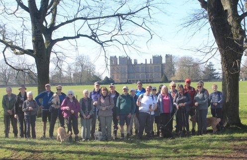
26 happy walkers with 4 dogs
Saturday 22nd March
Beauchief Abbey
Leader: Gavin J Photos: Mel
…


Wednesday 19th March
Elvaston Castle Country Park
Leader: Jean Report & Photos: David M
An ‘A’ to ‘E’ six mile linear walk from Derby’s Alvaston Park to Elvaston, via the Derwent Valley and the Country Park.
The useful Derbyshire bus and train Wayfarer has now been handed over to South Yorkshire’s TravelMaster with a 40% increase in the senior concession price.
However, unlike the Yorkshire version, it unfortunately can’t be bought on buses or online.
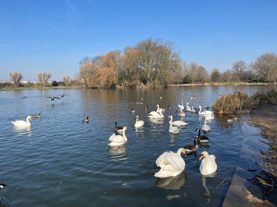
Alvaston Park


Elvaston Castle Country Park
Saturday 15th March
Dukeries Garden Centre
Photos: Mel H

At Creswell Crags
Wednesday 12th March
Moors & Dams
Leader & Report: Sue G Photos: Kath P
17 walkers & Mavis, the dog, set off from Rivelin Mill Car Park for a circular walk featuring fields, moorland & woodland. It was a walk of 3 seasons in a day – spring sunshine, almost summery in feel at times, and heavy hail showers. Initially we headed uphill using field & moorland paths, tracks & lanes, before descending towards Ughill. An ascent through Royds Clough, and across the moors between Crashaw Farm & Crawshaw Lodge, and another descent to Rivelin Brook, followed. By now, we were getting hungry, and enjoyed our lunch break near the Headstone after we had completed most of the climb up to Hallam Moors.
Heading along the conduit, we reached Redmires reservoirs. We continued to Lodge Moor before descending via Fox Hagg to Rivelin Dams and returning through the woods at Rivelin Rough, to our starting point.
Highlights of the walk included views of the varied countryside, through which we passed, the spring sounds of curlew and lapwings calling and the sight of lapwings in flight along the Redmires conduit.
11.8 miles & 1600 ft of ascent.
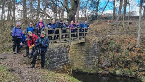
Wednesday 12th March
Matlock to Kelstedge
Leader: David Mann Report & Photos: Basil
When a planned walk leader becomes unavailable a volunteer often steps up to the mark. In this instance it involved a change from a circular in Matlock to a linear walk from Hall Leys Park, Matlock to Kelstedge. The X17 remained the service used.
The new route took us via the interesting Lumsdale, with its usual number of viewers passing through and onto to Highfield and Matlock Golf Course. Close to the public footpath we passed the Cuckoo Stone, an erratic rock, to be found on the 11th hole fairway. The stone is usually linked with a hazel tree, the sapling now present being the latest in a line of earlier ones.
Progressing via Wayside Farm, and Old Engine Farm we reached Cocking Tor, the 10,929th highest point in the UK. Our lunch had just started when a short hail storm led to iced sandwiches for a change. The downfall petered out and we descended near to Overton Hall to the always welcoming Ashover. Open pubs and an excellent cafe awaits, this being coupled with free public toilets and parking. Some other parish councils should take note. Good views of Crich Stand and Ogston Reservoir had been seen en route plus Ashover Spire.
After warming up, and refreshments, the walk of slightly in excess of 7 miles, and an ascent of 351 metres, finished at Kelstedge with another X17 back.

Lumsdale

Cuckoostone
Sunday 9th March
Heather Dean
Leader, Report & Photos: John G
On a hectic morning when car parking spaces were at a premium due to many people coming out to bask in the early hot weather, 15 walkers set off to enjoy a walk originally to be led by Phil Wilcoxson who sadly recently passed away.
The group were treated to fantastic views from Win Hill, Hope Cross and the path to Crookhill Farm. A drink was taken at the Ladybower Inn to remember Phil.
Distance: 10 miles
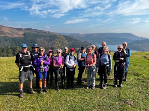
Saturday 8th March
Hardwick – Sutton Scarsdale Circular
Leader: Barbara Photos: Mel H
..
Which is the oldest dinosaur, The Sauropod, Fergy tractor or skeletal driver. Entrance drive to Sutton Hall.
Wednesday 5th March
Here Be Dragons
Leader, Report & Photos: Isobel M
It was slightly chilly, but bright and sunny when twelve ramblers met by the dam wall at More Hall reservoir between Wharncliffe Side and Stocksbridge. They were ready for an encounter with the infamous Wantley Dragon.
In essence, the route was a circuit of More Hall and Broomhall reservoirs, two of the reservoirs that form part of “Sheffield’s Lake District.” It began by crossing the dam wall to reach the south side of the reservoir, then turned uphill for the first climb of the day initially, through woods and then across fields to Brightholmelee. After crossing the road it went up Storth Lane to Glen Howe, a park gifted to the people of Sheffield. An attempt was made to have coffee in the sunshine on a bank overlooking Tinker Brook. Unfortunately, we were
moved on to a less sunny spot, by a farmer’s wife, because the path is only concessionary and she was about to move her sheep.After another short climb from Hob Lane House which led to views across towards Wharncliffe, the way descended to Carr House Meadows. It then went parallel to More Hall and Broomhead Reservoirs through woodland, finally reaching the western end of Broomhead Reservoir and a lunch stop by the water.
By this time the day was getting warmer and the water was sparkling in the sunshine as the route skirted the northern bank of Broomhead Reservoir. At Ewden the worst climb of the day, to Bolsterstone, began initially on the road and later on a footpath. By this time even the “nesher” members of the group were thoroughly warmed up. A couple of walkers opted out of the climb and walked back to their cars along the reservoir service road.
From Bolsterstone the route followed the edge and there were superb views of More Hall and Wharncliffe. At Hollin Edge Farm the steep descent started through woodland. The Wantley Dragon was found lurking in a clearing. According to legend the dragon devoured anything it wished until the knight, Moore of Moore Hall, delivered a fatal kick to its “arse-gut.” The present dragon is a stone wall with a sculpted stone head. The walk ended with a section on the service road back to the dam wall.
Distance 10.5 miles. Ascent 1850 feet.


Wednesday 5th March
Eyam
Photos: Mel H
..


Saturday 1st March
Chatsworth Panorama
Leader & Report: Sue G Photos: Mel H
On a beautiful, sunny Saturday, 9 ramblers and 2 dogs set off from Bakewell Old Station Car Park for a 10 mile circular walk.
The climb up to Ball Cross Farm and Carlton Pastures took us out of the shadow and zero degree temperature of our starting point into warm sunshine and stunning views of the surrounding countryside.
Unexpected highlights of the walk were the vintage car rally that we came upon as we descended towards Carlton Lees, a very chilled long-haired white cat, and a kingfisher flying low over the river at Rowsley: a flash of turquoise blue.
From here we began the final ascent to Bouns Corner. We enjoyed the warmth of the sun on our bare arms, but by now some of us were flagging and the long muddy descent to Coombs Farm did not help.
Nevertheless, we were back at our starting point by 3.00 pm, having enjoyed a welcome hint of
Spring.


Wednesday 26th February
Whirlow
Leader: Hilary & Anne Photos: Mel H
..

Porter Brook – note the dogs posing – now thats what I call control, or well behaved dogs.
Saturday 23rd February
Eyam – The three lows
Foolow, Grindlow, Hucklow Edge, Great Hucklow, Stanley House, Tideswell Lane.
Leader & Report: Mike B Photos: Mike B & Mel H
A group of 8 walkers met and set off from the free car park in Eyam. It was a calm still morning with the forecast being a dry sunny day.
We made our way from the car park and headed through Townend to follow the footpath to Foolow. The route took the group through many fields and stiles, passing by the very small dale called Linen Dale. At the duck pond at Foolow the group took a coffee break, this was supplemented by homemade flapjack provided by the walk leader.
From Foolow, the group proceeded onwards through fields and on tracks to reach Grindlow. From here, they made the muddy climb at Rose Farm to emerge onto Hucklow Edge. Good views from here looking towards Wardlow and Longstone Moor.
The group followed the track down into Great Hucklow to continue along the lane out of the village to follow the farm track to Stanleymoor Farm. After negotiating a series of difficult wall stiles the group proceeded to Stanley House for lunch in the adjacent field. After which, the group continued on the footpath through more fields and stiles to Brosterfield Farm to emerge in to Housley. From this hamlet to group followed the rough track ‘Tideswell Lane’ back into Eyam.
A fairly gentle walk with only one section of real ascent with good views and much enjoyed by the group. The dry sunny weather throughout made a pleasant change.
Distance: 8 miles
Elevation: 840 ft


Wednesday 19th February
Ladybower
Leader, Report & Photos: Dermot
19 walkers participated in a clockwise circular walk around Ladybower, on a very cold winter’s day.
We began the walk from Ashopton Viaduct and headed straight up Crook Hill to blow away any early morning cobwebs and then onward to Lockerbook. After a short coffee stop we walked down towards Fairholmes where the temperature was a fair bit warmer – well from the hand driers! After Fairholmes we walked the short distance, by the side of the reservoir, before the sharp ascent towards via Briery Side towards Derwent Edge. Lunch was taken by the Grouse Butts. From there we went up towards the Lost Lad for the obligatory photo stop and then we continued right along the Edge towards Lead Hill to then commence our descent ,back to the start.
A good winter walk, with a bit of ice and snow up on the tops. Sadly not much to see due to the mist,low cloud and absence of sunshine.
We kept up a nice steady pace finishing the walk just before 15.30.
Distance: 12.3miles
Ascent: 2070ft


Wednesday 19th February
Clay Cross to Grassmoor
Leader: David Mann Report & Photos: David Moore
A six mile linear walk from the bus station in Clay Cross to Grassmoor Country Park, via a few muddy fields and the Five Pits Trail on a dull February day.
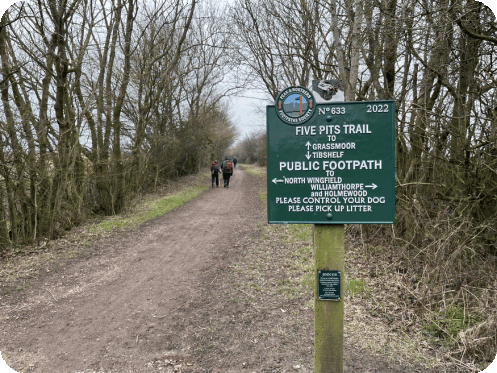
Yet another fine Peak & Northern Footpath Society signpost leads on to the Wolfie Pond.
Wednesday 19th January
Chatsworth
Leader & Report: Vanessa & David Photos: Vanessa & David , Mel H
Walk started from Chatsworth House with 23 walkers. We walked up to the Hunting Tower. A small group took the steps route. From here the walk followed Dob Edge then up under Birchen Edge where we could see above us Nelson’s Monument. This monument was erected in 1810 five years after the Battle of Trafalgar. The monument stands 1000ft above sea level. We then proceeded along Bar Road, [assing the Highland cattle along the way. Lunch was taken by the Wellington Monument before we followed Bar Road back down past the end of Baslow Edge and into Baslow and back through Chatsworth grounds to the car park.


Saturday 15th February
Coal Aston
Leader & Report: Mel H
Coal Aston was the start point for today’s medium car group walk with the first section taking in the deep valley between Nor and Long Woods to reach a point just beyond Hazlebarrow Farm for a coffee break.
The route then continued northward to reach Lightwood where a turn was made to start the eastward leg of the journey. A second deep valley was then crossed, passing through Carterhall Wood, to reach Carterhall Farm. The southern leg of the walk then took the group to Ridgeway and then Ford for a leisurely lunch stop in the picnic area for Ford Dam.
Following lunch the walk passed through historic Birleyhay before turning south west to reach Troway; noted for its honey production. A section of the Sheffield Country Walk was then used to reach Sicklebrook Farm for the final leg back to Coal Aston.
Wednesday 12th February
Linear to North Wingfield
Leader: Val Report & Photos: Basil
6 bus ramblers set off on a grey wet day on the circuitous route provided by the 55 bus from Chesterfield. Arriving in Morton the rain had stopped and led by Val F we were soon in uncharted territory. Uncharted, that is, by the 2011 version of OS Explorer map 269.
Instead of visiting the expected site of the claimed Centre of England, in the village of Morton, we quickly crossed the parish boundary into Tibshelf. Doe Hill Country Park took us into Blackwell where we paused near the old pit winding wheel, which was apparently made by Markham in Chesterfield. Next up was the Newton Link followed by Tibshelf Ponds. The Five Pits Trail beckoned and we soon completed the Tom Hulatt mile. Tom was born in Tibshelf and came third in the race on 6 May 1954 when Roger Bannister broke the 4 minute mile for the first time. Tom, used to practice on this uneven mile strip before the race. He is buried in the churchyard of St John the Baptist church in Tibshelf. We took a bit longer than 4 minutes.
Along the route snowdrops were aplenty, and daffodils afew. Both good spring signs to see.
The linear route finished with a section of the Trail which also forms part of the Chesterfield Round Walk. It is the 20th anniversary of the current Round Walk Route this year.
Terminating at North Wingfield 8.6 miles had been completed. Well timed as rain spots re-commenced.


Wednesday 12th February
Chat to Robin
Leader: John & Tricia G Photo: John G
16 walkers crossed saturated fields and walked on muddy paths to complete the 11.8 mile round walk from Calver Sough to Chatsworth via Bubnell, Pilsley, Edensor, the woods below Wellington’s Monument and Curbar. A very satisfying walk on a cold, damp, misty day.

Saturday 8th February
Unstone Circular
Leader: Colin C Photos: Mel H
…
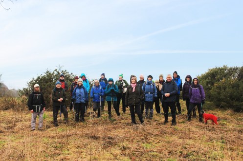
Todays group on the line of the ancient tramway between Unstone and Apperknowle
Wednesday 5th February
Low Bradfield to Broomhead and Morehall Reservoir’s
Leader & Photos: Kath P
…
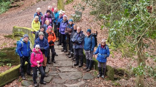
Wednesday 5th February
Derby Parks
Leader: Jean Report & Photo: David
Another outing for eight of us led by our Derby resident member, Jean – on a fine February day.
A four and a half mile linear trail from Normanton to Littleover, via the Sunnydale Park Nature Reserve, the Millennium Wood, Moorway Lane Pond, Griffe Field Park, and Clemson’s Park.
A scarcity of rights of way, as is typical of inner cities, but a fine cycle network in this part of Derby.

Wednesday 5th February
Hardwick & the Trails
Leader: Barbara Photos: Mel H
…


Wednesday 29th January
Six Edges – Count Them!
Leader, Report & Photos: Natasha
A stunning day where we enjoyed the views from no less than five Edges – Birchen, White, Froggat, Curbar and Baslow.

Wednesday 29th January
Whaley Thorns
Leader, Report & Photos: Mel H
The Wednesday medium car group left Whaley Thorns, (Langwith Station car park), in good spirits accompanied by a brilliant blue sky and bright winter sunshine.
After making their way through Poulter Country Park good cross fields paths were used to reach Old Hall near Upper Langwith. After admiring the stonework of the old but sensitively restored building a sharp turn to the North followed the broad bridleway through Scarcliffe Park to the delightful hamlet of Whaley. Here coffee break was taken looking over the broad expanse of Bolsover Moor.
Refreshed the group continued on a predominantly northerly route passing Whaley Common and Whaley Moor to reach the southern edge of Creswell. Turning east to reach the internationally renowned Creswell Crags, the group stopped for a leisurely lunch in a sun trap just above the eastern edge of the Crags. The lunch stop was enhanced by the cries of high flying buzzards and the skill of Rooks, now starting to gather for the nesting season, jealously protecting their rookery site.
Extensive field edge paths, forming a part of the national recognised trail “Robin Hood Way”, led then to the secluded village of Holbeck where a further delight awaited in the form of a pair of white horses gamefully pulling a four wheel carriage. A gentle reminder of times gone by and a more sedate form of transport though perhaps less so in less clement weather. Leaving Holbeck via a short section of lane walking, cross field, field edge and small woodland paths were used to return to the Whaley Thorns car park.
The whole walk completed in wall to wall bright winter sunshine.


Monday 27th January
Hornbeam
Leader: Mike S Report: Basil
On a grey but dry day 11 walkers completed an interesting circular of just under 6 miles starting from The Avenue free car park off Hornbeam Drive next to the A61 near Wingerworth. The group were accompanied by 3 individual dogs, all well behaved and on leads. As a circular the walk was also bus accessible. Whilst waiting for others to assemble the car park affords excellent views of Chesterfield, the Spire, and Town Hall.
The Avenue Nature Reserve is adjacent to the continuing housing developments on the restored former coke works, and is well managed, and well used by those in the vicinity. Clear maps, and information, is around together with some large excellent wood carvings. Highland cattle can be spotted as they are used to keep undergrowth in check. There are also good chances of seeing water birds and others.
The route took the party by Manor House Farm, and into Grassmoor Country Park (itself recently improved by remediation of the old coal workings lagoons), via the South Chesterfield Golf Course, where lunch was enjoyed, Returning via Hagg Hill there were views of both North Wingfield church tower, and Clay Cross spire to the south. To the north the new Avenue is still being extended towards the Rother and, when completed, is intended to re-create the original avenue re-connecting the Rother to the former Wingerworth Hall. In the construction process the Rother course was modified to slow down the current in periods of heavy rain, and large quantities of water were evident near to the levee (which carries the now restored Wingerworth FP14 after over 50 yers under the coking site).
Mud was inevitable but all were well prepared and enjoyed the walk and social chat along the way. All Ramblers walks are open to others, on a trial basis, provided they are well prepared and know their own abilities. A single dog per walker is allowed by the group with the leaders consent.

Wednesday 22nd January
Linear to Tupton
Leader: David Report: Basil
4 group members completed a longer bus ramble, using the Comet bus, to alight at Alfreton. Starting there the route took us via Shirland and Ogston, on a grey but largely fine day. It was a bit muddy, as to be expected, but we finished at Tupton in good time to catch a return bus. The linear route was just over 10 miles.
Wednesday 22nd January
Edging towards an Ethel
Leader, Report & Photos: Ann W
Despite a grey looking morning 22 walkers including two visitors and Mavis the dog set off from Monsal Head along the ridge towards the Ethal, Wardlow Hay Cop. Two decided to return after a couple of miles and the rest continued to the trig point in improving weather with good views . We then descended into Cressbrook Dale, up Tansley Dale to Litton and on to Tideswell for lunch. With blue skies and sunshine it was a pleasant walk down Tideswell Dale and along the river to Cressbrook mill. Crossing the lovely new bridge and up onto the Monsal trail and back to the start.


Wednesday 22nd January
Grassmoor
Leader: Mike S Photos: Mel H
…

The group at Woolfie Ponds
Sunday 19th January
Coffee Chez the Leader
Leader: John H Photos: John H & John G
Ten people assembled at High Street, Bolsover including two visitors from Rushcliffe Ramblers; a cloudy, cold morning (2°C). We crossed the town centre to Dykes Field where part of the earthwork surrounding the town in the 12th/13th century remains. Then via paths skirting allotments to Elmton Lane and a short road section giving access to a path across the fields to the historic village of Elmton.
One of the many items of interest here is a restored pinfold, where the group photo was taken complete with model sheep! The church (St Peters_18th century) warden had kindly left the door unlocked. In the vestry is an oil painting of Jedidiah Buxton, a local man who, though illiterate was an arithmetical genius. For a similar painting in better condition see the link below, which also gives an interesting account of his ability:
https://www.artwarefineart.com/gallery/portrait-jedidiah-buxton-1707%E2%80%931772-mathematician-english-mental-calculatorAfter a coffee break, we moved on by the village pond to a track leading to the Clowne Road and a section of road to Oxcroft. From here paths descend the escarpment to Church Road, an old track linking Stanfree to Shuttlewood that was muddy in its descent to Hawke Brook. An obscure path through the woods leads to a bridge across the brook giving access to paths back up the escarpment to Bolsover Hill Top.
Rather than following the road back to the town centre, a path below the limestone crags leads out onto a view of Bolsover Castle and on to the Cundy House, a cistern fed by a spring that served as a fresh water supply for the castle. Further on we passed the Fiddlers Rest pub, that was built in 1812 as a house for Peter Fidler’s mother during a holiday from his extensive mapping work in Canada. https://www.oldminer.co.uk/peter-fidler.html.
Finally, across the Chesterfield Road to the Castle Fields and the Back Hills and up the 111 steps of Surprise View to the start point_14km, 245m.


Saturday 18th January
Halls around Holmesfield
Leader & Report: Isobel M Photo: Mel H
Despite the cold weather, thirteen walkers met at Rumbling Street to find that although the temperature was around freezing, the ice and snow had melted away. The group included some new Ramblers’ recruits and some potential ones.
The first hall was Barlow Woodseats. There has been a house on this site since 1269 but
the current building dates to 1624. The house was the first marital home of Bess of Hardwick. It was remodelled by the Earl of Shrewsbury’s estate manager. A more dramatic remodelling was carried out by a German bomber in 1941, which dropped bombs intended for Sheffield steelworks on to the Millthorpe valley. The blast damaged part of the house and roof. There is a very rare 5 bay Cruck barn that dates to 1530.After passing through Johnnygate and reaching the edge of Millthorpe the route reached Unthank Hall. A 16 th century or earlier building also with an impressive cruck barn. It was the home of the Lowe family for many years. From there the walk went across fields to Eweford Bridge.
After crossing the road, a bridleway was climbed up to Horsleygate and then to Lydgate and views towards Sheffield. The next hall, Fanshawgate Hall, was inhabited by the Fanshaw family from1260 to 1944. It was restored by the Ramsdens from 1959 onwards and they also restored the gardens opening them to the public for the National Garden Scheme, but this unfortunately ceased due to their ill health.
The descent to Gillfield Wood was across fields. In the wood the walk briefly followed Totley Brook before heading uphill again. After lunch eaten just before reaching Woodthorpe Hall the ascent to Holmesfield continued, via Holmesfield Park Wood, on the accessibility trail.
Building started ata Cartledge Hall in Holmesfield in 1492, but most of it dates from the16 th or 17 th century. It was the home of the Wolstenholme family and later of the writer Robert Murray Gilchrist.
The final hall, Cowley Hall, has a Georgian front and an older rear section. From Cowley Hall the way descended to Brindwoodgate and Highlightley Lane. The last section of the walk was gently uphill across fields back to Far Lane.
Apart a slight glimpse of blue sky at lunchtime the day remained overcast and cold. Despite the recent snow the anticipated mud was not as bad as expected and was mainly by gates.
Distance 8.5miles.
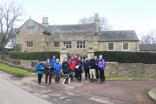
Hall hunters at Cartledge Hall.
Wednesday 15th January
Limb Valley & Porter Valley Circular
Leader & Report: Sue G Photo: Mel H
10 walkers and a dog named Bonnie set off from Whirlow Brook Park on a beautiful sunny morning, which was a welcome relief after the cold, snowy and icy conditions of the previous week. There were still patches of ice along the route, but we were able to walk along the edges that had begun to thaw. By the afternoon, it felt as though spring had arrived – the sun was warm, the sky blue and the bird song was wonderful.
After a steady climb up the Limb Valley to Ringinglow, we took an early mid-morning break at a picnic spot in a woodland parking area, before descending the Porter Valley to Forge Dam and beyond, via picturesque paths alongside Porter Brook.
The benches at Wire Mill Dam, provided a welcome lunch stop, and we enjoyed the warmth of the sun- a far cry from the bitter cold of the previous week. Suitably refreshed and re-energised, we climbed up Priest Hill, crossed the Ringinglow Road and took Coit Lane back to our starting point.
8.3 miles walked

From Priest Hill overlooking Forge Dam and Fulwood
Wednesday 15th January
Watery Ways
Leader: Nigel & Jane Photos: Jane & Simon
…


Saturday 11th January
Bolsolver
Leader, Report & Photos: Mel H
The historic Cotton Street car park was used today for the Saturday car walk. The group were joined by and welcomed a new member walking with the Chesterfield Ramblers for the first time. What a day to start, snow swept fields with a stunning backdrop of a cloudless blue sky under washed with an unusual for the time of the year very bright and warm sun. Coffee break was taken in Elmton this being enhanced with the distribution of homemade fudge, smiles al round as we left picturesque Elmton and headed for the hamlets of Oxcroft and Stanfree. Lunch was taken at Shuttlewood, again under cloudless blue skies before continuing on to Woodside and then Bolsover Woodhouse. A detour was required from this point due to an illegally blocked footpath. Not deterred the group returned to Bolsover where a number congregated in a tea shop for tee coffee and cakes – result.


Wednesday 8th January
Rowsley
Leader, Report & Photos: Mel H
Using Rowsley Station South car park the Wednesday Medium car group commenced with a short gentle climb to Chesterfield Lane, more commonly known as Rowsley Bar. Turning South the path through Copy wood and Northwood Carr was used to reach a suitable coffee stop at Northwood. Here one of the wonders of winter was visible in the form of the snow clad ridge to the east topped by Stanton Moor. Minor roads through Darley Hillside gave access to the delightful hamlet of Two Dales and Upper Hackney. Here the A6 was crossed to reach the trail alongside the Heritage Railway. Following a short walk along the trail lunch was taken just before reaching the outskirts of Darley Dale. The path across the ice covered flood pools leading to Darley Bridge was avoided and a detour made to take in the 2,000 year old Yew Tree in Churchtown. The Heritage trail was then re acquired to follow the river side path back to Rowsley and the car park.
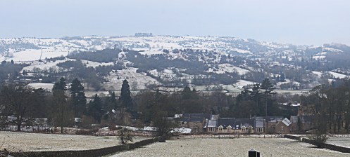
View East from Northwood
Saturday 4th January
New Year Stroll
Leader: Mike S Photos: Mel H
…


Wednesday 1st January
New Years Day Walk
Leader & Photos: Mel H
A few brave, (or certifiable), walkers set out for the traditional New Years Day walk from Hope. The picture was taken on the Hollowford Road heading out of Castleton. They were looking very happy after a serious coffee stop with bacon buties and toasted tea cakes. Wishing all members a very Happy New Year.
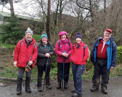
Sunday 29th December
Dam Flask
Leaders & Photos: Kath & Barry
…

Saturday 28th December
Doing the junctions
Leader & Photos: Mel H
…

Saturday group on new bridge over the canal at Hartington.
Wednesday 18th December
Holmesfield
Leaders, Report & Photos: Ann & Hilary
11 of us walked from Holmesfield through Fanshaw Gate and over Totley Moss where we had to battle the wind. Then through Totley Bents and back through Holmesfield Wood.


Sunday 15th December
Monyash
Leader: Terry & Eileen Photos: Simon
..

")
Saturday 14th December
Walking the Boundaries
Leader: … Photos: Mel H
..


Wednesday 11th December
Ford
Leader: David & Vanessa Photos: Mel H
This weeks walk was the annual Christmas Dinner walk. The meal was preceded by a 5 mile walk encircling Ridgeway.

Wednesday 11th December
Chatsworth Circular
Leader: Kay Report & Photos: David M
A select band of four enjoyed another Chatsworth bus walk – starting at Baslow Nether End and this time finishing at Chatsworth House.
The initial climb up to Stand Wood was followed by a walk around the Emperor Lake and the Cascade above Chatsworth House before dropping down to Calton Lees for a joint lunch spot with the car ramblers who we met on their longer Chatsworth walk.

Wednesday 11th December
For What It’s (Chats) Worth
Leader: Clive & Pauline Photos: Simon
..

")

Sunday 8th December
Baslow and the Edges
Leader & Report: Mike B
Route – Baslow, Bubnell, Calver Bridge, Froggatt Bridge, DVHW, Grindleford, Upper Padley, Hay Wood, Froggatt Edge, Curbar Edge, Bar Road.
To make allowance for the stormy conditions brought by Storm Darragh, the walk leader had already amended the original route to remove walking up on White Edge. The weather forecast for the day was for more very wet and windy conditions, this fact influenced the attendance as only 3 brave members decided to give the walk a go. It was dry and windy at the start.
The trio of hardy souls set off from Baslow Green to make their way to the bridge and into Bubnell. Baslow itself was awash with lots of runners about to attempt a ‘Mountain Marathon’, hope they survived the conditions.
Continuing on, the group followed the path from Bubnell through some standing water and muddy tracks into Calver Bridge and followed the Derwent Valley Heritage Way to Froggatt Bridge. Here a welcome coffee break was taken. They continued on the DVHW along Spooner Lane through woodland to reach Grindleford and onwards to cross the bridge over the railway into Upper Padley. Going past the cafe at Grindleford Station, the group climbed up into Tumbling Hill and Hay Wood. Here was a suitable place for the lunch break.
Duly refreshed, the trio made their way crossing A625 to enter environs of Froggatt Edge, heavy rain made its first appearance and stayed with the group for the rest of the walk. Following the footpath and avoiding the many pools of standing water, the group continued at a good pace, along Froggatt Edge and Curbar Edge. Crossing Curbar Gap, the trio took the bridleway behind Baslow Edge to pick up and follow Bar Road back into Baslow and return to the start point.
The wet and windy conditions did not dampen the group’s enthusiasm and they agreed that the walk was well worth the effort.
Distance: 11.1 miles
Elevation: 1470 ft
Saturday 7th December
Harthill Figure of Eight
Leader & Report: Isobel M Photos: Mel H
After much deliberating because of the dire weather warnings the walk went ahead, albeit considerably altered. A small group of five met at the car par park in Harthill. The route was shortened and remained close to Harthill, in the hope that the walk could be completed before Storm Darragh arrived, with an emergency option to allow a quick return to the car park.
The walk started on the path along the eastern edge of Harthill Reservoir. At last, the work on the dam wall has finally finished and it is great to see water back in the reservoir; the sailing club must be pleased. The route crossed one of the bridges to reach the western side of the reservoir and then turned towards Woodall. After walking through Woodall it followed Walseker Lane to meet the Cuckoo Way where a short break for coffee was had sheltering in the trees.
In a diversion from the original route the Cuckoo Way was followed to Kiveton Waters and Hard Lane. After a short section of road walking on Hard Lane the path along Broad Bridge Dike was taken. After ‘walking the plank’ it was a relief to find a path with a firm surface and to follow it back to Harthill.
Although the weather was showery, the strong winds and heavy rain did hold off until after the return to the cars. Due to the recent weather, there was quite a lot of mud and some surface water but all manageable. Better to be out than in and wise to cut it short.
Distance 5.5 miles

Wednesday 4th December
Hollingwood
Leader: Gavin Photos: Mel H
..

Wednesday 4th December
Chatsworth
Leader: Hazel Report & Photos: David M
Walks in the Chatsworth Estate are always popular and today’s route provided a circular from the bus-stop at Baslow’s Nether End for nine, including two visitors.
A misty start but by the time we had reached the Russian House it was much brighter.
Czar Nicholas I was scheduled to visit Chatsworth in 1844 but never made it.
The Russian House was built from a model of a farmhouse forwarded in his place – and like many Chatsworth Estate properties it is available for hire.Two more Chatsworth walks next week.


Wednesday 4th December
Around Ashover
Route – Ashover, Overton, Milltown, Ashover Hay, Highoredish, Ogston, Wooley Moor, Woodhead, Alton and Ashover Rock
Leader, Report & Photos: Mike B
A group of 20 walkers and two dogs met at the Village Hall car park in Ashover. The weather at the start was cool with sunshine. Sadly this did not remain so and low cloud slowly made its way after mid morning and the last section of the walk was done in damp heavy mist.
The route of the walk had been amended recently from the original version to avoid excessive muddy and boggy sections. Some parts of the local terrain do not lend themselves to ‘winter walking’ by large groups.
The group set off and followed the bridleway down at the side of the Poets Corner pub and continued up the ‘Coffin Lane’ and onto Overton. Good views looking back at the pretty village of Ashover. Passing the Overton Hall the group followed the track and lane called ‘Gin Lane’ .. not named after the spirit but is an old term for lifting gear used in lead mining. This lane brought the group to Milltown and upwards along small lanes to reach a high grassy bank at Ashover Hay and suitable place for a coffee break.
After consuming home made flapjack provided by the leader, the group moved on, following a short section of the busy B6014 road towards Clattercotes Wood and onto narrow Berridge Lane. Here an active ford had to be negotiated, the leader was at hand to prevent any group member taking an early bath in the stream! The group made steady progress up this lane to go past Highoredish Farm to reach the top at 910ft. After catching their breaths, the group took the bridleway behind Trinity Farm and descended past the ruined old Trinity Chapel and continued along various muddy field footpaths to come out near to Ogston Reservoir. After a series of lane and field footpaths through Wooley Moor, the group had lunch at an elevated grassy bank at Handley, overlooking the reservoir.
Well refreshed, the group followed the footpaths through fields to reach the lane at Woodhead Grange Farm and onto Littlemoor. Here, the group followed the field footpaths overlooking Holmgate to drop down through Broomy Wood and up the other side to come out at the hamlet of Alton. Continuing up the lane the group reached the stony outcrop known as the Fabrick or Ashover Rock, the highest point of the walk at 982 ft. Sadly, by now it was shrouded in heavy mist so no good views on offer. See the group photo.
The group took the steady descent behind this feature to drop back into the village and to the start point, fine rain marked our return. A shorter walk than normal but there was plenty of up and down climb, this made it a good day out for the group.
Distance: 9.5 miles
Elevation: 1870 ft


Wednesday 27th November
Wrap up well, it might be chilly!
Leader: John H Report & Photos: Dermot T
Our walk yesterday certainly lived up to expectations – it was quite chilly up top!
17 members, including one visitor, met up at Hathersage Station just in time for the overnight rain to clear for us.
We began our ascent from Hathersage towards Dennis Knoll via Brookfield Manor and the one and only stile of the day adjacent to Green’s House.
We stopped briefly on the slope to Stanage Edge for coffee, flapjacks and rocky road, before our climb to the trig point. Unfortunately the trig point was shrouded in mist preventing the obligatory photo.
As we began our descent towards Green Lane the clouds cleared and we did manage a photo before a pleasant, but cool, lunch stop overlooking Higgor Tor.
After Green Lane we dropped down through Burbage, one of the oldest woodlands in the country, and down towards the riverbank and then return to Hathersage.
We kept a very good pace throughout covering 11 miles in exactly 5 hours with around 1200 feet of ascent with the added bonus of it all being done in daylight with no rain.


Wednesday 27th November
Youlgreave
Photos: Mel H
..


Sunday 24th November
Whirlow Brook Park
Leaders: Clive & Pauline Photos: Mike B
EOn what should have been a very wet walk 7 members walked through Ecclesall Woods to find the Neolithic carved cup-and-ring stone which had eluded us on previous walks. (Thanks Clive.) The walk continued up the Porter Brook returning to Whirlow Brook via the Limb Valley.
Distance walked 9 miles


Wednesday 20th November
North Lees
Leaders: Jane & Keith Photos: Keith
Eight members and one dog walked Bamford and Stanage Edges taking in the fantastic winter views


Wednesday 20th November
Killamarsh to Renishaw
Leader: Bill Photo: Basil
..

Wednesday 20th November
Beauchief Abbey
Leader: Rhona Photo: Mel
..

Taken near Thryft House above Park Head.
Sunday 17th November
Fox House
Leaders & Report: John and Tricia Photos: John
What started out as a walk in sunshine across Totley Moor, Blacka Moor, Houndkirk Moor, Hathersage Moor returning to Fox House via Bole Hill Quarry and Longshaw, turned into a wet finish. The group are seen here where they belong, BEHIND BARS!
18 walkers, 11 miles
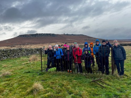
Wednesday 13th November
Eastmoor to Chesterfield
Leader: Basil Report & Photos: David
Thanks to Basil, who added a late bus walk to the programme schedule to take advantage of a fine sunny day.
Starting from the Highwayman pub at Eastmoor, newly acquired by the Chatsworth Devonshire Group, a seven mile route back down to Chesterfield was followed, via Freebirch and the Linacre Reservoirs.
Not exactly the traditional trig point photo ….

Wednesday 13th November
Toot-wit To-woo
Leader, Report & Photos: Natasha W
An impressive 32 Ramblers including guests from Sheffield 40s, East Cheshire and Derbyshire Dales groups joined todays 11 mile walk from the Fox House pub via Owler Tor and Carrshead Rocks to the summit of Stanage Edge.

Wednesday 6th November
Jamming
Leader, Report & Photos: Clive W
24 Ramblers plus 1 dog set off on a warm, misty day from Calver. We proceeded up the hill to Deep Rake where we had coffee and flapjack. After a bit of gardening at a stile we walked along Longstone Edge and then across Longstone Moor. We then descended to Great Longstone for lunch and a Titanic themed group photo. Some took the opportunity to purchase home made jam from “Two Robins”. We then walked through the graveyard (no jam jars please!) and over the fields to Rowland for additional purchases of jam. Back over Longstone Edge with some photogenic highland cattle and then back down to Calver. 10 miles in all.


Wednesday 6th November
Brimington to Arkwright
Leader: Ann Photos: David
Another very dull November day for a fairly flat local walk from Brimington to Arkwright, mainly via the Chesterfield Canal and the Trans Pennine Trail.
Eleven took part.Not the best of weather for the Duckmanton Cherry Tree Solar Farm.
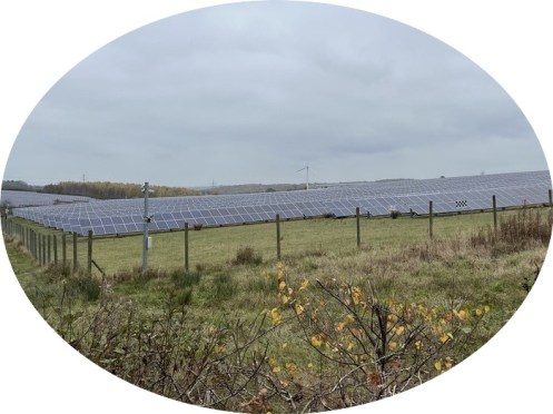
Wednesday 6th November
Renishaw
Leader & Report: Mel H (in place of Graham)
Making good use of the colourful autumn leaf strewn Trans Pennine trail the Wednesday Medium Car Group traced a route through to Killamarsh before turning on to the Cuckoo tow path for the gentle climb to Church Town. A pause at Netherthorpe allowed an intake of tea and coffee along with apple based goodies provided by Vanessa. At Church Town the route turned south along field paths located between High Moor and Upperthorpe to reach the western edge of Woodhall Common. Turning west lunch was taken before continuing on to Spinkhill via Parkhall Farm. At Spinkhill the route through St. Marys College was used to return to the Cuckoo Way. From here the canal towpath was used to return to the start point at Renishaw.
Sunday 3rd November
Castleton
Leader, Report & Photos: Kath P
15 walkers set off on a slightly ‘grey murky day’ for a lovely walk around Odin Mine.
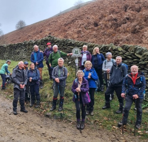
Monday 4th November
The AGM of the Chesterfield and NE Derbyshire Ramblers
Just a reminder that this years AGM will be held on Saturday 16th November from 12 noon to 3pm at The Church Centre, Longedge Lane, Wingerworth, Chesterfield, S42 6PU.
Free drinks and snacks will be provided. The AGM will be followed by a slideshow “The year in photos”. We hope as many of you as possible will be able to attend. A great opportunity to meet your fellow club members as well as an opportunity to influence the running of the club.
View the AGM Agenda online by clicking here
There will also be a short walk prior to the AGM, led by Mike S. Full details for the walk can be found at
https://www.ramblers.org.uk/go-walking/group-walks/cned-agm-walk-avenue-amble
Saturday 2nd November
Monsal and Bakewell Circular
Little Longstone, Great Longstone, Bakewell, Ashford in the Water, Monsal Trail
Leader & Report: Mike B Photos: Mike B, Mel H, Simon
A group of 13 walkers and three dogs met at Longstone Road at Monsal Head. The group included two new members. The weather forecast was for overcast skies, mild with no rain.This remained so for the duration of the walk
The group set off and followed the road down past the Pack Horse Inn to pick up the footpath across 5 fields towards Great Longstone. After negotiating the back streets of Longstone to emerge onto fields again and headed towards the A6020 and to go under the Monsal Trail. After a short walk along the road the group followed the path up and through Cracknowl Wood to emerge past Cracknowl House and on to the hill overlooking Bakewell and a suitable place for a coffee stop. Good views across towards Longstone Edge and Rowland.
After this break the group descended down the bridleway past the old quarry and onto Holme Hall. A group photo opportunity was taken at the bridge here. After which the group followed the River Wye into Bakewell and around the busy town centre to find the footpath through the churchyard at the All Saints Church, Bakewell and on to the footpath that heads East behind the church. This section was a steady climb and after crossing Stanedge Road the group dropped down to very boggy section before Crowhill Lane. A bit of nifty footwork was required here to avoid having boots full of mud but all was well. After which the group continued across uphill across fields to reach Lower Cowden Farm and lunch was taken here.
The group followed the lane for 1/2 mile going past Dirtlow Farm to then take the footpath down past the mast and the steady descent into Ashford in the Water. An opportunity use the toilets here was taken before the group moved on through the village passing Highfield Farm and onto the boggy path behind Thornbridge Hall and onto the Monsal Trail. This was a busy section with plenty of families using the trail. The group went through Headstone Tunnel and took the short but steep climb up onto Monsal Head and the end of the walk.
A varied circular walk with a nice amount of climb and was enjoyed and appreciated by the group.


Distance: 8.6 miles
Elevation: 1300 ft
Wednesday 30th October
Cutthroat
Leader, Report & Photos: Peter S
A group of 20 including 2 guests plus 3 dogs set off from Cutthroat Bridge. It wasn’t long before the mist set in which meant the lovely views were not visible.
We headed to Moscar House and then along Strines Edge. Alas Derwent Edge was not visible and we were not able to see the gritstone outcrops as promised.We crossed Strines moor where we had a coffee break on the number 5 grouse but After a little road walking we climbed Foulstones road and reached Back Tor for lunch . It was decided that we would not bother heading to the Lost Boy as the view would be rather limited. So we walked along Derwent Edge eventually ending at Whinstine Lee Tor where the mist lifted to give us a view of Ladybower reservoir below.
A gentle stroll down to Cutthroat Bridge where the walk finished.


Wednesday 30th October
Thieves Wood
Leader: Andrew Photos: Mel H
…
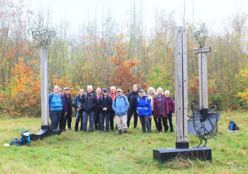
Group shot at Freckland Wood.
Wednesday medium car group enhancing the art work on the restored colliery tip, most likely Annesley Bentinck.
Saturday 26th October
Plague, Ford & River
Leader & Report: Sue G
On a beautiful autumn morning, 7 walkers & 1 dog set off from Stoney Middleton for a circular walk via Eyam, Stoke Ford, Leadmill Bridge & Froggat. On the initial climb up to Eyam Moor, we enjoyed the warmth of the sun & fantastic views, with sunshine on the tops & wisps of cloud in the valleys. As the day went on, the sunshine stayed with us, we heard and saw buzzards soaring high above us, admired fungi, including fly agaric, and marvelled at the microlights over Froggatt Edge.
In the afternoon, our route took us along the River Derwent to Grindleford. Although the river was flowing fast, we were treated to the sight of a dipper on a rock, the sun lighting up the yellow leaves of the trees and wonderful reflections in the water.
Rain earlier in the week had contributed to some of the paths being rather muddy, but this did not dampen our spirits on such a delightful autumn day.


10.5 miles walked, with 1500 ft of ascent.
Wednesday 23rd October
Heath to Bolsover
Leaders: David Mann. Report & Photos: David Moore
Another Heath to Bolsover bus walk – this one via Sutton Scarsdale, Palterton, Scarcliffe and Hillstown for eight of us.
Outward on the Nottingham Pronto – return from Bolsover on the No 1 bus.A misty view of Sutton Scarsdale Hall in the morning, but a brighter afternoon reminder in Scarcliffe of an upcoming event.
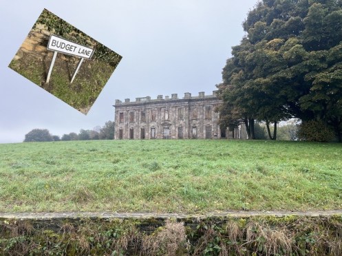
Wednesday 23rd October
Across The Moors
Leaders: John & Tricia G. Photo John G
21 walkers enjoyed an 11.5 mile walk starting from Mytham Bridge to Offerton Hall, Abney Moor, Bretton Clough & Offerton Moor, returning along the banks of the River Derwent. (Some bandits were interested at lunch but all was well!)
")

Wednesday 23rd October
Rowthorne
Leader: Dawn Photos: Mel H
…

Group picture at Teversall Church
Saturday 19th October
Offerton and Hathersage
Leader: Graham Photos: Mel H
…
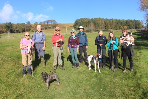
Taken from near Upper Hurst Farm with Bamford Moor and Bole Hill Wood as a backdrop.
Wednesday 16th October
Old Brampton and Cutthorpe|
Leader: Fred W Report & Photos: Basil M
Thanks to Fred a group of 8 assembled at Old Brampton Church for a bus accessible 5 and a half mile circular walk on an overcast but manly dry day. The route went via Linacre bottom reservoir, Cutthorpe outskirts, Woodnook Lane, heading across field to Westwick Lane before crossing the small, but awkward to use, ford at Brampton brook then ascending to the church. The light rain only started as we were on the last approach – perhaps the Angel of the Midlands smiled on us!
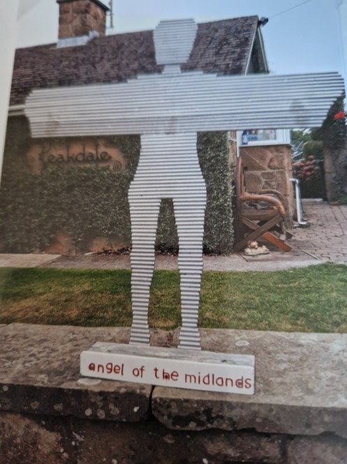
Wednesday 16th October
Ramparts and Ravines|
Leader: Joan D Report & Photos: Kath P
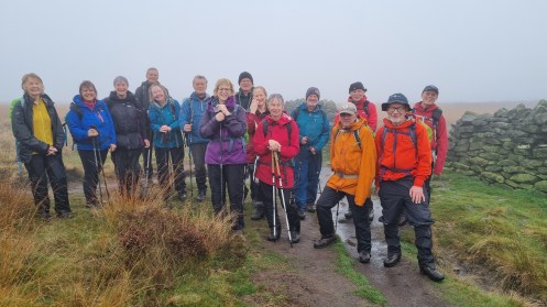
15 drowned rats + photographer, I think, just about sums it up.
Sunday 13th October
Through Chatsworth
Leader:, Report & Photos: John G
The Chatsworth Estate has been a popular location for walks this week with the third taking place on Sunday 13 October. Starting from Rowsley the route went by the way of Rowsley Wood, Hell Bank Plantation, Rabbit Warren, Emperor Lake, Hunting Tower, Edensor, Calton Pastures and Manners Wood. The changing colours of the landscape were something to be seen as Autumn takes hold. A sight not often seen was the local hunt galloping across Calton Pastures. 7 members and 2 guests from Hinckley Ramblers completed the 11.5 mile walk.


Saturday 12th October
Edale to Bamford
Leader: Barbara M Photos: Mel H
…


Saturday 12th October
Ramblers on tour!
A number of our regular walkers about to set off on a walk to Scarborough during their recent trip to Filey.

Wednesday 9th October
Carlton Lees
Leader, Report & Photos: Mel H
Commencing from Carlton Lees car park the Wednesday medium car group followed the broad track to Carlton Barns before turning south for the gentle climb to Beach-Square Plantation for a coffee break. Turning south east the group continued to Rowsley Moor Woods before doing a U turn to follow the concession path through Manners Wood to reach the lunch stop at Ballcross Farm. During the journey through the woods the group was treated to the sight of water vapour rising ethereal through the trees to eventually form clouds. Following the lunch stop the walk continued along Handley Lane to reach the track leading down to Edensor Village where the opportunity was taken to use the village and superb church spire as a backdrop for a group photograph. The high level path above the river Derwent was then used to return to the car park at Carlton Lees.

Saturday 5th October
The Peasants May Revolt Here
Leader, Report & Photos: Mel H
A group of eleven members departed from Revolution House, Whittington for an eight and a half mile walk in brilliant mid-autumn sunshine. The initial section of the walk used recently cleared arable field paths to reach The Brushes before descending the deep cutting to cross the main Sheffield to Derby line and thence to the Unstone road.
After crossing the road the broad track, recently created to accommodate the proposed Peak Resort at Unstone, was used to reach the inviting path running alongside the River Drone into Unstone. After crossing the ancient bridge over the Drone at Unstone Green the walk continued alongside the Drone before passing under the arches carrying the Sheffield – Derby line. It was noted by one member of the group that this particular line was the last to be created into a city in England, prior to this the terrain and ground conditions had prevented the line from being built.
Coffee break was taken at the northern end of Ramshaw Wood before doing a virtual ‘U turn’ for the trek up to the mast at Unstone. A short stop was made here to take advantage of the sunshine to enjoy the many views available over the Drone Valley Dronfield and Apperknowle. From here the route turned North East taking in the Hamlets of Hundall before skirting the northern edge of Stubbing Wood to reach first West then Middle Handley.
Lunch was taken with pleasant views across the valley between West and Nether Handley. Passing through Nether Handley part of the Chesterfield Round walk route was used to reach Parkhouse Farm before dropping gently down to the southern tip of New Whittington. A short detour was made here, due to path alongside the Rother being temporarily unusable, to reach the Brierley Wetlands Nature Reserve. The path across the Wetlands was used to return to the start point of the walk.
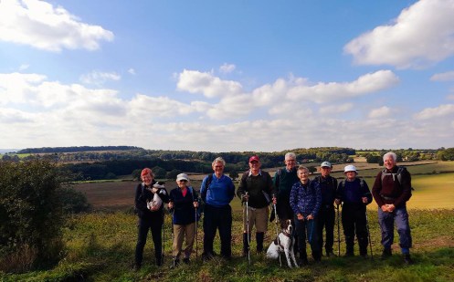
Picture taken at the view point between West and Nether Handley.
Wednesday 2nd October
Notification of a Discretionary Dog Restriction
A discretionary 5 year dog restriction has been accepted for the Broomhead and Barnside Moors and Cowell Pit, Grid Ref: SK220959.
Please see notice below for more information if this may affect any upcoming walks you had planned.

Wednesday 2nd October
Eyam
Leader: Jane & Keith Photo: Keith
16 members and one dog walked from Eyam over Eyam Moor to Stoke Ford and on to Leadmill Bridge following the River Derwent to Grindleford and Froggatt Bridge before climbing to Stoney Middleton and back to Eyam. The picture was taken at the historical Boundary Stone between Eyam and Stoney Middleton. The stone has 6 holes drilled into its surface where money, left as payment for food and medical supplies, was left in vinegar soaked holes, believed to kill the infection of the plague in 1665. After two days of torrential rain the mud was far less than expected
Distance walked 11.5 miles

Wednesday 2nd October
Monsal Head
Leader: Terry & Eileen Photos: Mel H
..

Heading back to Little Longston with Longstone Edge as a backdrop
Saturday 29th September
Limb Valley & Porter Valley Circular
Leader & Report: Sue G Photos: Mel H
On a lovely sunny morning, 7 walkers including 1 visitor, set off from Whirlow Brook Park. After ascending the Limb Valley to Ringinglow, we passed through Lady Cannings Plantation and headed to the Oxstones for our coffee break and the fine views of Burbage and Stanage Edges that could be seen in profile against the blue sky. From here we continued in a north-easterly direction on footpaths across moorland and fields past a viewpoint from which Lincoln Cathedral, 43 miles away, could be seen.
Then it was down through the Porter Valley to Forge Dam, where we paused to enjoy our sandwiches in the sun, accompanied by the quacking of many ducks. Following a circuitous route through woods and snickets and across fields , we eventually returned to Forge Dam. Taking the bridleway this time, we headed uphill across farmland & along lanes, to come out at the Bents Green end of Ringinglow Road. We walked alongside the grand playing fields of Birkbeck School before making our way down Coit Lane back to Whirlow Brook Park.
9.5 miles walked


Wednesday 25th September
From a Rock to a High Place
Leader, Report & Photos: Isobel M
Despite the unfavourable weather forecast a group of twelve met in Wirksworth for the last longer car walk of the summer programme.
The walk started from Barmote car park passing the cemetery before ascending steeply to Bolehill. After crossing Oakerthorpe Road the climb continued passing a trig point on the way to Black Rock. Black Rock provided views across to Willersley Castle, Riber Castle and Dene Quarry. After a coffee break the route descended to and crossed the High Peak Trail. It continued below and roughly parallel to the Trail, before joining the Midshires Way at its junction with the Trail. After a flat section on the Midshires Way the way crossed the road at Hollybush Farm and headed up through the woods to Whatfield Farm. A short descent led to a path alongside the Mere Brook. Another short climb followed before a welcome lunch break at the edge of Long Wood. The weather was getting warmer and the expected rain had not arrived.
After scrumping fallen apples near Knob Farm the path went through Alderwasley before another ascent. The transmitters of Alport Height came into view, but for a while the transmitters did not seem to get any closer. Eventually the viewpoint was reached. On a good day the Wrekin and the Long Mynd are visible in the distance and just below the viewpoint is the Alport Stone, a pillar of quarried stone. Fortunately, the weather was kind and although we may not have seen the Wrekin the view was impressive and extended to Derby.
After admiring the view, the group turned downhill towards Wirksworth crossing a stream on stepping stones at Ashleyhay. The paths alongside Pratthall Lane led to the top of Gorseybank. Instead of dropping down the road there, the lane was followed uphill and a path taken which led to a level crossing and finally the path reached the church. The rain finally arrived about ten minutes before the end of the walk.
Distance 10.25 miles


Sunday 22nd September
Hope
Leader: Phil W and Peter S Photos: Tricia
…
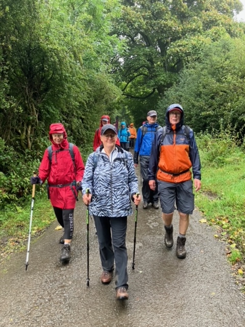
Saturday 21st September
Ford Circular
Leader & Report: Isobel M Photos: Mel H
Although the morning started cool, grey and damp, by coffee time the sky was turning blue and in the afternoon some of us were we wishing we had opted for shorts instead of longs.
A group of seven started out from the car park by the fishing ponds at Ford. The route went east by the side of the River Moss for a short distance before heading up through woods and then parallel to hedges along the edge of fields to reach the road at West Mosborough. It then followed a gennel behind Eckington Hall to come out on the A6135. Just as the sun started to appear a coffee, or should that be a Yorkshire Tea, break was taken sitting on Windmill Hill looking over the Rother Valley. After crossing over the River Rother and under the railway line we climbed up some steps and on to the Trans Pennine Trail where the direction of travel changed to south as far as Boiley Farm. There the direction changed again this time to westward across the now overgrown Renishaw golf course, redundant due to flooding.
After eating lunch in Eckington churchyard, the route climbed slowly along Lady Ida’s Drive and Back Lane to reach Bramley at Ford Lane. It was then downhill, diagonally across fields, which afforded views of the Moss Valley towards Sheffield, and over stiles to Greenside.
Then the final stretch was a descent to Birley Hay passing by the mill pond.
A pleasant day was rounded off with drinks and ice creams at the Bridge Inn.
Distance approximately 10 miles.
Reflection Moss Valley
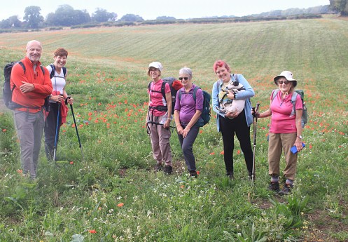
The group enhancing the poppies edge of Ince Piece Wood – Eckington.
Wednesday 18th September
White Edge Circular
Terry Powell Memorial Walk
Leader: Jean Powell Report & Photos: Mel H & David M
A good turnout of 18 at the Grouse Inn for Jean’s leisurely six mile circular – covering White, Curbar, and Froggatt Edges – meeting many people out enjoying a fine September day.

Picture taken on White Edge above the Grouse pub
Sunday 15th September
Tideswell
Limestone Way, Wheston, Tideswell, Peters Stone, Cressbrook Dale. Millers Dale
Leader & Report: Peter S
A group of 10 set of from Tideswell Dale in slightly overcast conditions. It wasn’t long before the rain began. After a short stint along the Limestone Way we turned towards Tideswell and as we prepared for a tea break awaiting the rain to stop . Off we set and picked up the Limestone way again and headed towards Wheston. More rain . A short time after walking through Tideswell we found the prearranged lunch stop on Litton Edge, just as the rain stopped. We finished off the Russian plum tart and set off again. Down to Peter’s Stone and along Cressbrook Dale. Heavier rain fell but at least we were under the tress now. Along to Millers Dale and back to the the Tideswell Dale car park.
Wednesday 11th September
Hartington
Leader: Rhona Report & Photos: Rhona & Mel H
The famous Hartington Duck Pond was used for the start point of the Wednesday medium car group walk, basically a wander around a section of the valley formed by the River Dove from Hartington to Pilsbury Castle. Leaving the village the group followed the path rising to and running along the rim of the eastern side of the valley taking in the lower reaches Carder Low. The high path afforded great views westwards over the valley with the high point of Sheen Hill forming a focal point.
After reaching a point above Parks Barn the gently descending north westerly route, over broad gentle pastures was used to reach the most northerly point of the walk at Pilsbury Castle, the site of a Norman Mot and Bailey Castle. A leisurely lunch was taken at this historically important point before the return journey commenced. After passing along the edge of the hamlet of Pilsbury the River Dove was crossed using the rather old, worn and very narrow wooden bridge.
A long gentle climb was then made to High Close Farm with its very aesthetic gardens and restored buildings. Passing along below High Sheen and Sheen Hill a mixture of field and woodland paths was used to for the return along the Western rim of the valley before the Dove was re-crossed for the return to the start point. The majority of the group then finished the day with tea and cake at the villages Beresford Tea Rooms.


Wednesday 4th September
Wingerworth Wander
Leader: Mike Photos: David M
A welcome late addition to the scheduled programme from Mike resulted in a local eight mile circular from Wingerworth’s Barley Mow pub.
Holymoorside is not really classed as a wild place for walking, but passing the current well dressing we saw the tribute to the invaluable services of the emergency services, who provide an invaluable backup to all walkers.
We always welcome donations to Mountain Rescue and the Air Ambulance on our annual Chesterfield Area Walking Festival walks in May.

Saturday 31st August
Park & Woods
Leader: Photos: Mel H
…

Saturday group taken from Rough Standhills overlooking the Limb Valley.
Wednesday 28th August
Heath to Bolsover
Leader: Basil Photos: David M
Not the quickest route but an 8.5 mile attractive walk from Heath to Bolsover, via Doe Lea, Ault Hucknall, Glapwell (with lunch at the cricket ground), and Palterton.


Wednesday 28th August
Ashover Rock
Leader: Mike S Photos: Mel
…
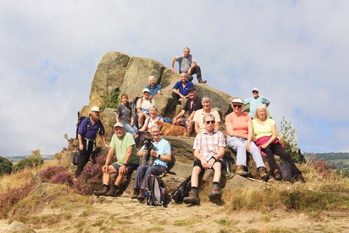
Wednesday 28th August
Where Eagles Dare
Leader: Clive & Pauline. Photo: Simon
15 walkers set off for todays ramble from Longshaw going via Froggatt Bridge, Eagle Stone, Big Moor & White Edge (where we were able to enjoy observing the deer). The heathland looked spectacular in its full purple bloom.
")
Wednesday 21st August
Holloway Circular
Leader, Report & Photo: Lorraine W
A group of nine people and a dog set off from Holloway on a Wednesday that promised sunny intervals, if at times a tad blowy. First stop the beautiful Dethick church and yard and then onward to Tansley before safely crossing the busy A615 and heading for the centre of the village for coffee and plenty of date and walnut cake to fortify us for the climb through Tansley Knoll toward Oaksedge Farm and the Lower Pond at Lower Lumsdale.
Entering the permitted route through Lumsdale to the atmospheric if gloomy waterfalls we made our way down the steps to the road and followed Bentley Brook to Baileys Mill and pushing our luck once again recrossed the A615 and began the long pull up to the road at Stark Holmes and the even steeper pull up the road.
Finding our footpath off to the right we lunched overlooking Matlock Bath around the bench dedicated to “John Beano – warrior of love and kindness” where our photograph was taken with a refurbished Riber Castle also in the frame.
After lunch we began our epic trudge along Hearthstone Lane to its end by the blue plaque dedicated to Alison Uttley author of The Little Grey Rabbit books who grew up at nearby Castle Top Farm and beloved by women of a certain age and much remembered from their childhood.
Next came Bow Woods down to Smedley’s factory and on to Cromford Canal passing the refurbished Aqueduct Cottage and along the canal exiting via some very steep stone steps to begin a long pull up through woods to Wakebridge pausing for breath at the road before the last push and scramble up a bank to the ridge. A stroll through fields and then the descent back into Holloway.
Plenty of ascending and descending, good company and conversation. My idea of a great ramble coming in just short of 12 miles.

Wednesday 21st August
Minninglow
Leader: Andrew T Photos: Mel
…


Saturday 17th August
Encircling Ancient Steam
Leader, Report & Photos: Mel
Starting from Rowsley Old Station car park the Saturday walking group followed the short section of pathway to reach Rowsley Bar. Here a slight change of route was required to accommodate footpath closures associated with forestry work. Undeterred, the group made good use of the bridleway through Copy Wood to return to the planned route at Tinkersley for the woodland traverse to Northwood Carr and Northwood. Here coffee was taken with sunlit views over to Stanton Moor. From here single track roads, dotted with cottages and homes many recently restored, were used to reach Darley Hill Side and on through Tow Dales to reach the western edge of Upper Hackney. After crossing the A6 the route chosen joined the Dewent Valley Way Heritage Way for the very pleasant walk back to Rowsley. On the way the group were treated to the sight of one of the Peak Rail steam locomotives travelling towards Matlock. Lunch with entertainment at the Darley Bridge cricket ground and a short stop to view the 2000 year old Yew Tree at Churchtown.

Watching a couple of overs at Darley Bridge.
Wednesday 14th August
Monsal Head
Leader: John C Photos: Mel
Monsal Head and Seven Dales, Water cum Jolly Dale. 1994 ft of ascent today, but the views were worth it.


Wednesday 14th August
Long Dale Comin’
Leader & Report: John Photos: Dermot
13 walkers enjoyed a 12 mile walk from Winster over the fields towards Aldwalke before heading off to Pikehall and the surprisingly spotless fields after the Y-NOT Festival just over a week ago. Climbing out of Long Dale the route took us towards Youlgreave and then Elton using the Limestone Way to return to Winster
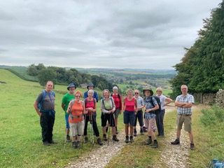
Sunday 11th August
Harthill
Leader & Report: John & Tricia Photos: John & Mike
On a hot Summer Sunday 13 walkers and a dog set off from Harthill to walk across farmers’ fields rich with crops to Shireoaks. Coffee was taken at Netherthorpe Airfield watching a number of planes land. Walking around the Old Hall at Shireoaks the canal was joined just below the marina. When we reached Turnerwood, (ice creams for some!), we met the Hugh Henshall trip boat of the Chesterfield Canal Trust. (Perhaps we all should take a trip on it as all the passengers looked very satisfied). Lunch was had at Thorpe Triple Lock, where some shade was found, and eventually we left the canal at the tunnel entrance at Kiveton. The team photo was taken at the high point of Kiveton Waters Country Park where the decision was taken to walk directly back to Harthill, because of the heat, and shorten the walk from its original 13 miles to a reasonable 11.1 miles. A good decision!!


Wednesday 7th August
Highs And Lows From Hayfield
Leader & Photos: Kath P
15 regular walkers and 2 visitors headed out for todays walk from Bowden Bridge.

Wednesday 7th August
Ashford in the Water
Leader: Bob Photos: Mel H
22 walkers headed out on todays walk around Ashford in the Water
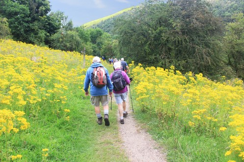
some people are “in the pink” ramblers go one better, they are “in the yellow”

Near the cascade in Monsall Dale.
Sunday 4th August
Winster
Leader: Terry K Photos: Tricia
…

Saturday 4th August
Shireoaks
Leader & Report: David B Photos: David B & Mel H
There were 17 of us on today’s 9 mile walk around the South Yorkshire / Nottingham borderlands We set off from the marina at Shireoaks and then walked across the Lindrick Golf Course , using one of the permissive footpath underpasses to get under the busy A57. Then on to the village of Woodsetts and along wide clear paths between sugar beet crops, with long views as far as the last remaining (and recently closed) power station cooling towers at West Burton. We continued on the outskirts of South Anston,where we had lunch.
The route then followed paths into Anston Stones Wood ,where we saw rare butterflies and displays of summer wildflowers, including harebells. We continued through the unusual limestone gorge ( though resisting the temptation to seek out Dead Man’s Cave). Next we went back on to the concessionary golf course paths – nicely mown for us , using the second of the underpasses for a safe road crossing. Then on to Brancliffe Grange and beside the canal feeder on to Turnerwood , where the ice creams proved irresistible .Then back in the sunshine along the towpath to our starting point.


Sunday 28th July
Monsal Head
Leader, Report & Photos: John G
15 walkers including a guest from the Netherlands completed a 10.5 mile walk in hot conditions. Setting off from Monsal Head the route took in the Monsal Trail over the tunnels at Cressbrook Mill and Litton Mill and across the River Wye at Litton Mill. Walking through the woods in Cressbrook Dale towards Litton and turning to go down Tansley Dale, lunch was taken at the top of the climb of Cressbrook Dale before Wardlow and Longstone Moor returning by the Packhorse Inn which looked very inviting.

Saturday 27th July
Bothamsall
Leader: – Photos: Mel H
…

Group image taken at Clumber lake.
Wednesday 24th July
Amber Hill to Kelstedge, via Tansley
Leader: Ann & Bob Photos: David M
Another X17 bus walk – this time coping with the Matlock Farm Park diversion. This entailed a start at Amber Hill before setting off for Tansley where lunch was taken. Some road walking, combined with this year’s dense footpath vegetation. The bus conveniently turned up just as we reached Kelstedge at the end.


Wednesday 24th July
Carlton Lees
Leader: Hilary & Ann Photos: Malcolm, Mel, Simon
…


Saturday 20th July
Ogston – Ashover
Leader: Gavin Photos: Neil D & Mel H
…


Wednesday 17th July
More Edges than U2!
Jarvis Clough, Bamford Edge, Green’s House, Stanage Edge, Moscar Lodge
Leader & Report: Peter S Photos: Peter & Simon
There were a group of 9 of us that left Cutthroat Bridge. We crossed the A57 and headed up to Moscar house and onwards to Moscar lodge. On the way we tried to find Moscar Cross alas it was nowhere to be found. After crossing the A57 again we headed up towards Stanage Edge. We walked along the edge before cutting down towards Green’s house. Lunch was taken overlooking a derelict chapel. We headed up through the woods and up to Bole Hill where we climbed through some rather tall ferns before entering an abandoned quarry. Eventually we reached Bamford edge which gave us some excellent views of the Ladybower reservoir. We crossed the Ladybower brook via Jarvis cough and returned to Cutthroat Bridge.


")


Distance: 18km
Ascent: 517 m
Sunday 14th July
Ramblers on tour!
Photo: Tricia G
11 members of the Chesterfield ramblers have recently been on a trip to Canazei in the Dolomites. Here they are enjoying their first walk! (just a little bit different from the normal Sunday walk!)

Saturday 13th July
Wharncliffe Wander
Leader, Report & Photos: Isobel M
A small group of four met the Glen Howe carpark in Wharncliffe Side on a cool and cloudy morning. The route went round two of the reservoirs in the Sheffield Lake District. It started by climbing up steps in Glen Howe Park and then headed into fields before crossing Tinker Brook stream. After crossing Brightholmelee Road a farm track was followed uphill towards Spout House. From there it descended back to the road and then went down Bud Lane. The coffee stop was in the meadows near Carr House Farm before we descended to the woods on the southern side of More Hall Reservoir. From there it continued on the south bank of Broomhead Reservoir reaching the end of the reservoir at Broomhead Bridge. After crossing Yewtrees Lane the way was uphill initially by Ewden Beck then bearing east through woodland and across Wood Brook before turning steeply uphill to Heads Lane. Then there was an easy section along Heads Lane to Bolsterstone with views across the valley. After passing the church it continued east along a footpath to Cote House from where it descended steeply to the north side of More Hall Reservoir. At the dam wall the route changed direction and headed south and then south easterly to Brightholmelee before descending to Glen Howe on Storth Lane.

Distance 8.5miles
Ascent 439m
Wednesday 10th July
Well, Well, Well
Leader, Report & Photos: Clive W
Poole’s Cavern, Solomon’s Temple, Derbyshire Bridge, Errwood Reservoir, The Beet, Buxton Dome, Pavilion Gardens
14 ramblers set off from Poole’s Cavern, Buxton. We visited Solomon’s Temple, a hilltop folly with extensive views. We then walked to Errwood Reservoir for lunch and a return to Buxton via a hillside contouring old railway line followed by a descent through Cavendish golf course. The walk concluded with a visit to the acoustically amazing Buxton Dome, the Crescent, the Pump Room, 2 dressed wells and the Pavillion Gardens for refreshments. 20km and 540m of climb.


Wednesday 10th July
Cutthroat Bridge
Leader: Ruth H Photos: John & Simon


")

Sunday 7th July
Edale
Leader & Photos: Kath P
Ringing Roger, Crowden Tower, Noe Stool, Jacobs Ladder, Upper Booth.
Sundays walk was over Ringing Roger and Kinder edge. Sunshine was on offer after a late start due to torrential rain.

Saturday 6th July
Hope
Leader, Report & Photos: Mike B
Route – Twitchill Farm, Hope Brink, Win Hill Pike, Aston, Navio Roman Fort.
A smaller than normal group of 4 walkers and one dog met at the car park and toilets in Hope. The weather forecast was for rain showers in the morning and clear in the afternoon. In reality, it was the reverse of that with clear skies at the start and light showers at the end.
The group set off and followed the Edale Road towards Killhill Bridge. From here the group made the steady climb up the tarmac track to reach Twitchill Farm. Behind this holiday complex the group made the steep climb to reach the bridleway that leads along Hope Brink. Excellent views could be seen here of the Hope Valley and Vale of Edale, with Lose Hill standing proud in the sunshine. A suitable place to have an early coffee break and consume some chocolate treats provided by the leader.
After this break, the group continued on this bridleway to make the steady climb along Thornhill Brink to reach the rocky summit of Win Hill Pike. The group were exposed to the strong northerly winds at this location. See group photo at the Trig Point.
The group met a really fun group of men doing the climb as part of a ‘Middle Earth Themed’ stag weekend. The ‘stag’ was dressed as Frodo Baggins, his cape was a sight when the strong wind got beneath it!.
The group made a careful descent of this rocky summit and made their way down to reach the footpath in the direction of Aston. It was decided to take the lunch stop here and take in the views of Hope and Bamford below. After lunch, the group made it to the hamlet of Aston and took the footpaths through the fields to reach Hope Station. Over the footbridge, the group continued to the crossroads to enter Brough. After the Mill, the group took the footpath through the remains of the Navio Roman Fort and continued through fields and returned to the start point in Hope.
It was one of the shortest walks in the Saturday programme. The steady climb to Win Hill and the gentle paths back through fields was appreciated by those in the group.


Distance: 7.2 miles
Elevation: 1300 ft
Wednesday 3rd July
The Lady is Hopeful
Leader, Report & Photos: Natasha W
The longer car walk today had 14 walkers. A 10.5 walk up Win Hill and around Ladybower Reservoir enjoying sweeping views across The Hope Valley and Derwent Dams, ending at the Quaker Hall at Thornhill.
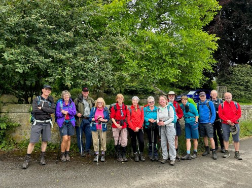
Sunday 30th June
Cutthroat Bridge
Leader, Report & Photos: Peter S
A total of 18 Ramblers, including 1 guest, set off from Cutthroat Bridge on an 11.5 mile walk. The weather was perfect for this walk although slightly cool and quite windy. We headed up towards Whinstone Lee Tor where we took the low path, which gave us excellent views across Ladybower reservoir. After a short stiff climb we reached White Tor. After a well deserved coffee break and a piece of Plum cake we continued along Derwent Edge towards Bradfield Head Gate where we descended down to Green Sitches and then up to the Lost Lad and onto Back for for Lunch. We then crossed Foulstone Moor and down to Strines Bridge, past Strines Inn and across Strines moor and Strines ridge before heading back to Cutthroat Bridge via Moscar House. It was rewarding to note that many experienced walkers had been introduced to several paths they had not walked along before.


Saturday 29th June
Cutthroat Bridge
Leader: Barbara M Photos: Mel H
…
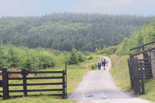
Walking up the long Foulstone Rd towards BackTor.

On White Tor with the Wheelstones as a backdrop.
Wednesday 26th June
Curbar Gap
Leaders & Report: David & Vanessa Photos: Mel H
Altogether there were ten on today’s walk. The weather was super sunny and no rain. Walked up onto White Edge where we were able to get a good view of Big Moor. After coffee break we made our way down to The Grouse Inn crossing the field that is now well drained due to recent trench digging. We crossed back up onto Froggatt Edge where we had lunch seated at the ancient stone circle. Our walk continued along Froggatt Edge and Curbar Edge back to our cars. Thank you for your company today.


Saturday 22nd June
Edwinstowe
Leader: Chris & Jill Photos: Mel H
—

The team at the Major Oak.
Wednesday 19th June
Hathersage
Leader, Report & Photo: Clive W
19 ramblers set off from Hathersage. We went via North Lees Hall and then up to Stanage Pole (photo). The weather improved as we descended to Redmires reservoirs where we joined the Conduit and followed it to the pond at its end where we had lunch. From there we struck out directly across Hallam Moors to Stanage Edge. A long descent via Dennis Knoll brought us back to Hathersage after an enjoyable 11 mile walk.

Wednesday 19th June
Monsal Head
Leader: — Photos: Mel H
—
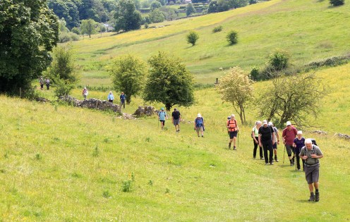
Climbing to the trail near Thornbridge Hall.
Saturday 15th June
Litton Village
Cressbrook Village, Millers Dale, Litton Mill, High Dale, Priestcliffe, Limestone Way, Tideswell Dale.
Leader, ReportL Mike B Photos: Mike B & Mel H
A group of 9 walkers and one dog, including a visitor, Mike from Amber Valley Ramblers, met at the village shop in Litton. The group set off towards Cressbrook in overcast conditions with thunder and heavy showers forecast for lunchtime and early afternoon.
The group followed the footpath that went through 7 fields to reach the woodland above Cressbrook Dale. The footpath in this woodland was narrow and tricky underfoot with tree roots and slippy wet limestone, so progress was steady along this section. On reaching Cressbrook, a coffee stop was taken in the community garden area.
Refreshed, the group continued on the lane above the village to pass the church. Here was the village Well Dressing tableau, designed by the school children of the village, see photo. The group followed the track above Cramside Wood to drop down the winding path into Millers Dale and Litton Mill. On crossing the footbridge, the group took the path up on to the Monsal Trail and then continued to climb up the steep footpath in Priestcliffe Nature Reserve to reach Bulltor Lane. A herd of inquisitive cows hampered the last few yards!
The heavy rain that was forecast arrived as the group made their way to High Dale, a change into full waterproofs required. From High Dale the group followed the footpath and stiles through fields to reach Priestcliffe. It was decided to seek shelter from the rain under trees and have lunch. After which the weather improved and remained dry for the rest of the walk. The group continued through fields to then descend the footpath down Millers Dale Nature Reserve. This was a tricky decent made worse with the recent rain on the stony path but all group members arrived down safely onto the Monsal Trail.
A refreshment and toilet stop was made at Millers Dale Station. From here the group made the steady climb past Monksdale Farm and along the Limestone Way. After a mile the group followed the walled track and footpath to reach Meadow Farm and continued to Tideswell Dale. From here, they took the path parallel to the road and eventually back into start point in Litton.
An interesting walk and the weather did not dampen the spirits of the group and they all enjoyed it.


Distance: 9.6 miles
Elevation: 1790 ft
Wednesday 12th June
Eyam, Abney and Offerton Moors
Leader & Report: John R Photos: Malcolm
21 walkers, including a visitor from Holland, plus one dog set off from the Grindleford end of Sir William Hill Road. The first section took us downhill on Eyam Moor past Ring Cairn before turning back up the hill passing near to Stanage House and on to The Barrel Inn at Bretton for our morning break. Here we were asked by a member of staff from the Pub not to linger on the grass bank so we moved a few yards up the road and sat on the verge.
The next stretch was road walking towards the gliding club and Hucklow Edge then down to Abney Grange and on to Abney Moor for lunch at Robin Hood’s Cross. The route then took us across to Offerton Moor where we were able to enjoy magnificent views across to Ladybower as the sun decided to join us at this point (no RAF fly past unfortuately).
We then continued down towards Offerton Hall then past Robin Hood’s Stoop to Highlow Hall. From here a bit more descent before the final leg and steady ascent across Eyam Moor once more to return to our cars.
")
")
")
")
Total Distance: 11.5 miles and ascent of approximately 1450 ft.
Wednesday 12th June
Bakewell
Leader & Report: Graham W Photos: Mel H
15 ramblers set out on a 8 mile walk from Ashford in the Wate via Monsal Head, Bakewell and Lumford Mill. The path into Monsal is very over grown and difficult.
In the fields near Litte Longstone we saw Buzards and several Kites. What a sighting.
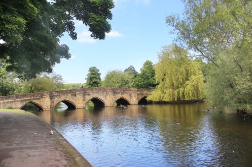
Lunch with a view, Bakewell.
Saturday 8th June
Roswley – Stanton
Leader & Report: Sue G Photos: Mel H
7 walkers, including 1 visitor, set off from the Old Station car park at Rowsley, thankful that the early morning rain had passed.
Our route took us via Congreave & Sheepwalk Wood to the Nine Ladies Stone Circle on Stanton Moor. Although there was a strong cold wind, the sun was shining & there were wonderful views to the north-west of Haddon Hall & Haddon Fields.
After crossing the moor, and pausing for the obligatory group photo at the Cork Stone, we descended through Barton Hill Quarries to Birchover & Uppertown. We took our lunch at Barn Farm, accompanied by the cries of peacocks, one of which spread its tail feathers, offering us a magnificent colourful display.
Our return route took us past the Earl Grey or Reform Tower, & through the old Lees Cross quarry workings to Stanton Woodhouse & back to Rowsley.


9 miles & about 1250 ft of ascent
Wednesday 5th June
Mini Round Walk
Leader, Report & Photos: Dermot T
10 walkers participated in a clockwise circular walk around Chesterfield on a cool bright day.
We began the walk from Chesterfield Railway Station and then followed the route of the River Hipper going up through Queen’s Park , Walton Dam and then onto Somersall Park. From there we headed over to Linacre Reservoirs, stopping for coffee en route and then we made our way to Cutthorpe. We then walked through the fields to Barlow and picked up the Chesterfield Round Walk Route for a few miles.
Lunch was taken near the Barlow Country Club and from there we headed towards Dronfield. Immediately after crossing the A61 footbridge we made our way towards Old Whittington and Revolution House – which is closed to visitors at the moment. After a short descent towards the Chesterfield Canal we then followed the canal towpath, the Cuckoo Way, to the Railway Station, meeting up with the John Varley II, as it passed through Wheeldon Mill Lock.
A very pleasant walk, with little or no mud! We kept up a nice steady pace finishing the walk just before 1600. Sadly our usual photographer wasn’t on today’s walk so we had to improvise!


Distance: 14 miles
Wednesday 5th June
Whatstandwell circular
Leader: Bill Photos & Report: David M
Another X17 route bus walk, connecting with the Trans Peak in Matlock.
On the eve of the 80th anniversary of D-Day a circular walk for eight group members from Whatstandwell to the Crich Stand war memorial – originally erected in 1923 after the First World War. A fine blustery day with just a brief hail shower on the way.


Wednesday 5th June
Ashford in the Water
Leader: Kath C Photos: Mel H
..


Saturday 1st June
Rivers & Dales
Leader & Report: David B Photos: Mel H
There were 10 us on today’s 9 mile + 1100ft of ascent walk from Youlgrave. This included visitors from Amber Valley and , for part of the walk, a friend of mine who lives in the village who told us about the efforts of the Pommie Pilgrims ( named after the local band , noted for going pom pom pom). They are aiming to raise £42,000 to provide toilets and kitchen in the 12th century parish church by walking to each of the 42 Anglican cathedrals in England, a task involving trekking an amazing 10 million steps (and are about half way in cash terms)
We followed Bradford Dale to Alport , up Lathkill Dale to Conksbury and then round to Meadow Place Grange ( an outpost of the Monks of Leicester Cathedral founded around the 12th century). Next it was down into Lathkill Dale again continuing round into Cales Dale . A bit disappointing that in a couple of places there were adults, children and dogs in the water despite notices emphasising why thats not appropriate in the National Nature Reserve.
Next it was the challenging climb out of the dale up to the steps ( ive settled on 170, though we got a range of different numbers) and on to the farm at Calling Low. Magnificent views up here, including of One Ash Grange, another one time monastic outpost – this time of Roche Abbey
Home stretch back to Youlgrave now. Mel was disappointed we had not seen any orchids on the walk, then suddenly, in our very last field there was a bank of early purples ( and a happy Mel). Weather was pleasant, albeit dull, breezy and cooler than hoped for at the start of June
Many thanks to the villagers for providing a good car park and excellent toilets for us and all the other walkers


Wednesday 29th May
Ashford in the Water
Leader, & Photos: Kath P
…
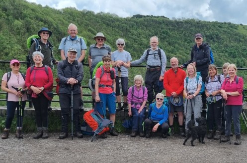
Wednesday 29th May
Beauchief Abbey
Leader: Rhona Photos: Neil D
A few photos from todays walk to Beauchief Abbey. 19 walkers and 2 dogs covered 7.6 miles


Sunday 26th May
Fox House
Leader: Phil Report & Photos: John
11 Walkers set off from Fox House to Stanedge Pole via Lady Canning Plantation, where a Stag was spotted amongst the trees. Taking lunch at the Pole the group were subjected to a heavy downpour which was thankfully the only real rain of the day. The walk back along Stanage Edge and Burbage Edge was the best part of the day with the waterproofs relegated to the rucksacks

Thursday 24th May
2024 Chesterfield Walking Festival
Report: Neil D Photos: Neil D & Mel H
Over 80 walkers took part in 7 walks organised by our group, in support of the Chesterfield Walking Festival. Covering over 1100 miles between them on walks from 8 to 34 miles in length & in weather ranging from a hot 22 degrees Saturday to heavy rain affected walks on Tuesday and Thursday. There was lots of positive feedback received from the participants . Thanks to all involved leaders, back makers and very importantly support staff in making the week a success for us.


Wednesday 22nd May
Edges & Tors
Leader, Report & Photos: Sue G
Four hardy souls joined me on an amended route more suitable to a day of heavy rain. From Fox House we walked along Burbage Brook before heading for Owler Tor. The rain was torrential on Millstone Edge, so we delayed our elevenses till we reached the relative shelter of Whim Plantation. At this point we decided to cut the walk even shorter than originally intended & to take the track that follows the railway line back towards Grindleford Station. Padley Chapel provided a dry, sheltered spot for lunch, after which we returned via Padley Gorge, accompanied by the roaring of the stream in spate.
6.5 miles walked

Wednesday 8th May
Heights of Abraham
Leader: Steve H Report & Photos: David M
There are many potential X17 based bus walks that take advantage of the route from Barnsley to Wirksworth through the heart of our group area. A route from Matlock Bath via the Heights of Abraham and Bonsall and on to the centre of Matlock is only six miles, but you need a bit of energy for over 1400 feet of ascent / descent.
Ten on Steve’s walk on a fine spring day.


Wednesday 8th May
The Nine Rings Part 3
Old Tupton, Redcar Hillside, North Wingfield
Leader, Report & Photos: Mel H
Taking advantage of the brilliant sunshine The Round Part 3 commenced with a walk through bluebell strewn Far Tupton and Mulberry Woods to reach Martins Lane for the steady climb to the northern edge of Hardwick Wood and Redcar Hillside. Now turning south the ridge walk to Britton Wood provided excellent views over the meadow covered valleys on both the Press and Tupton sides.
After taking coffee on the edge of Britton Wood the route then proceeded through Woodthorpe Grange and Henmoor to reach Stretton Hall Farm and then Handley Lodge. From here the streamside path was used to reach Smithy Moor before turning east to reach Stretton Top via Stretton House. After crossing Roman Ryknild Street lunch was taken before crossing the infant River Rother and proceeding through Padley Wood, with more bluebells, to reach the outskirts of Pilsley.
Turning back north expansive meadow field paths led the group to Lower Pilsley and Waterloo before negotiating the route around Senor Farm for the gentle climb to North Wingfield. Passing North Wingfield Hall the group proceeded to re-join the Round walk route just below Deincourt School. From here the Round Walk route was followed past the impressive, and currently very visible, northern portal of the Clay Cross Tunnel, to re-cross Ryknild Street and return to the entrance to Far Tupton Woods.

Wednesday 8th May
Coal Aston
Geer Lane, Marsh Lane, Troway, Coal Aston
Leader: Hilary & Ann Report & Photos: Vanessa
13 walkers set out today for the 7.5 mile circular walk from Coal Aston along Geer Lane, Marsh Lane and through Troway. A super walk in the sunshine!

Wednesday 1st May
The Abbey and Capability Brown
Leader and Report: John Reynolds Photos: Malcolm Smith
A group of 17 walkers and one dog headed off from Laughton-en-le-Morthen for 7.5 mile circular walk to Roche Abbey for lunch.
We were blessed with a warm and dry day. Conditions underfoot were much improved with just one difficult stretch of muddy conditions.We had a morning break near Thwaite Farm before heading off to Firbeck which once contained the private racecourse of Anthony St Leger who originated The St Leger Stakes. From Firbeck we headed off cross-country to Stone and then descended into the velley in which Roche Abbey is situated. The Abbey ruins are still quite impressive and it is not difficult to imagine it in its hey day. Lunch was enjoyed on benches in the Abbey grounds courtesy of English Heritage staff who kindly agreed to let us use the facilities, albeit that not all the group were members.
Our return to Laughton was out of the Abbey valley, across stepping stones, which only a few weeks earlier were impassible, and then a slow and steady ascent to Slade Hooton before our final stretch back to our cars.
Thanks to all those who supported the walk, some of whom had travelled a considerable distance.


Sunday 28th April
Bamford and Stanage Edges
Hollin Bank, Bole Hill Wood, Bamford Edge, Cutthroat Bridge, Moscar Lodge and Stanage High Neb
Leader, Report & Photos: Mike B
A group of 6 walkers started the walk from Hollin Bank Car Park.
The weather at the start was very cool for the time of year with heavy rain. Full waterproofs required from the start. It was forecast to improve and stop raining from lunch time, which it did. The breeze was light and by mid afternoon we had a rare sighting of blue sky and sunshine.We proceeded past the toilets above North Lees and descended to follow the path along the moorland and woodlands to reach Green’s House. From here we continued onto Bole Hill Wood. We decided to take an early sheltered coffee stop here. We were entertained by a number of Curlews calling out to each other.
A steady climb up and along Bamford Edge followed and allowed the group to admire great views through the mist and rain of Win Hill and Ladybower Reservoir. The poor weather seemed to have reduced the normal amount of walkers along this popular scenic section. We continued along the edge and made our way around Jarvis Clough and along Hardron Edge to reach Cutthroat Bridge.
We continued along the paths and tracks passing by Moscar House to reach Moscar Cross Road. Along this path we encountered two pair of Lapwings giving us a fine view of their aerobatic skills. It was decided to take our lunch stop on this section.
From this road we picked up to path and climbed up and along the Sheffield Country Walk bringing us to Moscar Lodge and the A57. The group crossed this busy road and continued on the Country Walk passing Stanage End and onto High Neb and Stanage Edge. See the group photo taken at the trig point at High Neb.
It was wet and muddy underfoot in some parts, a theme which has continued on most walks since Nov 2023. The clouds eventually cleared and the group walked in sunshine and clear skies for the remainder of the walk. We descended from the edge through Stanage Plantation to North Lees and back to the start.
After the initial wet and gloomy start the walking conditions improved and the group enjoyed the walk


Distance : 11 miles
Elevation : 1750 ft
Saturday 27th April
The Old Tram Way
Staveley, Renishaw, Eckington, White Lodge, Barrow Hill
Leader, Report & Photos: Mel H
The group commenced Saturdays walk from an alternative start point, Poolsbrook Country Park, due to an unforeseeable issue. The Trans Pennine trail was used to skirt Renishaw before a brief coffee stop just before Birley Farm. After crossing the river Rother, the remains of the old tramway was used to traverse the now defunct Renishaw Golf Course. Here a brief stop was made when a member of the group spotted a photo opportunity in front of a magnificent Cherry tree that was in full bloom. Passing through Eckington Setcup lane was then used to reach Hornthorpe Cottage for the turn South towards Foxstone woodlands and Dam. Here we were treated to delightful views of the woodland floor completely carpeted in Bluebells interspersed with the occasional white of emerging wild Garlic. Lunch was taken at White Lodge before continuing on towards Barrow Hill. Here, a significant detour was required due to the current closure of the two bridges which cross the Rother at Staveley. On reaching the Hollingwood Hub the canal towpath was used to return to Mill Green at Staveley before climbing Constitution Hill to return to the trail and then Poolsbrook Country Park.


Wednesday 24th April
2 Halls and a Castle
Kelstedge, Ashover, Fallgate, Tansley Knoll, Lumsdale, Farley Wood, Cuckoostone, Bottom Moor
Leader: Neil D Photos: Neil D
A group of 20 plus one dog set off from Eddlestow Lot car park, down to Kelstedge and then across to Ashover. Coffee was taken in the churchyard, then it was onwards past the show ground with views of Eastwood Hall and the Ashover tulip fields to Fellgate. It was then a steady uphill climb up Jetting Street and on past Overton Hall and Gregory’s Mine with time taken to admire views and catch our breath along the way. The route then took us across to Tansley Knoll for a relaxed, comfortable lunch.
Feeling rested and refreshed we set off again and walked past old mills and the mill pond on the way to the bottom of Lumsdale Falls. Rather than follow the usual route we turned left here and climbed up the old stone path and stairs to allow us to walk across top of Matlock Bank. We walked past many grand old properties and the hydro with magnificent views down Matlock valley. It was then up past the sports ground with a quick stop for a group photo (sorry for cutting one of you off either end😂) before returning to the cars via Farley Moor, Matlock golf course and Bottom Moor.
The weather was fine all the way round with very only short section of wet ground although there was cold wind in some parts reminding us summer is not yet here.
Thanks to all walkers and for your comments at end of walk.
Thanks to Clive for back marking.


Distance: 12.5 miles
Ascent: 1650 ft
Saturday 20th April
Around Junction 29
Astwith, Hardwick, Ault Hucknall, Bramley Vale, Stockley Trail, Rylah, Heath
Leader: Neil D Photos: Mel H
The sun was shining on nine walkers and two dogs as we set off from Holmewood across the fields to Astwith. The walk then dropped down and under the M1 to Hardwick Park where we had coffee at the Hardwick pond visitor centre. After, we proceeded onwards up to Ault Hucknall where we had time for a quick visit to the church before carrying on down via Bramley Vale to the Stockley Trail where lunch was taken. After lunch we continued on the trail until it meets the footpath which took us across the fields under the M1 then up to Heath. It was then across to the Five Pits Trail and finally back to the cars. It was nice to have sunshine all the way and very little mud. Thanks to everyone for joining the walk and to Barbara for back marking.


Distance: 10.7 miles
Ascent: 760 ft
Thursday 11th April
The Lost Paths
Does the smell of thyme still linger in Dronfield ? The long awaited book by Jack Cornish, the Head of Paths at Ramblers Central Office, has finally arrived – and our area gets a mention! A route from Dronfield to Stubley (presumably now lost to housing development) forever smells of thyme, allegedly – the result of a man murdering his sweetheart while she was carrying the herb along the old path. Jack Cornish has also discovered a rare use of direct footpaths between Winster and Bonsall to avoid having the join the road traffic.
For any members interested in reading a copy, the book is available now from all good bookshops.
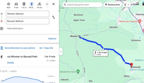

Saturday 6th April
Rowsley
Rowsley, Congreave, 9 Ladies, Birchover, Barn Farm and Stanton Woodhouse
Leader: Graham Photos: Mel H
..


Distance: 8.5 miles
Saturday 30th March
Rowsley – Two Dales
Rowsley, Tinkersley, Darley Hillside, Derwent Valley Way
Leader, Report & Photos: Mel H
Starting from Rowsley Old Station car park the Saturday group, including a visitor and a new member, made good use of the wall to wall sunshine to follow a route through Copy wood and Northwood Carr. Here the paths were lined with extensive displays of bright yellow Celandines responding to the early spring sunshine. These were accompanied by extensive growth of Wild Garlic with the flower heads trying to burst open and thus soak up the dappled rays of sunshine painting the woodland floor.
Following a short break for coffee, the quiet side roads running through the hamlets of Northwood and Darley Hillside were used to reach Two Dales. On then to drop down to Darley Dale to cross over the A6 and then join the very busy path alongside the Peak Railway. Here the group was treated to the sight of a heritage line train pulled by a Deltic Diesel Engine and a Saddle Tank steam engine running “Foot Plate” experience rides.
Lunch was taken at Darley Bridge before following the Derwent Valley Way through fields, once again strewn with bright Celandines. The remainder of the route followed the edge of the River Derwent, where in the wooded sections the Celandines were enhanced with contrasting white Wood anemone. On return to the car park a number of members took the opportunity to finish of the walk with a visit to the Chatsworth cafe located in the Peak Shopping Centre, for tea, scones and ice-cream.


Distance: 8.5 miles
Wednesday 27th March
Malin Bridge
Rivelin & Loxley valleys
Leader: Kay W Report & Photos: Basil M
By a combination of bus or train plus tram 8 eco-Ramblers gathered at Malin Bridge for a 9 mile circular combining the Rivelin and Loxley Valleys in Sheffield.
Both valleys are scenic, particularly the Rivelin, and show evidence of their industrial past with many weirs, and remains of mills and forges evident. On a grey, but largely dry day, the group ascended via the Rivelin Valley before continuing to climb up to and along the ridge, mostly in Bradfield parish. The paths are well signed and maintained thanks to the efforts of the Parish Council and Sheffield Ramblers who used both volunteers and funds from the Bradfield Ancient Ways Initiative (BAWI).
It was windy on the tops but provide good views when in shelter. The descent down the Loxley Valley is initially blighted by abandoned remnants of a more recent industrial past which needs clearing. However, these were soon passed and dams, fishing ponds, with heron etc. spotted. A pleasant descent to Malin Bridge was achieved.
Thanks to our leader Kay W, who recced the route, and provided Easter buns for the lunch stop.


Wednesday 27th March
Old Copper Mines – Hartington
Hulme End, Manifold Trail, Dale Farm, Back of Ecton, Ecton Hill, Hulme End, Haysgate, Townend and Sheen.
Leader & Report: Mike B Photos: Mike B & Mel H
A group of 19 walkers, including a visitor from Kidderminster, met at the duck pond in Hartington and set off in the direction of Hulme End and the Staffordshire Moorlands. The weather was cool, overcast and a little breezy at the start with rain forecast for lunch time
Passing through the narrow pinch stile and footpath the group entered the first of five fields on the way to Mill Lane. Recent heavy persistent rain made this a muddy and boggy section. This theme of deep slippy mud and standing water was repeated in most field paths encountered during the walk. It made the walk heavy going in places.
After 1/4 mile on the busy Mill Lane, the group picked up the footpath through the fields to Endon House to emerge via the campsite adjacent to the Manifold Hotel on the road to Hulme End. At the Visitor Centre at the old Railway Station, the group used the facilities and a coffee break was taken. Following the Manifold Trail, on the path of the old narrow gauge railway, the group walked this flat track for about 2 miles. The heavy rain began and came to us in an horizontal direction. The fast flowing River Manifold was always close by.
On reaching Dale Farm, a National Trust property and working farm, the group proceeded up the green valley to reach the limestone rocky feature known as the ‘Sugar Loaf’. A steep climb was made around this hill and the climb continued along muddy footpaths to reach a section before Broad Ecton Farm and lunch was taken. The group continued upwards to the top of the hill. A diversion was made by some of the group to reach the Trig Point at Ecton Hill, the highest part of the walk at 1230ft. A group photo was taken here with good views of Wetton Hill and Narrowdale Hill in the back ground.
The group descended down from the Back of Ecton to reach the lanes and footpaths towards Westside Mill and eventually picked up the Manifold Trail and made use of the facilities again at the Visitor Centre at Hulme End. From here the group walked along the lane to Haysgate, then taking the very muddy footpath down to a footbridge over the River Manifold. From here, the group climbed up through the fields to Townend and then along the main road into the small hamlet of Sheen.
The group now heading East towards Hartington, followed the footpaths through boggy fields to reach Bridge End and dropping down towards Digmer Farm.The lack of grip here due to the muddy conditions made this descent interesting! Passing by the new housing development and returning to the start at the duck pond.
A varied walk in the quieter parts of the Staffordshire Moorlands. The muddy conditions slowed the pace but with good views throughout, it was enjoyed by the group.


Distance: 11.6 miles
Elevation: 1340 ft
Wednesday 27th March
Calver
Leader: Judith K Report & Photos: Vanessa
15 walkers set off from Calver Cricket Ground. The walk followed the River Derwent along to Froggatt Lane where we climbed up to a path running under Curbar and Baslow Edge. We found a sheltered spot for lunch before descending down through Baslow to Bubnell following the Derwent again. We were lucky to see a raft of beautiful Mandarin ducks when we were almost back to our starting point in Calver.

The group on Baslow Bridge
Distance: 7 miles
Saturday 23rd March
Hathersage and Grindleford
Hathersage, Leadmill Bridge, Grindleford Station, Longshaw.
Leader & Report: Sue G Photos: Mel H
It was cold & blustery as our group of 8 walkers & 3 dogs set off from the Fox House car park. At first, frequent showers assailed us, temporarily banishing the sunshine, but as the day wore on, the periods of sunshine became more sustained. We started along Burbage Brook on a very muddy footpath, before cutting across to Owler Tor & Lawrence Field. From this area of moorland, we descended towards Padley Gorge, through woods of ancient twisted oak & birch trees.
A short climb up to Bolehill Quarries took us to our coffee stop amongst the silver birches. The path then led us past abandoned millstones in various stages of completion. After crossing the Hathersage Road, we walked below Millstone Edge to emerge onto moorland in a blast of hailstones. By the time we reached Hathersage & our lunch stop, though, it was a completely different story & we basked in beautiful sunshine.
After lunch, we took the route along the Derwent River from Leadmill Bridge, eventually emerging at Grindleford Station. Our progress on this section was slowed by long sludgy stretches churned up by the many feet that had followed the same path. Our final climb, on a steep path, was facilitated by stone steps through Yarncliff Woods & into the Longshaw Estate by the pond. From here it was a short stroll back to Fox House.
Despite the cold gusty wind, and muddy terrain, we were rewarded by splendid scenery & magnificent views bathed in spring sunshine.

In Bolehill Quarry

Longshaw – looking for the Easter Bunny.
Distance: 9 miles
Wednesday 20th March
Old Brampton
Leader, Report & Photos: Fred W
Once again 8 eco-travellers proved that you can go for a ramble in the countryside without using a car.
8 assembled at Old Brampton Church (where time moves slower than in surrounding areas as there are 63 minutes in an hour according to the clock face) and set out on a planned circuit of 5.5 miles on a grey day with more rain threatening. In the end only a little light drizzle was encountered on a route via Ashgate and Linacre reservoirs before return to the village for a bus back.
Briefly crossing the Holymoorside, and Chesterfield boundaries, the Holymoorside North Millennium Boundary Stone was passed and a dinosaur spotted – albeit one made of pieces of wood in a garden near Linacre entrance. Lunch was taken near the middle reservoir but the planned route around the top reservoir was prevented by closure due to board-walk repairs.
Whilst there was no great amount of added rain the ground conditions reflected the quantities which have descended recently. Care was needed to aavoid slipping and testing out the old folklore that a little mud does wonders for the skin complexion. Sadly one who tested the possible health gains failed to realize that direct skin application is necessary.
A longer car free circuit will take place in Sheffield next week. There’s room on the bus or train as you choose (+tram). Why not improve your health and help save the planet at the same time?

Wednesday 20th March
Early Spring in Chatsworth
Leader, Report & Photos: Dermot
14 walkers, including 1 visitor, participated in a walk on a relatively warm, wet and of course “muddy” first day of Spring.
The original advertised walk had to be heavily revised due to the damage caused by the recent floods to the local foot bridges.
We left the car park at the Robin Hood and walked around the bottom of Birchen Edge. From there we made our way up to Wellington’s Monument meeting the always present local herd of Highland Cattle.
After coffee we. began our descent from Baslow Edge and into Baslow, where we entered the Chatsworth Estate. We then made our way up to the Hunting Tower where we stopped for lunch. After a relatively brief shower we walked round the Emperor Lake before making our way down to Chatsworth House. After a short stop, we then walked back to Baslow and then followed the footpath at the side of the A621 for about a mile, before crossing over to Moorside Farm.
After a short ascent towards Gardom’s Edge we were greeted by the first lambs of 2024, before returning to the Robin Hood.
A very pleasant steady walk.


Distance: 11.75 miles
Elevation: 1321 ft
Sunday 17th March
Eyam
Riley Graves, Froggatt Bridge, Froggatt Edge, Hay Wood, Grindleford, Leadmill, Hog Hall, Eyam Moor
Leader, Report & Photos: Mike B
A group of 12 walkers met and set off from the free car park in Eyam. This included 3 visitors from the Sheffield S40 Group and 2 visitors from the Rushcliffe Ramblers Group. We had rain showers at the start but they soon cleared away to give a dry day with sunny spells. Heavy overnight rain had increased the amount of surface water we encountered for most of the walk. Many paths on the elevated sections being streams.
We made our way from the car park into the centre of Eyam and climbed through Riley Wood. Passing the Riley Graves and Top Riley, continuing on the paths to descend and reach Froggatt Bridge. From here we made our way to climb up through Froggatt Wood. The rocky footpath became a steady stream in places and careful footwork was needed to avoid getting a boot full of water. The climb became a short scramble before we emerged onto Froggatt Edge. The appearance of the sun required layers of waterproofs to be removed on this climb. Opportunity was taken to take a well earned coffee break on Froggatt Edge and to admire the distant views.
We continued to follow the bridleway along the edge and eventually dropping down to the A625. We crossed this road and into Hay Wood. Picking up the footpath the group descended through this wood to emerge at the church at Grindleford. A toilet stop opportunity was taken here for some of the group.
Entering the fields at Grindleford, the group followed the Derwent Valley Heritage Way towards Leadmill. This was a wet and muddy section of the walk. The path through Coppice Wood was particularly muddy and slippy. The group had stopped prior to this for lunch.
On reaching Leadmill, the group crossed the B6001 and proceeded along the road to reach a footpath over a stone bridge (see group photo) and onwards passing Hog Hall towards Hazelford. From here the group continued upwards on the lane passing Leam Farm to eventually enter Eyam Moor. Following the footpath, the group made the steady ascent through the moorlands to reach Sir William Hill Road. Following Edge Road, the group continued onwards, passing Mompesson’s Well, to descend into Eyam and back to the car park.
A varied walk done in wet and muddy conditions with good views and enjoyed by the group.


Distance: 11 miles
Elevation: 1800 ft
Saturday 16th March
Wentworth Woodhouse and its Follies
A walk through the fields around Wentworth Woodhouse and Elsecar
Leader: Barbara M Photos: Mel
..


Wednesday 13th March
Staveley
Leader: Steve Report & Photos: David M
A well-trod circular to Staveley and back from Chesterfield Rail Station for eight on a dull day, interrupted by a slight afternoon drizzle.
The route took us through Tapton golf course and the West Wood, reaching Poolsbrook Country Park for a lunch stop. A return via the Chesterfield Canal.

The West Wood carvings

The West Wood carvings
Wednesday 13th March
A Harthill Circular
Harthill, Barlborough, Spinkhill, Killamarsh
Leader & Report: Isobel Photos: Mel
Lured by the promise of mud “A Grand Union” of twelve Gongoozlers met at the car park on Woodall Lane in Harthill. The route had been extensively altered due to the recent heavy rain as the paths that had been drying out were impassable again because of deep mud. This meant that the length of the walk had increased to 13.5 miles (ouch).
The walk started by following the eastern side of Harthill Reservoirs the largest of which is still devoid of water. It continued to Rotherham Road via Pebley Grove Farm. After crossing the road, the route crossed a field to reach the parkland of Barlborough Hall. The hall designed by Smithson, of Hardwick Hall fame, is now a private school. There was then a gentle climb up Ward Lane to Barlborough village green where the benches provided comfortable seats for coffee.
A long, diverted, section on tarmac followed, through Barlborough village, down Siday Lane and uphill to Spinkhill. After walking through the grounds of Mount St. Mary’s, another private Catholic school, we descended to the Trans Pennine Trail. It was easy walking on the trail and the old station platform on the edge of Killamarsh was soon reached and it provided a good location for lunch.
After lunch the route along the Cuckoo Trail followed the line of the Chesterfield Canal gradually ascending through Netherthorpe and Nether Moor and passing Gongoozlers Walk, reaching Mansfield Road at Norwood. After crossing the road, it continued west by the edge of Nor Wood before going under the motorway and turning south down Walseker Lane to the attractive linear village of Woodall. The same direction was followed along Dowcarr Lane which becomes a track and finally reaches the path that borders the western side of Harthill Reservoirs. Unfortunately, the path around the end of the reservoir is closed meaning a bit of back tracking had to be done to cross to the other bank. The relieved muddy Gongoozlers reached the car park at 4pm.
Credits Clive Wilson for finding the definition of Gongoozler, “one who harbours an interest in canals and canal life but do not actively participate” and coining the collective noun, Grand Union of Gongoozlers.

The group at Harthill reservoir (with absolutely no photoshopping! If you believe that you must believe in the tooth fairy 😛 )
Distance: 13.5 miles
Saturday 9th March
Holloway Circular
Starkholmes, Lumsdale, Tansley, Dethick.
Leader & Report: Isobel Photos: Mel
It was a slightly foggy and damp morning when a group of eight met by the cemetery in Holloway.
The walk started gently downhill through Lea Wood to return to the road at Lea Bridge. After crossing the road Bow Wood was entered and the route started to climb uphill, at first gradually but after turning right at Castletop Farm, more steeply. Castletop Farm sports a blue plaque stating its connection with Alison Uttley the author of the Little Grey Rabbit books. Hearthstone Lane was followed up to Hearthstone Farm. Part of the way up a coffee stop was taken where there were views across the Derwent Valley to Cromford and Willersley Castle. The sun threatened to come out and the mist lifted but the sun only fully emerged at the end of the walk. At the top of the path there were views across to Crich Stand and of Riber Castle.
After reaching Riber Road the way descended steeply on the road until at Ward’s End where a path was taken heading northeast to the A615. Once the A615 was crossed Lumsdale Valley was climbed. Lunch was eaten at a playground. Nobody went on the swings. The views of the Lumsdale waterfalls were particularly impressive due to the persistent heavy rain we have had. From the Middle Mill Pond, the walk contoured before descending into Tansley Knoll and Tansley.
After crossing the A615 again the gradual ascent back to Holloway started, passing through Dethick, Lea and ended, after a slight detour onto private property (due to an obscured sign) by dropping down to Holloway on the path by the church.
Group in Lumsdale with the waterfalls as a backdrop


Group in Lumsdale with the waterfalls as a backdrop
Distance: 9.5 miles
Wednesday 6th March
Rowsley
Congreve, Nine Ladies, Birchover and Stanton Woodhouse.
Leader & Report: Graham & Edna Photos: John R & Neil D
18 Ramblers walked 9 miles from Rowsley to Congreave via Nine Ladies, Birchover, Barn Farm and Stanton Woodhouse. After the morning mist had cleared we had a
lovely sunny Spring Day. The footpaths are beginning to dry up and the mud not too bad.


Wednesday 6th March
Fly the Flag
Flagg, Priestcliffe, Brushfield and Deepdale
Leader & Report: Clive W Photos: Mel H
John was unable to lead due to illness. Clive deputised at short notice and led 17 Ramblers on a replanned 11 mile walk from Monyash. We walked via Flagg and Priestcliffe to Taddington where we had a sunny lunch in the churchyard. After lunch we returned to Monyash via a terrace path above Taddington and then down lanes and across fields finishing with a steeplechase of 11 stiles. The weather was beautiful, a real early spring day, and the views were extensive. Wildlife highlights were 2 Red Kites and (for a lucky few at the front) a weasel.

Taken at the High Low nature reserve
Sunday 3rd March
Calver Sough
Coombs Dale, Black Harry Gate, High Rake, Rowland, Hassop, Edensor, Baslow, Bubnell
Leader & Report: Mike B Photos: Mike B & Neil D
A good turnout of 18 walkers set off from Calver. This included walkers from Congleton Ramblers, S40 Ramblers and Stockport Ramblers. It was quite misty but dry at the start with no breeze. The weather was forecast to brighten up during the morning and to remain dry throughout.
We made our way across the fields at Calver Low to join the path along the bottom of Coombs Dale and made the steady climb up this steep sided dale. A footpath on the left was then followed and the group steadily climbed up the hillside above the dale. The path was narrow and care was needed during the ascent. We reached the final gate at High Rake and our coffee break. This was the highest section of the walk at 1109ft. The heavy mist was still present and did obscure the normal good views towards Eyam and Froggatt Edge.
Dropping from Bleaklow the group took the narrow path down to reach the hamlet of Rowland. Following the lane through Rowland to group walked to main Hassop Road.
A section of road walking was necessary from here to reach Hassop. The group crossed the busy B6001 to join the path behind Home Farm and walk through Birchill Bank Wood to reach the A619. This section was the first opportunity the group had to walk along a very muddy path and paddle across a stream! After crossing the busy A619, the group took the bridleway and climbed up to Pilsley.
The group then walked up Handley Lane to reach the bridleway and lunch was taken here. Suitably refreshed the group followed this bridleway down into Edensor and then into Chatsworth Park. Here a group photo was taken with the house in the background, The group continued through the park in the direction of Baslow, to eventually leave via the tall rotary gate. In Baslow opportunity was given to use the toilets, after which the group continued through passing Baslow church to reach the small bridge at Bubnell. Continuing along the road through Bubnell the group followed the DVH Way all the way back into Calver and completion of the walk.The recent heavy rains made this final section particularly muddy and slippy.
A good varied walk, with some interesting climbs and enjoyed by all members of the group.


Distance: 12.25 miles
Elevation: 1450 ft
Saturday 2nd March
Waymarked Wanderings
Leader & Report: David B Photos: Mel H
Not much sign of the start of Meteorological Spring as 8 of us set of from Dronfield Sports Centre on a 9.5 mile walk around Cowley, Barlow Lees and Unstone. The weather was dull cold and quiet wet, though it did turn out a good deal better by coffee time. As expected , lots of mud again , with one or two short diversions to try and avoid the worst of it. We had our lunch stop overlooking the site of the huge & long running Peak Resort project. Despite decades of delays and false starts, the project remains live , with outstanding detailed planning issues currently being considered by Chesterfield Council. Dont hold your breath- though it was nice to be able to use the well surfaced replacement rights of way around the site – a mile without any mud !
We then followed the path beside River Drone , still lots of snowdrops around, and on under Unstone’s substantial 8 arch railway viaduct , little known as well hidden from view. Then through the woods and along the Unstone Line trail back to Dronfield
Interestingly , almost all the walk followed parts at least one of 6 popular waymarked routes, including the Chesterfield ,Dronfield and Holmesfield Round Walks


Wednesday 28th February
Circular via Wolfie Pond and Pilsley
Leader: David Mann Report & Photos: Basil
6 walkers set off on the 8 mile programmed walk around Clay Cross. A pleasant walk completed without incident. The attached photograph shows the George Stephenson’s Clay Cross tunnel, completed in 1839 at a cost over nine years of £140,000 – an overspend of £42,000! The vegetation around it has recently been cut back allowing walkers a great view.

Wednesday 28th February
The 9 Rings Part 2 – A Loop Around the South
Leader & Report: Mel H Photos: Neil D
Commencing from Grassmoor Country Park, the Wednesday long car group completed an 11 mile walk to complete the second of the Nine Rings that make up the complete Chesterfield Round. Making good use of a section of the Five Pits trail the group headed south east past Wolfie Ponds before turning east for a coffee stop at the picturesque hamlet of Astwith.
It was south then through Hardstoft to head for the most southerly point of the walk at Cocktop. Back then to the Five Pits trail for the short hop to Pilsley Station then on to Upper Pilsley and Hallgate Farm before turning towards Danesmoor. Lunch was taken in the fields just before reaching Danesmoor. On then through Danesmoor, Clay Cross and Egstow to reach the portal of the northern end of the Clay Cross Tunnel.
At this point the route joined the section of the Chesterfield Round passing alongside the railway to reach Hepthorne Lane. Continuing to follow the Round route the walk continued up the long incline past Deincourt School then over the North Wingfield road to return to Wolfie Ponds. From here the group retraced their steps along the trail to return to Grassmoor Country Park.


Saturday 24th February
Chatsworth Circular
Edensor, Calton Lees, Chatsworth House, Hunting Tower.
Leader & Report: Sue G Photos: Mel
Having left home in brilliant sunshine, 11 walkers & a dog set off from Baslow village green beneath a cloak of chilly mist. We walked through the grounds of Chatsworth to the bridge over the Derwent, before branching off to the village of Edensor & the first ascent of the day.
As we emerged onto Handley Lane, the sun was beginning to break through and the eerie shapes of the trees in the fields alongside the road came into view. By the time we reached Carlton Pastures, we were in the sun above the mist & the photographers amongst us were thrilled by the scenic effects of the cloud inversion.
We crossed the wet & muddy pastures & descended past Carlton Houses to Carlton Lees. The hedgerows were full of birdsong & a woodpecker could be heard drumming nearby. The fields along the river to Chatsworth House were squelchy & it was good to get back onto a hard surface as we went up past Chatsworth House to ascend through the woods, via the old aqueduct to the Hunting Tower. From here it was a short descent back into Chatsworth park & back to Bakewell.


Distance: 9.8 miles
Ascent: 1290ft
Saturday 24th February
A Friend Remembered
Earlier this month saw the sad loss of Rex Bryan; a firm friend and a very valued member of the Chesterfield Ramblers group. Rex was a strong supporter of Richard Felton who led evening walks from Ashover for a good many years. Indeed Rex stood in for Richard when he was unavailable. He will be fondly remembered by the Ramblers footpath volunteer group, of which Rex was a valued member, often providing a little hilarity on even the most difficult jobs. Rex will be sadly missed.

Rex with his volunteering friends
Wednesday 21st February
Clowning Around
Leader, Report & Photos: John R
I was joined by three other group members who had decided to take on the elements on this relatively short circular walk from Clowne to Cresswell then Elmton and back to Clowne.
The first stretch was along The Clowne Greenway which was good walking and sheltered for much of the way. We took our morning break a little early but decided the covered and seated shelter on Cresswell railway station was our best option out of both wind and rain. Then off through Clowne and The Model Village before heading out into the countryside down tracks and field paths to Elmton, all of which were surpringly free of mud. Lunch should have been taken at Elmton but we decided just to plough on following a slightly abridged route back to Clowne. We arrived back at the car park at 12.45 having completed just over 7 miles.
St Barnabas Charity Shop and Cafe was our final port of call where we enjoyed some well earned hot drinks


Sunday 18th February
Ashford
Little Shacklow Wood, Sheldon, Over Haddon, Conksbury, Ditch Cliff
Leader & Report: Peter & Loreta Photos: Peter
16 Ramblers including 2 guests and 2 dogs walked nearly 12 miles over some muddy fields and tackled some very tricky stiles. After walking along the river Wye we climbed up through Shacklow Wood, definitely worth it, over some fallen trees and up to Sheldon. On to Over Haddon and down to the river Lathkill which was in full flow. After a short loop we made it back to Over Haddon. Brownie points for 2 public toilet breaks. After leaving we walked through Ditch Cliff and eventually made it back to Ashford. The weather was perfect for walking especially after the deluge the night before.

Saturday 17th February
Barlow and Millthorpe Circular
Rumbling Street, Bradley Lane, Cartledge, Millthorpe, Unthank, Moorhall, Oxton Rakes
Leader & Report: Mike B Photos: Neil D
A group of 6 walkers and 2 dogs set off from the car park on Far Lane. One of the group was a new local member, Tracey, who was was keen to try a longer walk. The weather at the start was mild and remained free of rain.
The group walked down the lane to take the footpath down through six fields to reach Bradley Lane. The recent wet weather made these fields quite muddy with standing water in many places. This ‘muddy theme’ continued for the remainder of the walk. Crossing this road the group continued on the footpath to emerge on Highlightley Lane. From this lane the group started the steady climb through fields up to Peakley Hill. From here joining the bridleway up to Cartledge. At Cartledge the group had their coffee stop and admired the views over the Cordwell Valley.
After the break, the group continued to Cartledge Hall and then descended down the bridleway to Millthorpe. The group crossed the ford and took the footpath to Unthank. Taking the footpath the group entered Meekfield Wood and climbed steadily through the woodland up to Moorhall Farm.
The group crossed the lane and joined the footpath at Grangewood Farm and descended down to Grangewood . Climbing out of the wood the group took the footpath to Barlow Grange. A welcome lunch break was taken. After which the group continued on the road at Barlow Grange to reach highest point of the walk above Cutthorpe at 970ft.
After a short distance the group took the muddy bridleway down to Oxton Rakes to emerge eventually onto Grange Lane. A section of road walking along Wilday Green Lane was needed to get back to the start.
Although this was one of the shortest walks in the Saturday Programme, it was varied enough and had a good amount of climb and enjoyed by the group.
")


Distance: 8 miles
Elevation: 1300 ft
Wednesday 14th February
Jarvis And The Bear
Porter Valley, Botanical Gardens, Bramall Lane, Cholera Memorial, Norfolk Park, Brincliffe Edge
Leader, Report & Photos: Clive & Pauline
Today’s walk saw 15 Ramblers negotiate a 12 mile urban route around Sheffield. We encountered the bear in the Botanical gardens bear pit and a mural of Jarvis (Cocker) near Berkley Precinct. Sweeping views of the City were available at the Cholera Memorial, Norfolk Park and Meersbrook Park. Unfortunately, the famous Porter Valley kingfishers failed to show.

Saturday 10th February
Alport
Conksbury Bridge, Lathkill Dale, Calling Low Farm, Moor Lane, Bradford Dale.
Leader & Report: Graham W Photos: Mel
11 Ramblers including 2 guests walked 8.7 miles over flooded fields & washed away paths. After wading our way through, we managed to complete without any accidents.


Wednesday 7th February
Along The Edge
Derwent Edge, Back Tor, Abbey Brook, Bamford House, Lady Bower Reservoir
Leader: Kath P Photos: Mel
…


Wednesday 7th February
Tupton Tap
Linear to Clay Cross bus station via Alton, Littlemoor
Leader : Val Report & Photos: David
It’s a short flat direct route from the Tupton Tap pub to Clay Cross, but this week’s bus walk followed a seven mile undulating way via Hardwick Wood, Alton and Ashover Rock, with its views over several counties. From the high point of the Rock it was a gradual drop via Woodhead into Clay Cross on a fine February day for the ten walkers and the dog Pippa.


Wednesday 7th February
Kelstedge
Upper Moor, Farley Moor, Cuckoostone, Bottom Moor
Leader, Report & Photos: Neil D
22 walkers including 1 guest & a dog gathered in a surprisingly very congested car park (U3A walkers were also there for a dog walk). The walk took us down through Bottom Moor then up across fields to Jaggers Lane where coffee was taken in Ashover Quarry. We then walked past Matlock Farm Park to enter Farley Wood where we followed woodland paths and tracks through the forest, missing the really wet areas. We took lunch in the woods above Matlock Moor after which we descended to Sandy Lane across the golf course and back to our cars via Bottom Moor.
The weather was kind to us all the way around and many of the group commented on not having walked some of paths used before. Thanks to all who walked and to the two back markers who ensured we made it back with all 22 walkers.


Distance: 7.5 miles
Ascent: 650ft
Saturday 3rd February
Staveley Road – Calow and the Canal.
Calow, Tapton and back along the canal
Leader, Report & Photos: Mel H
The Car park on Staveley Road was the start point for a walk taking in Calow and the Canal. A section of the Trans Pennine Trail was used to skirt around the southern end of Inkersall Green estate before heading across fields to reach Calow. Here a short stop was made for coffee before proceeding through Calow then across the Hospital car park to reach Hady where the route turned north to cross one of the fairways for the Tapton Golf course.
After passing Dobbin Clough Farm the quite lanes adjacent to Tapton House were used to reach Tapton and then the Lock for a leisurely lunch with the sun now pocking through to add to enhance the pleasure. From this point on the Canal tow path, “Cuckoo Way” was followed to Staveley Mill Green with a short drink stop and visit to the Canal Trust shop at The Hub.
Although we were not treated to a sighting of Kingfishers we were given a take-off and landing demonstration by Goosanders and a gently floating paddle, very serene, boarder.
Finally the path up Constitution Hill led to a short section of street side walking through Staveley Town to return to the Pennine Trail for the short hop back to the car park.


…. previously on
chesterfieldramblers
![]()