News Archive (August 2018)

Thursday 30 August
Agricultural Bill
|

Wednesday 29 August
Fox HouseLeader: Michael
|
Lea, Dethick, & CrichLeader: Bill Photos: Mel  Crich Tower  A fast grass snake  Ramblers at rest |
Saturday 25 August
Bamford Edge & High Neb
Leader: Barbara Photos: Mel
 High Neb trig point  Out of the quarry  On Great Tor  Even one with the camera man  |
Wednesday 22 August
Kinder Round Kinder  Lorraine with admirers  Kinder Low |
Castles in the AirLeader: Hilary Photos: John  Coffee on Rowlee Pasture A nine mile circular from the Upper Derwent Visitor Centre at Fairholmes to Alport Castles, at over half a mile long said to be the largest landslide in the UK, and back. 19 in the group on a warm if somewhat cloudy day.  Alport Castles |
Saturday 18 August
Rushup Edge
Leader: John
Only 16 miles on another Saturday long walk – with cricket thrown in ;
An excellent walk – bright and breezy weather and not too warm.
Four taking part.
We started from Rushup Edge and proceeded to the small hamlet of Malcoff where we were afforded a view of the Old Hall and its Annex.
From there to Hayfield Road.
Then on to Cracken Edge, Chinley Churn and Hayfield, where we lunched and watched an entertaining local cricket match.
From there it was nearly all climbing to Mount Famine and South Head, the passage of Roych Clough, and a return to our transport.
A grand day out as some would say, with all finishing fit and healthy.


Wednesday 15 August
Bamford to LadybowerLeader: Janet Eight train walkers headed out from Bamford Station, following the northern bit of the Derwent Valley Heritage Way, with a halt for lunch at Heatherdene.  Ladybower credits  Street View panorama from Whinstone Lee Tor of a diminished Derwent Reservoir |
Around LadybowerLeaders: John & Tricia Photos: Mel  Panorama from Win Hill ; Lose Hill and the Mam Tor Ridge on the left and the Kinder Plateau in the background  arriving on Win Hill  heading for Hope Cross. |
Tuesday 14 August
‘Ploughing & Cropping’ Campaign
 County council guidelines on ploughing & cropping We are currently concentrating on a ‘Ploughing and Cropping’ campaign and seeking to monitor the significant problems to walkers when meeting blockages or trying to negotiate the line of a right of way. It is an area where, because problems are relatively temporary (although often recurring), the County Council wrongly gives them little importance. If you meet a problem relating to ploughing or cropping obstructions to legal rights of way please report it to the Ploughing & Cropping Campaign All reports of any sort are forwarded to the County Council Rights of Way Team. |

Saturday 11 August
Monsal Head
Leader: Dawn Photo: Mel

The group walking down Cressbrook Dale – en route for a Bradwell’s ice cream
Friday 10 August

Silverhill Wood & The Miner
Leader: David


Wednesday 8 August
Around the QuarryLeader: Graham Photo: Mel  Chrome Hill and Parkhouse from above Earl Sterndale |
Pleasley to TeversalLeader: Kath The ‘shorter’ bus group took the Pronto bus to Pleasley Pit for a 6.5 mile fairly flat walk to Teversal.  A shelter from heat or rain in Hardwick Park ?  Hardwick Hall in the distance  Sutton in Ashfield FP11 – south of Norwood Lodge |
Sunday 5 August
Kinder
Leaders: Gavin & Rhona Photos: John


Saturday 4 August
Hartington
Leader: John
 John, Diane, and Simon at Ilam Rock  Simon and Diane leaving the cave  John and Diane on Narrowdale Hill making our way to Hartington  Looking down the way from Bunster Hill  Thorpe Cloud from Ilam Rock |
A great walk today in our series of summer strenuous outings.
21 miles and a lot of ascent, probably in excess of 3000 feet.
A select band of three started at 9:00 and made its way past the Youth Hostel in Hartington en route to Biggin Dale – where we happened upon a lamb trapped in a wire fence from which (after some effort) we extricated it.
It appeared slightly injured from its struggles, but limped all the way back to its mother.
On to Milldale, and then to Ilam Rock – where we ascended to Ilam Tops via Dovedale Woods and then Bunster Hill.
Ilam Cross followed, and then up to Musden Low for lunch, Musden Wood, and Castern Hall.
Next on to Alstonefield and the ‘George’ for extremely welcome refreshments.
A traverse of Narrowdale and Beresford Dale completed the walk back to the Hartington Duck Pond.
Overall this took 9 hours with all in good spirits.
Thursday 2 August
Pilsley to Bakewell
A good ‘step’ walk from Pilsley to Bakewell, down the quiet Handley Lane and on to Edensor ; then the southerly track through the Chatsworth Estate to New Piece Wood ; westwards to Ballcross Farm and down into Bakewell.
The warm weather continued, although the skies varied from bright sunshine to ominous looking clouds.
Unfortunately the two planned bus journeys suffered from either delay or cancellation.
Over 90 minutes waiting clueless at bus-stops is not acceptable for bus walks in the Peak.
No wonder Bakewell car parks were heaving. The slow death of rural buses
Wednesday 1 August
Walk to DiscoverLeaders: Gavin & Rhona Photos: Mel   Chesterfield Art Trail Highbrake Photography |
Edale to BamfordLeader: Val
|
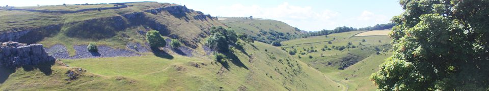
Rocky Edges & Heather Covered Moors
 Win Hill & Kinder in the background from Stanage Edge  Meandering along Stanage Edge  Descending to North Lees |