News Archive (August 2023)
Saturday 26th August
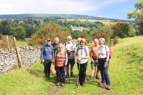
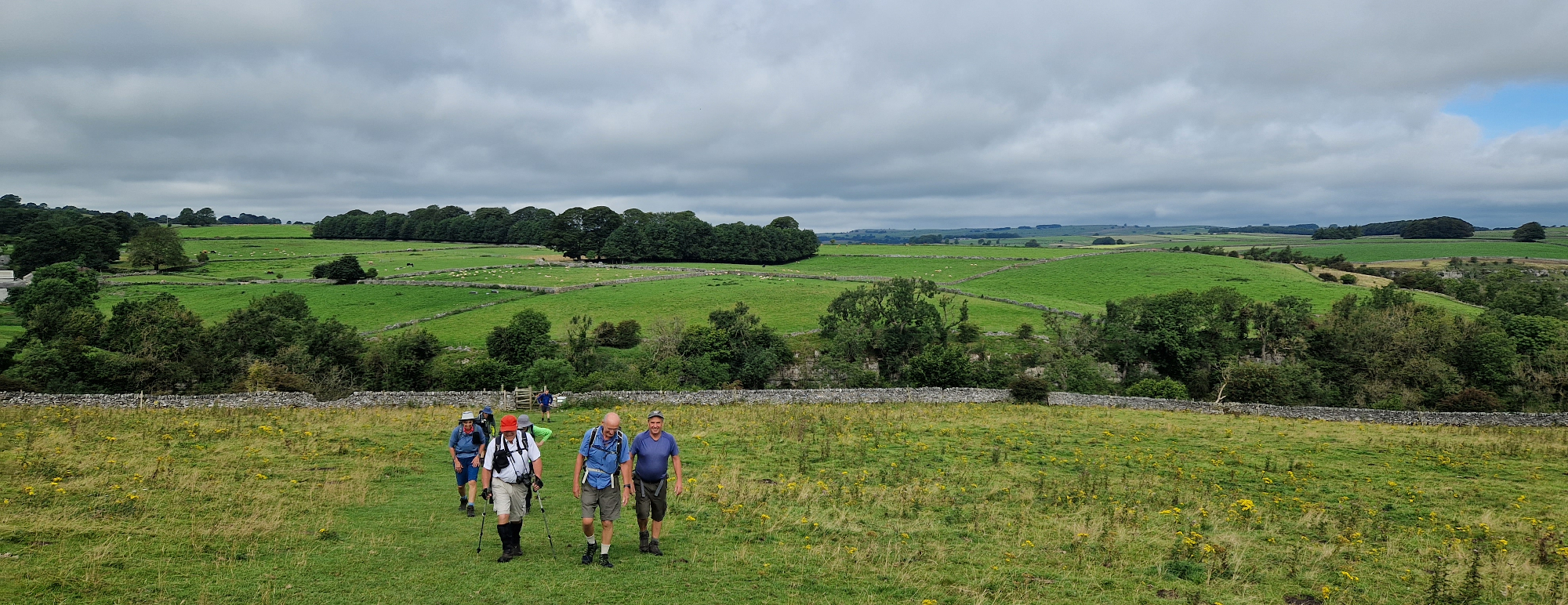
Stanton Moor & Nine Ladies
Leader & Report: Sue Photos: Mel
9 ramblers, including 2 visitors, left the car park at Old Station Close, Rowsley, hopeful that the rain would hold off till they returned & that they would not be caught in a thunder storm.
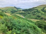
A steady climb took us up through wooded slopes, past impressive rock walls & other remains of quarrying activity, to the Nine Ladies Stone Circle on Stanton Moor, where we had our coffee break.

Aaron Hole Plantation looking down Coombs
From here our route took us downhill through the village of Stanton in Peak. Footpaths then continued to lead us downhill, eventually descending some steep steps to emerge on the road near Alport.
Then it was uphill to Shiningbank Quarry. The path was bordered by abundant wild marjoram, great mullein, knapweed & hare bells & the opaque blue pools that had collected in the quarry bottom could be seen far below.
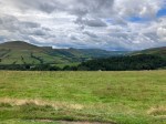
After a short sharp shower, we had lunch on Haddon Fields & when we set off again views of Haddon Hall opened up. After crossing the A6, we took a damp path alongside the River Wye, before rambling along lanes & tracks back to Rowsley.
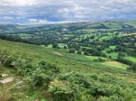
Throughout the day, we enjoyed panoramic views & warm sunshine, happy that the rain had held off except for one brief shower.
Haddon Fields with the Hall in the background
Distance: 8.8 miles
Ascent: 1384ft
Friday 25th August
Glyn Williams – Funeral Arrangements
We recently received the sad news that valued Chesterfield Rambler’s member, Glyn Williams, has recently passed away. Derbyshire Times (where Glyn worked as a journalist for many years) have published a tribute to Glyn, which includes details of funeral arrangements for any members who may wish to attend. Please see link below for further details.
https://uk.news.yahoo.com/sons-tribute-retired-derbyshire-times-064026046.html?guccounter=1

Image of Glyn leading his ‘Walk With Williams’ in 1984. Photo from the Derbyshire Times Article.
Wednesday 23rd August
Misbehaving Monks of Monyash
Leader & Report: Fiona Photos: Mel
Monyash, Cales Dale, Over Haddon, Conkbury Bridge, Lathkill Dale
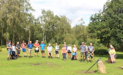
A group of 24 walkers which included 1 visitor and one possible new member set off walking from Monyash, a farming and former lead mining village.
No waterproofs in sight, walkers headed for the Limestone Way, towards One Ash Grange Farm. On arrival at the Grange there was no sight of a Monk, however there we sightings of a horse, 2 peacocks and a few goats. After descending into the head of Cales Dale and back out via a steep stepped climb it was time for a well deserved coffee break to enjoy the splendid pastoral vista of Lathkill Dale.
Following a path through to the tip of Low Moor Plantation and onward to Back Lane, crossing fields heading for Over Haddon, passing through the farm yard of Meadow Place Grange, walkers went down a track to cross a bridge at Lathkill Lodge.
The group then made a short road climb up into Over Haddon walking through the pretty village and around the back of the Lathkil Hotel.
Following the field path and after a short road descent towards Conksbury bridge the group turned right just before the bridge onto a path beside the river. Lunch break was taken looking over the beautiful crystal clear river Lathkill where walkers were joined by very inquisitive ducks and a swan.

The next stretch of the walk followed the river up the valley, through Palmerston Wood, along by various caves eventually passing a bridge at the foot of Cales Dale. The final part of the walk progressed up the narrow gorge over boulders emerging onto fields, then a short walk back into Monyash.

At the junction of Lathkill and Cales Dale
Distance: 11 miles
Ascent: 1360ft
Sunday 20th August
Dales and Hills
Leader & Report & Photos: John
Castleton, Cave Dale, Ox Low Rake, Mam Tor, Lose Hill
A group of 11 members, 1 guest and 1 dog set off from Hope on another rain free day, over the fields to Castleton, up Cave Dale along the Limestone Way until we branched off to Oxbow Rake. Lunch was taken on the slopes of Conies Dale overlooking Peak Forest and the magnificent scenery beyond. Walking across the fields to Mam Tor we started to come across other walkers who helped make up the normal Sunday crowds on the peak. The walk along the Great Ridge was a fitting end to the day descending to Townhead and Hope
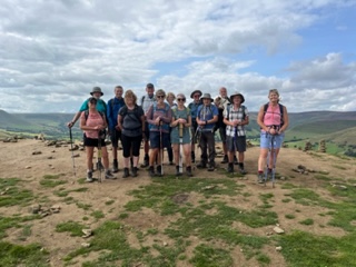
Group photo on Back Tor
Distance: 12.5 miles
Ascent: Over 2000ft
Saturday 19th August
Along the Trail and down the Hole
Leader, Report & Photos: Mel
Circular walk via Churn Hole, Wye Dale, Cheedale, Miller’s Dale and Priestscliffe.
A group of 12, including visitors, set off from Chelmorton following field paths and narrow lanes, defined by the areas iconic limestone walls, to arrive at the top of churn Hole. After taking in the views loins were girded for the steep descent to Topley Pike and the A6. After walking alongside the River Wye, enhanced by the presence of a Dipper, coffee break was taken at Blackwell Mill with some members taking the opportunity to partake of fresh coffee from the cycle hire centre. After crossing the Wye the riverside path was followed along the ever deepening gorge to reach Chee Dale with its sheer limestone cliffs and challenging stepping stones. Although some areas of the limestone strewn path were indeed challenging the visual rewards afforded by the views, especially the magnificent Chee Tor, and the sense of place made all efforts more than worthwhile. The group then continued to follow the riverside path to reach the remains of Millers Dale station where a leisurely lunch was taken in brilliant sunshine.
Following lunch the group dropped down to the road through Blackwell dale to pick up the Limestone Way along Long Lane past Priestcliffe Ditch and on to re cross the A6 road. The limestone strewn Sough Lane was then used to reach the crossing path which joins Chelmorton to Sough Top. Here an opportunity for a drink stop allowed everyone to take in the magnificent views and contemplate on the beauty looking down on the Wye and Chee Dale valley. Bribed with sweets then a swift right turn, a little more field walking and through the Led Rake back to Chelmorton with a short stop at Illy Willy Waters spring.
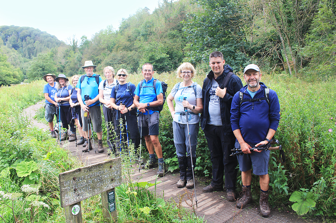
We made it through Chee Dale

Stepping along nicely
Wednesday 16th August
Rowsley
Leader & Report: Sue Photo: Mel
Churchtown, Darley Bridge, Wensley, Upper Town, Stanton Moor
On a warm & sunny summer’s day, 19 walkers and a dog called Pippa set off from the busy Old Station car park at Rowsley , where our fellow ramblers from the Rotherham Metro Group were also gathering.
Starting off at a brisk pace, we followed the River Derwent to Darley Bridge, then ascended a small hillock where we enjoyed a late coffee stop, overlooking Darley Dale. After descending to Oaker, our route passed through a number of fields, where cows were grazing with their calves, & into Wensley Dale, until it reached the outskirts of Wensley itself. Climbing again we passed an “eco lodge” which can be rented as a holiday cottage.
The steep & slightly slippery descent through Cambridge Wood which followed was the most challenging part of the walk & we were pleased to rest & refuel at our lunch spot at Old Millclose Mine. After lunch, we rambled through woods, along a lane and across meadows in order reach the Nine Ladies Stone Circle for a photo opportunity. The path took us across heathland, where we relished the sight & scent of heather & gorse & the buzzing of bees enjoying their nectar. From here it was downhill all the way back to our starting point. An enjoyable & varied walk for a lovely summer’s day.
Nine Ladies Stanton Moor
Distance: 11 miles
Ascent: 1400ft
Sunday 13th August
Along the Edges
Leader, Report & Photos: Mike
Low Bradfield, Sugworth Edge, Boot’s Folly, Moscar House, Derwent Edge, Foulstone Road, Strines Bridge, Brogging End, Dale Dyke Reservoir.
A group of 13 walkers plus Puzzle the dog, assembled at The Sands car park in Low Bradfield. The weather was still and overcast with a forecast for rain later in the day. The group started on time and headed through the village to pick up the bridleway to follow the ‘Sheffield Country Walk’ through Bradfield Dale and along Blindside Lane.
Entering a nice wooded section, the group continued on the SC Walk climbing through fields and boggy sections above the Strines Reservoir at Sugworth Edge to reach the stone tower known as Boot’s Folly. This structure was constructed by Charles Boot to give employment to his stone masons at the time of the depression in 1926. It stands adjacent to his home at that time, Sugworth Hall. A welcome coffee break was taken here to shelter from the oncoming showers.
Passing by the Hall, the group walked along Sugworth Road towards Moscar Crossroads to enter moorlands and Moscar House. Rain showers arrived again as the group started the steady climb on the bridleway above Highshaw Clough. Here, the group passed various grouse butts, to eventually reach Derwent Edge. Heading northwards along the edge, the group continued on to the Wheelstone rocks to take shelter and have a lunch break. During this break the clouds lifted and the group had fine and sunny conditions for the remainder of the walk.
The group continued to walk on the edge taking in the great views of Dams below and the fabulous display of purple and pink heather. The moorlands looked at their very best. Passing by the rock formations ‘Salt Cellar’ and ‘The Cakes of Bread’ the group headed eastwards at Bradfield Gate Head to descend down Foulstone Road bridleway to reach Strines Bridge.
Taking a short road section, the group reached Brogging End and made their way down and along the footpath on the western edge of Dale Dyke Reservoir. The collapse of the original dam wall in 1864 caused the ‘Great Flood of Sheffield’ and took the lives of 250 people. After this wooded section, the group emerged on to Dale Road and walked back into Low Bradfield and to the car park. Various walkers then took advantage of the refreshments on offer at the village cafe and pub.


Distance: 13 miles
Elevation: 1900ft
Saturday 12th August
Bothamsall
Photos: Mel
A circular walk via Kirton and Walesby and by the river Maun.

Comma butterfly
Wednesday 10th August
Beer and Religion do mix!
Gun End, Hollinhall, Heaton, Dane Bridge, Hanging Stone, Lud’s Church
Leader & Report : John Photos: Mel (and apprentice photographer Ashley!)
12 happy ramblers took up the challenge of this walk mainly to put away their waterproofs and get out the sun tan lotion.
The route took into account a few very muddy sections from the latest rainy season as well as an over grown section of nettles which unfortunately defeated us, but after a quick look at the map an alternative was found and a after a little backtracking we were on our way again.
Any one who had thoughts of a having a well earned rest and refreshment at Wincle Brewery, Danebridge were disappointed as we commenced the ascent to the Hanging Stone and Lud’s Church which was in splendid colour. The ascent continued onto the Roaches where fantastic views of Staffordshire, Derbyshire, Cheshire and distant Wales due to clear skies which were with us throughout the day.


Distance: 12 miles
Ascent: 2020ft
Sunday 6th August
Ladybower
Ashopton, via Crook Hill, Rowley Farm, Hope Cross, Hope Brink and Aston
Leader: Paul Photos: Mike
-
- Crook Hill
-
- Rowley Pasture
-
- Lose Hill & Edale
-
- Hope Valley
-

- A plug hole at LadyBower
Distance: 11.6 miles
Elevation: 1770ft
Saturday 5th August
5 Villages
Leader & Report: Isobel
At Harthill car park, a leader and four homeless people met: they must have been because who else would turn up for a ten-mile walk, on a day when the forecast was for continuous rain?
The walk began by skirting the eastern side of Harthill Reservoir. Unfortunately, the view was marred by the fact that the reservoir is currently empty for large scale works. After passing through a wood and across a field the route ran parallel to the M1 from Pebley Oaks passing Barlborough Hall and going up Ward Lane towards Barlborough, before eventually going under the M1. Having crossed more fields and passing Quarry Dam, Park Hall Farm at Spinkhill was reached. This farm is well known for causing problems with footpaths and currently is a maze of electric fences. These were negotiated successfully and Spinkhill Road was reached.
After crossing the road, the way was uphill through woods and fields to Upperthorpe and Church Town. From Church Town the line of the Chesterfield Canal was followed along the edge of Rother Valley and through Norwood. Heading uphill until it ducked under the M1 again before reaching Walseker Lane and returning to Harthill.
Distance: 10 miles
Wednesday 2nd August
Oh Odin
Leader: John Photo: Mel
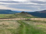
Mam Nick, Lords Seat, Perry Dale, Cave Dale, Castleton

Top of Cavedale
…. previously on
chesterfieldramblers
![]()