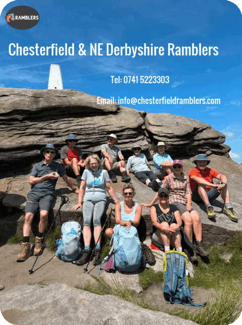
News Archive (January 2024)
Wednesday 31st January
Lumsdale to Cromford
Leaders: Anne & Bob Photos: David

A linear bus walk for seven from Upper Lumsdale to Cromford of just under eight miles, using the X17 bus. Fine if cold January weather for a route starting from the Lumsdale woods, and then on to Tansley, with a lunch stop at Riber Castle and a call at the High Peak Junction.


Wednesday 31st January
Up, Down, Along, Up, Down and Along again
Russian Cottage, Edensor, Chatsworth, Jubilee Rock, Robin Hood, Hob Hurst’s House, Chatsworth, Calton Lees.
Leader & Report: Neil D Photos: Mel H & Neil D
15 members and Mavis the dog met in Calton Lees car park and having informed everyone that the walk would be the opposite way round to that advertised, we made our way up Beeley hillside then up to Hob Hurst’s House for a coffee stop. We then followed the track across the edge of Gibbet Moor to join the boundary footpath which in turn took us down into Chatsworth Park. We were thrilled to be treated to a fly past by a single Red Arrow plane en route. Another climb then took us to the Hunting Tower for our lunch stop. Following lunch we looped round past Swiss Cottage then down past the Chatsworth old stables and across to Edensor village. It was then uphill again to Carlton Pastures and then downhill all the way to the car park. It was lovely to see several herds of deer watching us whilst walking through Chatsworth Park. Thanks to all for putting up with me and thanks to Mike for back marking.


Distance: 12.7 miles Ascent: 1650 ft
Saturday 27th January
Washlands and Trails
Avenue Farm, Grassmoor Country park, Five Pits Trail, Holmewood, Hagg Hill
Leader & Report: Neil D Photo: Mel H
16 walkers including 2 visitors from Leicester, and Minnie the dog, met at an unexpectedly busy car park (3 Football matches were taking place). We walked down through the Washlands under the railway line and up past Avenue Farm and continued onwards through Grassmoor to reach the start of The Five Pits Trail in Grassmoor Country Park. We followed this trail in a loop around Holmewood stopping for coffee at Wolfie pond. We ate lunch at Picnic tables further along the trail on the far side of Holmewood looking over to Clay Cross with Ashover Fabric on the skyline. We completed the loop back to Wolfie pond then walked across to Hagg Hill House before dropping down onto the Avenue Washlands path back to the car. The weather was kind to us all the way round. So we were very fortunate. Thanks to all for putting up with me, and thanks to Jeff for back marking.

Enjoying the View from Hagg Hill.

Overview of the route walked
Distance: 10 miles Ascent: 450 ft
Saturday 20th January
Holmebrook
Ashgate, Frith Hall, Hemming Green, Linacre Reservoirs, Cutthorpe.
Leader & Report: Mike B Photos: Mel H
A group of 15 walkers plus two dogs met and set off from Holmebrook in the direction of Ashgate. Included in the group was one visitor, Jill, trying her first walk with the Ramblers. Hopefully she will join up and walk with us again in the future. It was a cool and breezy morning with rain forecast for later in the day. The group made its way through Holmehall Estate to reach Woodnook Lane and followed this lane to reach Upper Ashgate. Continuing on Piper Lane to Broomhall Farm, a coffee break was taken with biscuits provided by the leader. Following Westwick Lane the group climbed up to Frith Hall. The ‘Cruck Barn’ at the Hall was highlighted and its unique construction explained to those in the group who hadn’t seen it before. The group followed the bridleway up Bagshaw Lane and though the farm and stables at The Birches to reach Hemming Green. Crossing the road here, the group followed the footpath above Priestfield Wood. After stopping here for a group photograph, the group dropped down to reach the top reservoir at Linacre and had lunch at the picnic tables by the waters edge.

The group above the top Linacre Reservoir
The group followed the boardwalk and paths around the top reservoir and continued on the paths through the woods towards the bottom reservoir and made use of the toilets situated there. Refreshed, the group walked along the footpaths through Kitchenflat Wood, passing Cutthorpe Hall and Hall Farm and back to the start point at Holmebrook Valley Country Park. The weather stayed fine throughout and not as muddy as previous walks. Enjoyed by all in the group.
Distance: 7.7 miles Elevation: 950 ft
Wednesday 17th January
Odin to Jaggers
Leader: Kath P Photos: Mel …


Sunday 14th January
Bolsover
Leader, Report & Photos: John H
18 people assembled at High Street, Bolsover. We descended Surprise View onto the Back Hills passing one of the four conduit houses; part of a system to supply water to the castle. The view is wide ranging across the Doe Lea valley to the three towers of Hardwick Hall, Crich Stand and the plateau of Cocking Tor above Ashover. Then back up to the top of the escarpment and along Hornscroft passing the edge of the ancient earth work that once surrounded the town. The first destination was St Leonard’s Church, Scarcliffe, reached across the fields from Hillstown, passing the hawthorn covered “Blue Banks”, a mound of shale spoil from the now defunct Lancs East Coast railway tunnel excavation; an air vent remains. There was no service this Sunday but the church wardens kindly showed us round and related the legend of Lady Constantia and her son, John.
Inside St Leonards
Sculpture of the Lady Constantia and her infant son.
https://churchmonumentssociety.org/monument-of-the-month/a-monument-with-a-story A path from the back of the church led us to the track up and over the eastern slopes of Fox Hill for coffee break, then down to Gildwells and up through Cross Hills plantation to a ½ km section of the A632 to negotiate before turning right down to the bed of the river Poulter, on its way to the Trent via Cuckney and Carburton Lake. Above the river near the top of the hill is Langwith Cave. I had prearranged with the farmer that the gate was unlocked to allow access. Excavations in the early 20 th century found remains of woolly rhinoceros and cave bears as well as evidence of hearths and flints


Group by the entrance to the cave
Inside the cave
https://her.derbyshire.gov.uk/Monument/MDR6323 Return was along the Archaeological Way with lunch break at the edge of Langwith Wood followed by our second crossing of the Poulter leading to the ancient bridle way of Poulter Well Lane, the eponymous well passed on our right. On to Palterton and back across the top of the Magnesian Limestone escarpment to Bolsover.


Distance: 9 miles Ascent: 600ft
Saturday 13th January
Crich
Leader, Report & Photos: Simon R
Eight stout souls enjoyed a 10 mile circular walk from Crich, bathed in winter sunshine. The route took in Fritchley, Heage Windmill, Starvehimvalley Bridge, Cromford Canal, Pentrich (lunch), Parkhead.


Friday 12th January
BBC finds nearly 32,000 places where paths are blocked in England and Wales
You may have heard through various news outlets that a BBC investigation has found nearly 32,000 places in England and Wales where walkers are blocked from using the path network. Ramblers always encourage members to make sure we report any obstructions or blockages that we come across. If blockages are not reported, they will never be removed so it’s crucial we make sure the local highway authority is aware. To find out more about reporting problems on our right of way network, check out the comprehensive guide on the ramblers website, or contact our footpath secretary & coordinators Mel Hardy & Mike Sims who can assist with reporting blocked paths to the relevant authorities.
Wednesday 10th January
Winter Wander Bakewell and Chatsworth
Coombs Farm, Bakewell, Ballcross Farm, Edensor, Chatsworth,
Leader & Report: Dermot Photos: Mel
25 walkers, including 2 visitors, participated in a very nice walk on a cool, dryish January day. We left the car park at Rowsley and walked up to Coombs Farm before picking up the Monsall Trail and walking on to Bakewell Station. After coffee at Bakewell Station and then we climbed up the road to Ballcross Farm. The planned route was changed due to the number of fallen trees and deep mud on the path through the Castle Hill Woods. From there we walked through a muddy Carlton Pastures and down to Edensor where we had lunch overlooking Chatsworth House. After lunch we followed the banks of the Derwent and stopped for our photo shoot in front of Chatsworth House. We then walked through the meadow to Beeley and then followed the footpath at the side of the B6012 road to Rowsley to avoid even more mud. Just before the end of the walk we had some extra physical activity as we had to cross two large fallen trees blocking our path which required a bit of negotiation. An earlier than usual finish largely due to the absence of stiles – only one!

Chatsworth House and the fountain as a backdrop – the hunting tower just visible on the sky line.
Distance: 10.5 miles Ascent: 1096ft
Saturday 6th January
Happy New Year in Happy Valley
Poolsbrook Country Park, Clowne Greenway, Slayley Lane, Woodhouse Lane, Happy Valley, Cuckoo Way
Leader & Report: Fiona Photos: Mel H
A group of 12 walkers, which included 4 new members, started the walk around Poolsbrook Park on what was a beautiful sunny morning. Many varieties of water birds were to be seen on the lake including Canada and Greylag geese. Leaving the lake we headed for the Clowne Greenway, crossing the river Doe Lea. We then left the Greenway at Slayley Lane but not before looking right to see Bolsover Castle on the horizon. After walking up Slayley Lane we headed for Woodhouse Lane where we stopped for lunch sitting in the warmth of the sun under a brilliant blue sky. Heading off again we walked to Happy Valley, joined the Cuckoo Way and finally joined the Trans Pennine Way.

The group on Woodhouse Lane.
Monday 1st January
Happy New Year
Castleton, Cave Dale, Mam Nick, Mam Tor, Hollins Cross, Lose Hill
Leader, Report & Photos: Mel H
Sixteen members, including visitors from Leicester, set out from Hope for the now traditional New Year’s Day walk. Accompanied by a brilliant blue sky and slightly warmer than usual weather the group followed the path alongside Peakshole Water to Castleton. Coffee break, enhanced by beautiful chocolate cake, was taken half way up Cave Dale with views over the Hope Valley with Lose Hill and Wooler Knoll forming the backdrop. Climbing to the top of Cavedale the route then followed the track past Rowter Farm before dropping down to skirt Windy Knoll before the climb to Mam Nick and Mam Tor. Here the traditional group photo was taken around the trig point followed by lunch with wonderful views of Castleton and the upper reaches of the Hope Valley. At Hope Cross the group split with half taking the lower route along Barker Bank and Brockett Booth Plantation whilst the remainder took the more challenging course up Back Tor and Lose Hill. After re grouping at the base of Lose Hill the path down past Lose Hill Farm was used for the return to Hope. My sincere thanks to all those who supported this traditional walk and provided me with assistance and encouragement along the way.

At the Mam Tor Trig point

…. previously on
chesterfieldramblers
![]()