News Archive (July 2023)
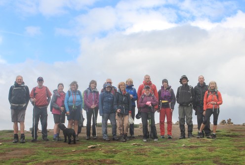
Saturday 29th July
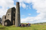
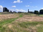
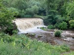
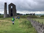
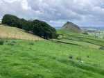
Ashford in the Water
Leader: Mike Photo: Mike, Michael & Mel
Great Shacklow Wood, Deep Dale, Wheal Lane, Magpie Mine, Sheldon and Kirk Dale
-

- At the Magpie Mine
-
- At the Magpie Mine
-
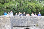
- All on the Sheepwash Bridge


Elevation: 960 Ft
Notice of an extra walk added to the programme
A big thank you to Neil who has kindly offered to lead an extra Monday evening walk starting at 6pm on Monday 31st July. The circular walk will begin from the Grassmoor Country Park car park on Birkin Lane, Chesterfield.
Grid reference: SK 41200 67179
Nearest postcode: S42 5BP
what3words: secure.reader.tucked
Start time: 6:00 pm
This walk is open to both members and non members and will be approx. 4 miles at a leisurely pace.
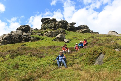
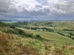
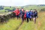
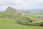
Wednesday 26th July
Hathersage with a bit of an Edge
Leader: Dermot Photos: Dermot & Mel
Hathersage, Bolehill Wood, Bamford Edge, Shatton, Derwent Valley Heritage Trail
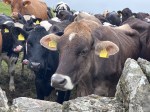
19 walkers, including 2 visitors, participated in a very pleasant walk on a very pleasant bright July day.
We left Hathersage Station and walked via Baulk Lane towards Bolehill Wood passing some fellow ramblers from Rotherham who were also out today to explore the local area.
Our coffee stop at Bolehill Wood was accompanied by rhubarb flapjack which proved to be very popular. We then finished the ascent onto Bamford Edge and stopped for our photo shoot – not to mention taking time to admire the magnificent views of the Peak District from this unique vantage point.
We then descended to Heatherdene before we crossed the Ladybower Dam Wall. Our lunch stop was an open area adjacent to the Thornhill Trail so we could enjoy the views of Bamford Edge and celebrate our earlier climb.
After lunch we headed to Shatton and then enjoyed the flattish walk back to Hathersage following south bank of the River Derwent.
Mileage 10.9m
Ascent 1322 ft.
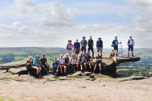
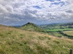
Bamford Edge
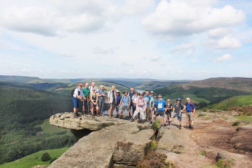
Great Tor Bamford Edge with Ladybower in the background.

Bamford Edge from the Derwent Heritage Way – just to show the walkers where they had been.
Sunday 23rd July
Ashford in the Water
Leader: Paul Photos: Mike
Monsal Trail, Monsal Dale, White Lodge, Deep Dale, Magpie Mine, Over Haddon & Bakewell.


13.4 miles
1250ft elevation
Wednesday 19th July
Rob Randal’s Memorial Walk
Leader: Gavin & Rhona Photo: Mel
Slippery Stones, Deer Holes, Barrow and Grinnah Stones, Round Hill, Linch Clough
Looking back at Grinnah Stones mid-descent
Monday 17th July
Poolsbrook Circular
Leader: Tricia B Photos: Mel
Tricia led her first walk for the group this evening. The sun shone for what was an excellent walk starting from Poolsbrook Country Park.

Near the ponds created by Countryside Services to encourage nature
Wednesday 12th July
Chrome Hill (Peaky Blinders)
Leader & Report: Mike Photos: Mike & Mel
Longnor, Hardings Booth, Fawside Edge, Leycote, Chrome Hill, Earl Sterndale, Underhill
A group of 13 walkers ventured over the border to the Staffordshire Moorlands and started the walk from the village of Longnor. The weather was cool for July and it was forecast to be changeable with heavy showers at times.
The group followed the Manifold Trail in a westerly direction through fields and farm tracks for about 4 miles. Passing through Hardings Booth and a steep climb up to Fawside Edge. A diversion from the trail was necessary at Ball Bank House Farm as extensive and very tall bracken was blocking the path. This obstruction has been subsequently reported to the Staffordshire Rights of Way.
A steady descent to High Ask was followed by another steep climb up to Edge Top for a well earned coffee break. Sadly, heavy rain arrived and shortened this break.The quality of the stiles at this location and others on the walk were found to be poor and have also been been reported.
A section of road walking was made along Edge Top giving excellent views towards Axe Edge and Buxton. Following the footpath the group descended to the hamlets of Gollingate and Tenterhill. A narrow and stoney path lead the group down to a very old packhorse bridge over River Dove. Heavy rain made this section quite tricky underfoot. The group continued up another steady climb following the paved pack horse route to Leycote and onwards to Booth Farm. The imposing Chrome Hill AKA the ‘Dragons Back’, became visible at this stage.
The group continued on paths through the open grasslands above Tor Rock and then picked up the Concessionary Footpath down and towards Chrome Hill. After the lunch break the group made their ascent of this limestone feature. A stiff wind was encountered early on and care was needed on certain exposed rocky sections. The summit was soon reached and gave good views of the surroundings. The steady but long descent to the road below gave everyone’s knees a good work out!
Going around the bottom section of Park House Hill, the group made their way towards Hitter Hill. Climbing a section of this hill, the group headed towards and through the village of Earl Sterndale.
Another steady climb from here took the group in the direction of Longnor. The wet conditions underfoot made the descent to Underhill Farm a little tricky in places but everyone made it safely down. On looking back up the hill the group was treated to aerial display by a large Barn Owl.
Continuing along farm tracks and footpaths the group passed Beggers Bridge and made two more steady climbs back into Longnor.It was tough walk on stoney paths and tracks with a large amount of climb. The remoteness of this part of Staffordshire and the great views on show was fine reward for our efforts.

Distance: 10.25 miles
Ascent: 2250 ft
Wednesday 5th July
Around The Vale Of Edale
Leader & Report: Isobel Photos: Mel
Hollins Cross, Lose Hill, Jagger’s Clough, Ollerbrook Booth
The car park in Edale was the starting point for a circular walk round the Edale Valley. The weather forecast was for rain in the morning and brighter weather in the afternoon. It turned out to be accurate and luckily the rain wasn’t heavy and the sun appeared in the afternoon.
Sixteen ramblers set off across the fields to Barber Booth before starting the climb up to the Great Ridge. The coffee stop provided views across towards Kinder and up and down the valley. After reaching Hollins Cross the route continued along the ridge via Back Tor to Lose Hill. On the way we passed several groups of teenagers taking part in the DofE scheme weighed down by huge rucksacks. After the stiff climb up, the walk descended to Townhead, where way turned north passing Losehill House Hotel, before the tarmac changed to a broad grassy track. Edale Road was reached and crossed at Bagshaw Bridge.
After walking through Upper Fulwood Farm a concessionary path through woodland was followed to Jaggers Clough. After another climb a beautiful view of the Great Ridge opened up and the morning’s route was visible in the sunshine. From there the way skirted the northern side of the Edale valley passing Rowland Cote Youth Hostel and descending to Ollerbrook Booth and Edale.
Distance: 10 miles
Monday 3rd July
Ford Circular
Leader, Report & Photos: Isobel
Plumbley, Haven Farm, Ridgeway, Carterhall Farm and Birley Hay
Once again, a group of seven met for an evening stroll this time from the car park behind the Bridge Inn at Ford. The sun was shining and everyone had their fingers crossed that the heavy showers of earlier in the day were over.
The walk started by the side of the fishing ponds and the Moss. It then turned northeast across fields and along a track to Plumbley Farm before crossing more fields to meet the bridle way from Mosborough to Haven Farm that emerges onto B6388 near High Lane. The lovely views across the Moss Valley, woods and ripening crops in the evening light also included a rainbow.
The route continued west towards Ridgeway and after crossing the main road it turned right by the Swan Inn and then dropped down to Robinbrook Lane. At Carterhall Farm the direction changed again to almost due south following field edge paths to Geerlane Farm. From there it was a quick and easy return passing more fishing ponds and the mill pond and wear to reach the car park just before the rain returned with vengeance.

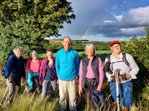
Distance: 5 miles
…. previously on
chesterfieldramblers
![]()