Short Walks


(1) Carr Vale (3 miles)
Short walks are often available not too far from our own doorstep that can fill the odd half day, without a great travelling commitment.
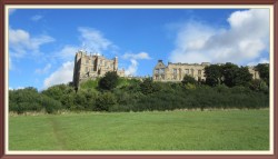
One such area to be explored are the nature reserves sandwiched between the English Heritage sites of Bolsover Castle and Sutton Scarsdale Hall.
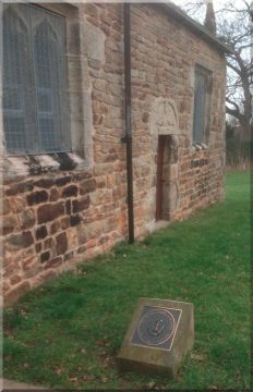
From the Riverside Way car park just off the A632 road on the edge of Bolsover you find yourself immediately in the Peter Fidler Nature Reserve.
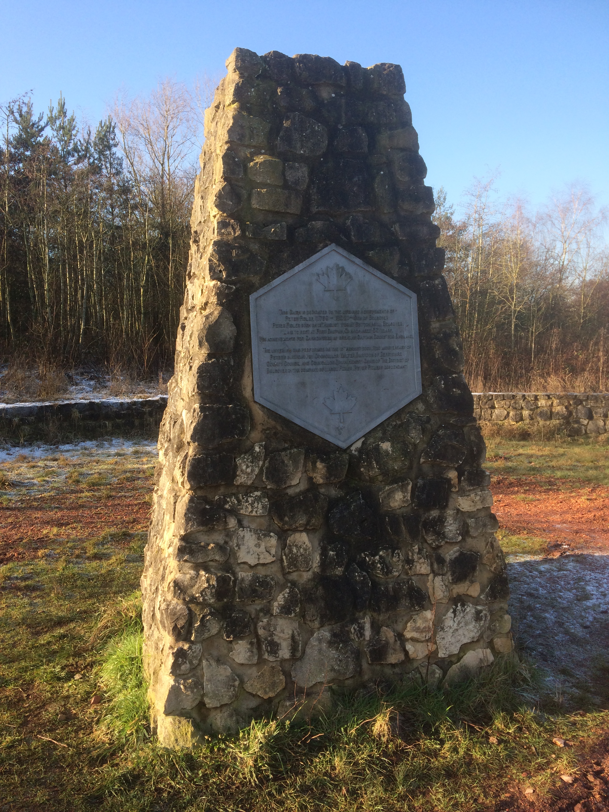
A walk to the right quickly brings the Peter Fidler memorial into view.
This was a remarkable local man who joined the Hudson Bay Company in 1788 and played a significant role in the early surveying and mapping of Canada, marrying a Cree wife and fathering 14 children in the process.
His memorial here is matched by one at Meadow Lake, Saskatchewan.
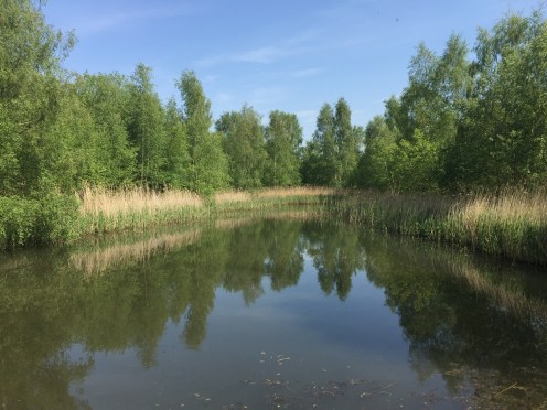
The Fidler reserve merges into the Carr Vale Nature Reserve in the very attractive wooded wetlands controlled by the Derbyshire Wildlife Trust
Crossing over the Doe Lea leads onto the Stockley Trail, from where a route can be followed into the model village of New Bolsover.
Built around a ‘village green’ in the 19th century by colliery owners with the interests of their employees at heart, the model village is well on the way back to its former glory, thanks to an injection of refurbishment lottery money.
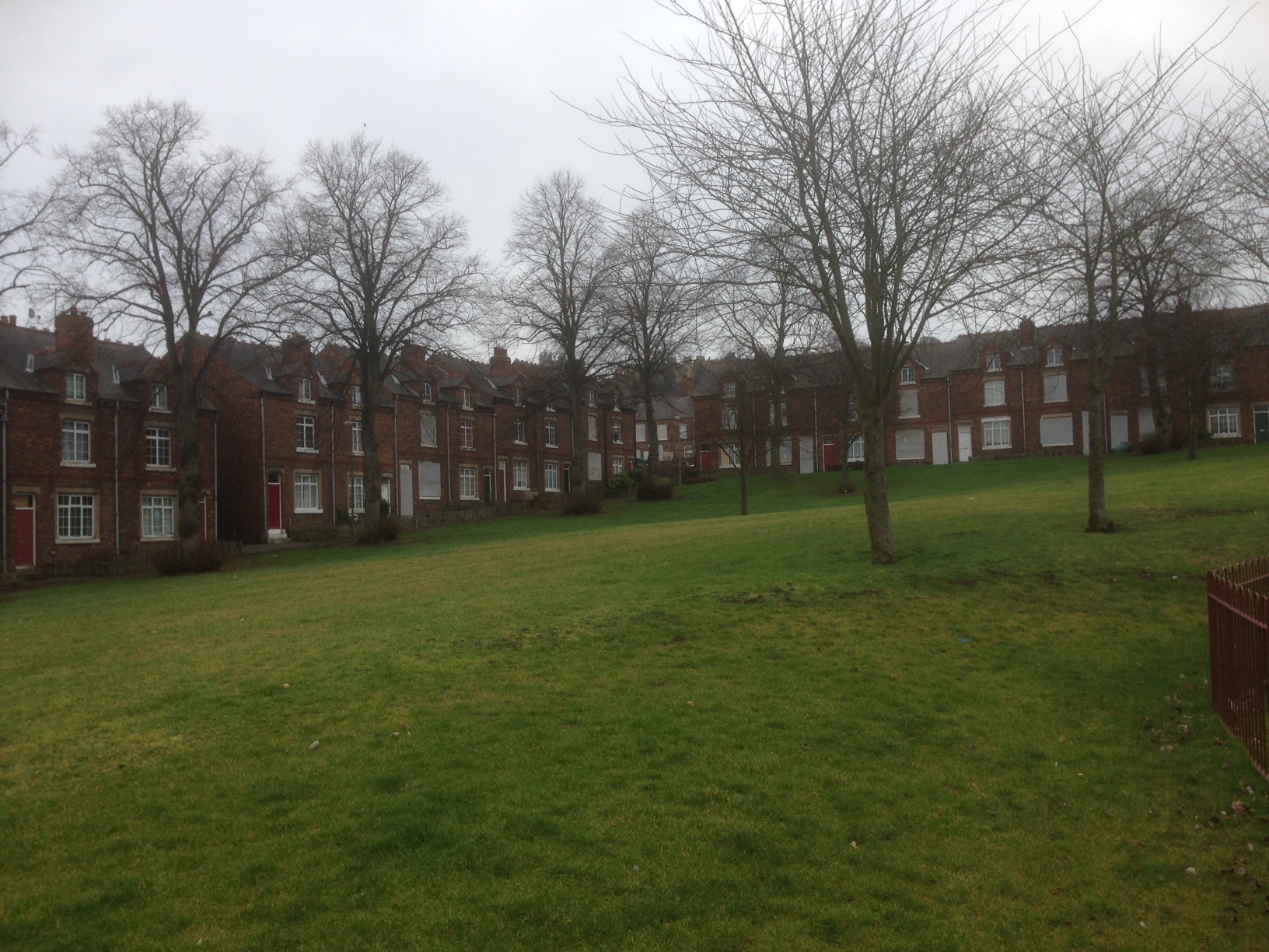
At the upper end of the model village lies a grassy hill leading to Bolsover Castle, giving fine views back to the nature reserves and the country beyond.
Refreshments are available in Bolsover and a return to Riverside Way can be made by the grassy verge alongside the A632.
(2) Avenue Washlands (4.8 miles)
With a railway line passing through the centre of it and housing surrounding part of it, the Avenue Washlands doesn’t quite match the wildness of many other nature reserve sites – but it nevertheless provides a popular walking area close to Chesterfield, and has formed the basis of several past Ramblers group walks.
This short circular from Hasland can also be started at various points surrounding the Washlands, such as Wingerworth, Tupton, and Grassmoor.

Leaving the Green on the outskirts of Hasland, follow the footpath that runs roughly parallel to the Grassmoor road, passing through several well-built gates, helpfully provided by the ‘Big Local’ Green and Open Spaces Working Group.
Walk due south, passing Hasland Cemetery on your left and Avenue Farm on your right.Where the track bears left into Grassmoor follow the footpath across the fields and turn right at Mill Lane, heading towards the railway line.
Turn left just before the line and continue south along the path to Tupton, keeping to the east side of the railway.
On reaching the road at Hagg Hill, turn right and follow Bridge Street and Queen Victoria Road before turning right into North Side.
Then turn right towards the local Rugby Club and head north towards the Washlands area on the west side of the railway line.

On reaching Mill Lane again, turn right and then quickly left on the broad path heading north towards Chesterfield town centre.
At the River Rother monitoring station turn right on the path over the railway line back to Hasland Green.
(3) A Stephenson Trail (3.3 miles)
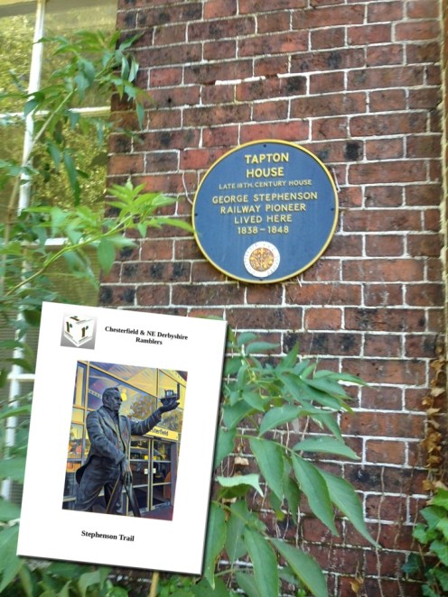
The railway pioneer George Stephenson (1781-1848) was born in Northumberland, but has a strong association with Chesterfield.
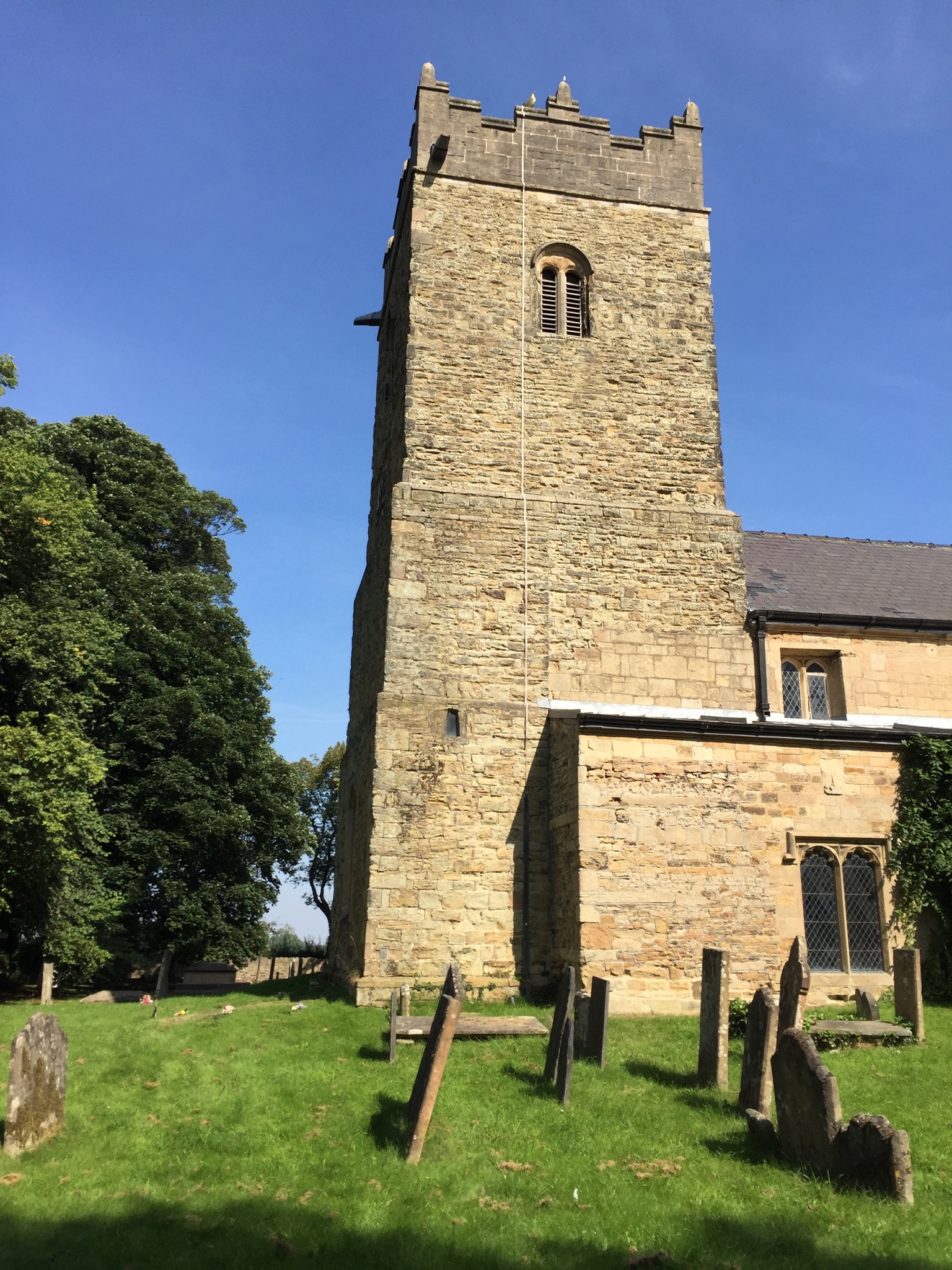
He spent the last ten years of his life at Tapton House and is buried in Holy Trinity Church in the town.
This three and a quarter mile trail begins at his statue outside Chesterfield Railway Station and follows a route to Tapton House and Holy Trinity Church, before returning to the town centre and the Stephenson Memorial Hall (Museum), which holds Stephenson
memorabilia.
Beginning outside Chesterfield Railway Station at the statue of Stephenson holding a model of ‘Locomotion’ (an early steam engine) the trail follows Crow Lane on to Tapton Golf Course and the route of the southern spur of the Trans-Pennine Trail.
After crossing the golf course turn left into Pettyclose Lane and after a while look for a footpath on the left leading into Tapton Park.
Bear to the left in the Park and follow a path through woodland approaching Tapton House. A blue plaque is by the front door of the building.
Follow the road down to the Park exit on Brimington Road, but before reaching it bear sharply backwards to the left along a public footpath heading south,running fairly close to the Midland mainline railway.
Turn right along a footbridge over the railway and cross Brimington Road.
Bearing right, away from Chesterfield town centre,there is a fairly well hidden footpath on the left leading down to the Chesterfield Canal.
Turn left at the Canal and continue straight on across the A61 footbridge, emerging on to Wharf Lane.
From Wharf Lane, turn left into Infirmary Road and right into Shirland Street.
At the end turn left and follow Sheffield Road past the Abercrombie Street junction.
Cross over and enter the churchyard of Holy Trinity Church.

George Stephenson is buried in the Church below an east window provided by his son, Robert.
Leave the churchyard by the main gate, and turn left into Newbold Road.
Cross the road and take the footpath on the right known as Union Walk towards Chesterfield Town Centre.
Turn left into Saltergate and proceed along Holywell Street towards the Crooked Spire.
The Stephenson Memorial Hall, with Stephenson memorabilia, will be found at the junction of St Mary’s Gate, adjacent to the Spire.
Crossing St Mary’s Gate take the path through the Churchyard and turn left into Stephenson Place.
This is the end of the walk, and refreshments, if required, can be found in the town centre.

(4) Chesterfield Western Walk (4.6 miles)

Revolution House, Old Whittington
(5) Two Revolutions (7 miles)
Old Whittington, The Handleys, Barrow Hill, River Rother
A local morning walk of 7 miles, passing two ‘revolution’ museums.
The first meaning of ‘revolution’ is ‘a change in the way a country is governed, usually to a different political system and often using violence or war’ and is reflected in Old Whittington’s
‘Revolution House’, with its part in the Glorious Revolution of 1688.
The other meaning is ‘one complete circular movement of something, for example, a wheel’ and can refer to Barrow Hill’s railway ‘Roundhouse’.
(Definitions from the Cambridge Dictionary)
A steady climb from Old Whittington leads to the Handleys, and is followed by a descent to Barrow Hill.

River Rother on the Hollingwood Hoop
The return is via the River Rother, which runs parallel to the Chesterfield Canal here and forms part of the
‘Hollingwood Hoop’.
The Canal Trust hold an annual
Walking Festival each September.
(6) Bluster Castle (4.3 miles)
Linacre, Birley, Oxton Rakes, Ingmanthorpe
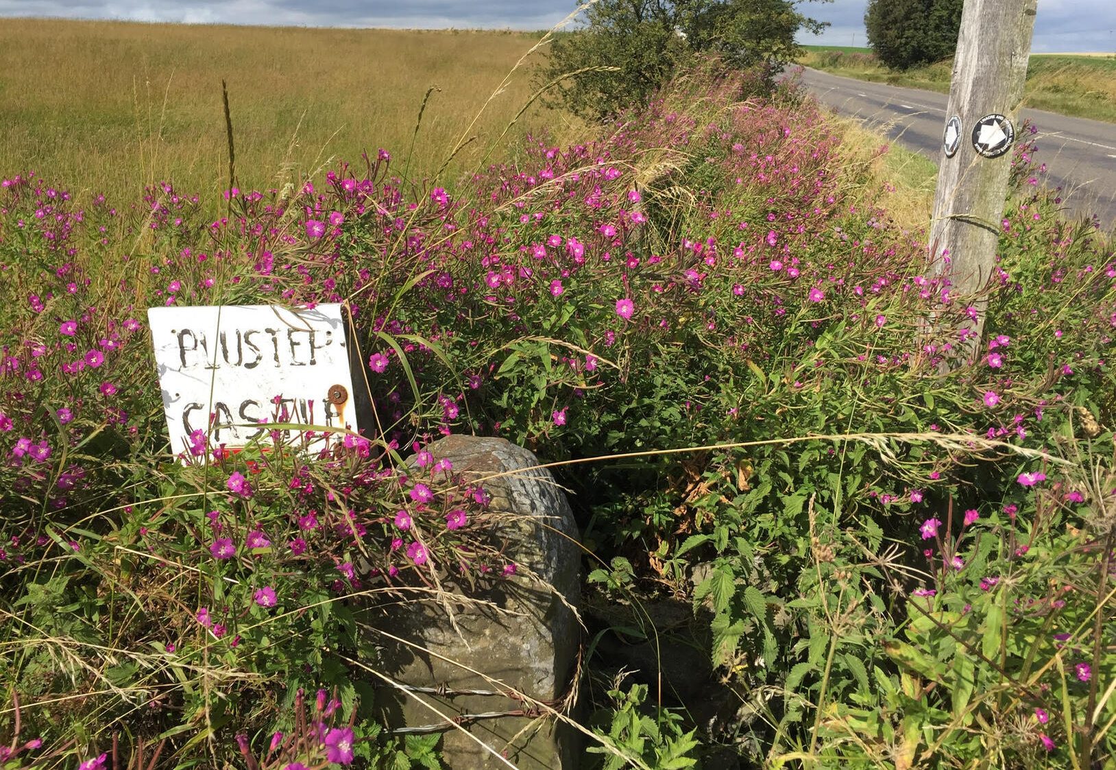
Another short morning walk of a little over 4 miles, this one requiring more energy than some, as it involves a climb with some hefty wall stiles from the Linacre Reservoirs to Bluster Castle, at virtually 1000 feet.
No evidence of any castle here – the area was probably named after its windswept nature – but it gives fine views over Chesterfield & NE Derbyshire.

(7) Silverhill (3.1 miles)
Silverhill, Teversal
A walk of 3 miles, just over the Nottinghamshire border from Hardwick.
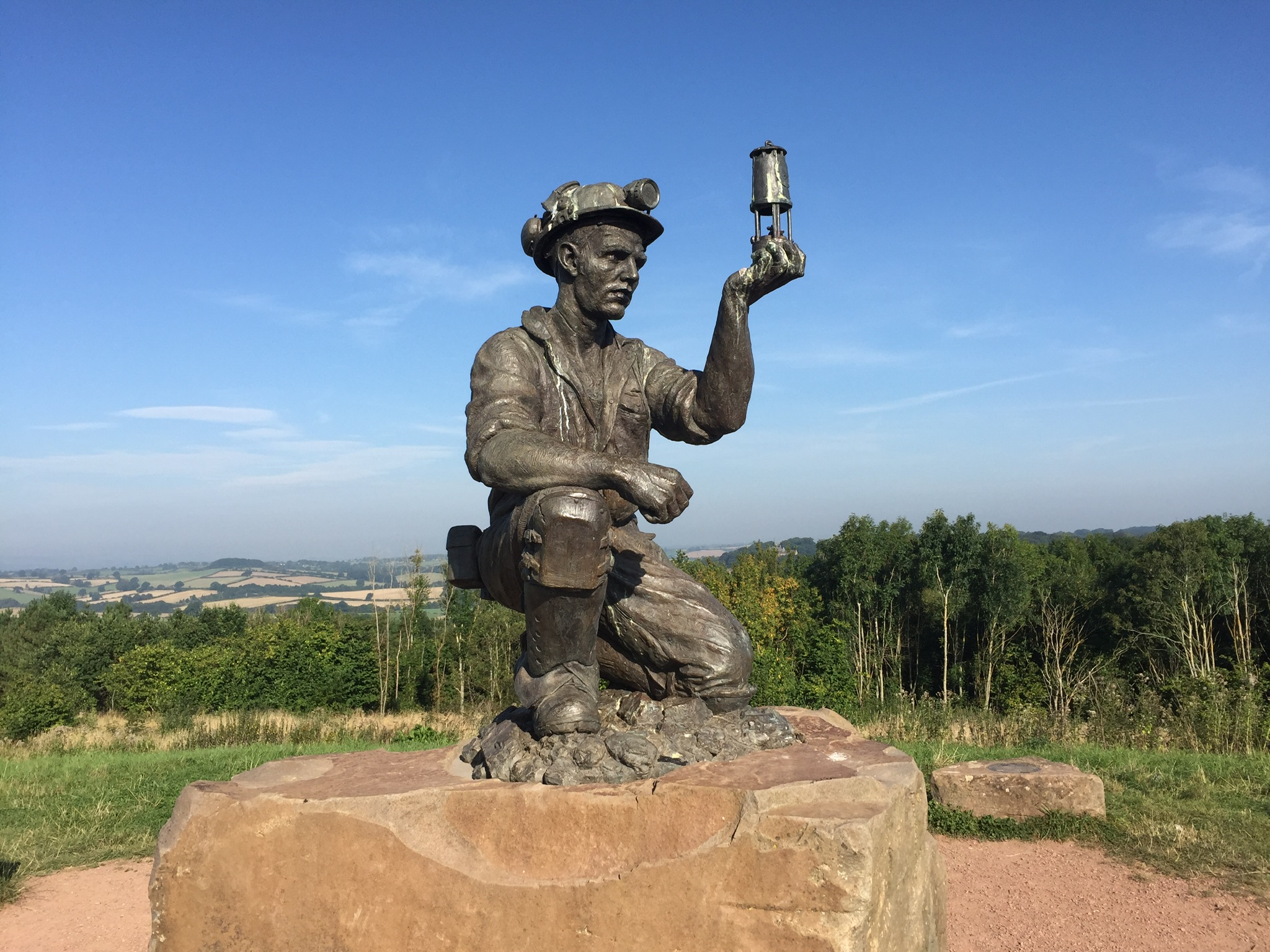 From the Silverhill Wood car park, make the gentle ascent to the ‘Miner’ – on the site of one of many former pits in the area, and widely claimed to be the Nottinghamshire high point of 670 feet.
The sculpture, entitled ‘Testing for Gas’ , was created by artist Antony Dufort as ‘a tribute to the miners of the Nottinghamshire coalfields’.
Hardwick Hall can be seen behind the trees.
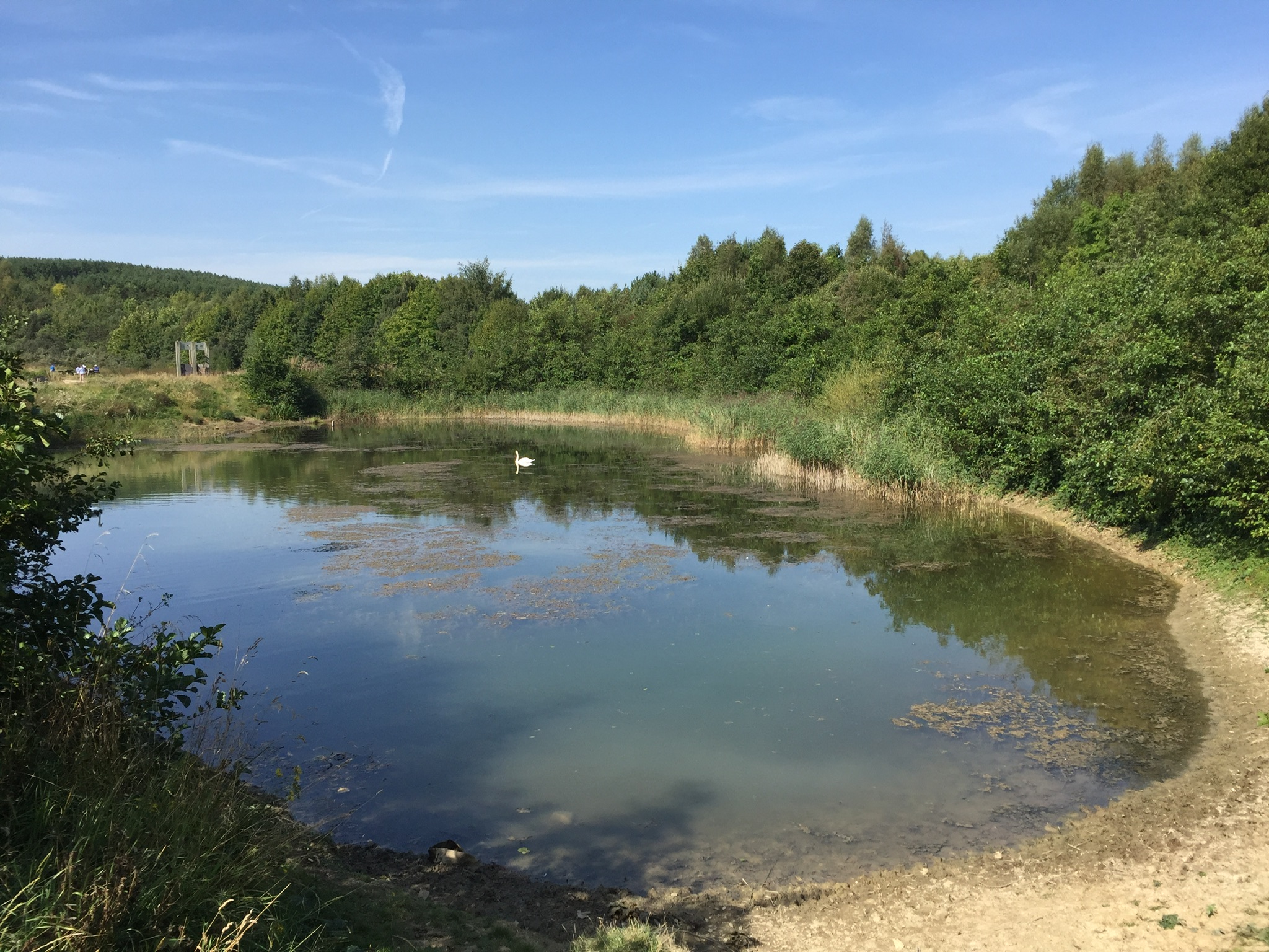
Continue along the track around the Wood and after passing between two small lakes take the Silverhill Trail to Teversal village. The old village contains St. Katherine’s Church and, behind it Teversal Manor, the assumed home of Lady Chatterley in the DH Lawrence novel.
Return via the Silverhill Trail and the lower path of the Wood.
(8) Chesterfield Northern Walk (4.31 miles)
Newbold