Parish Rights of Way ….
![]()
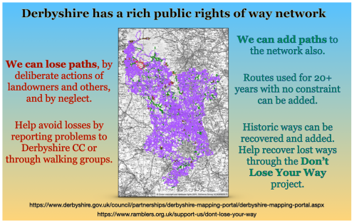
There are many paths, both ‘lost’ over time or used every day, that are unrecorded by the County Council, and are not legal ‘rights of way’.
Pre-1949 unrecorded paths were due to be ‘extinguished’ in 2026 by legislation in the Crow Act (2000).
The cut-off in this part of the Act has now been moved to 2031.
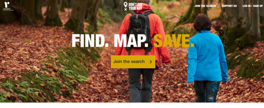
The following have been identified in our group area as potential claims on the Ramblers ‘Don’t Lose your Way’ (DLYW) project.

Holmesfield 125177
Barlow 126200
Brampton 126205
Eckington 131609
Eckington 131610
Eckington 131934
Eckington 131975
Eckington 131976
Eckington 132279
Heath & Holmewood 133392
Any member willing to further research these, or who can identify unrecorded paths not shown in the parish lists below is invited to contact Bernard Caddy or Ken Brockway to help.


How to claim an unrecorded right of way
The link to the maps below show current rights of way (in bold colours) for all 42 ‘parish’ categories defined by the County Council in the north-east of the county (Bolsover, Chesterfield, & NE Derbyshire) as defined in April, 2019.
| Area* | Ordnance Survey |
Bing Aerial |
Area* | Ordnance Survey |
Bing Aerial |
||
|---|---|---|---|---|---|---|---|
| Ashover | NED | Holymoorside & Walton | NED | ||||
| Ault Hucknall | B | Killamarsh | NED | ||||
| Barlborough | B | Morton | NED | ||||
| Barlow | NED | North Wingfield | NED | ||||
| Blackwell | B | Pilsley | NED | ||||
| Bolsover | B | Pinxton | B | ||||
| Brackenfield | NED | Pleasley | B | ||||
| Brampton | NED | Scarcliffe | B | ||||
| Brimington | C | Shirebrook | B | ||||
| Calow | NED | Shirland & Higham | NED | ||||
| Chesterfield | C | South Normanton | B | ||||
| Clay Cross | NED | Staveley | C | ||||
| Clowne | B | Stretton | NED | ||||
| Dronfield | NED | Sutton cum Duckmanton | NED | ||||
| Eckington | NED | Temple Normanton | NED | ||||
| Elmton | B | Tibshelf | B | ||||
| Glapwell | B | Tupton | NED | ||||
| Grassmoor | NED | Unstone | NED | ||||
| Heath & Holmewood | NED | Wessington | NED | ||||
| Hodthorpe & Belph | B | Whitwell | B | ||||
| Holmesfield | NED | Wingerworth | NED |
* B Bolsover C Chesterfield NED North-East Derbyshire

Bolsover


Chesterfield


NE Derbyshire


Any lost ways here ?
1898 map
(National Library of Scotland)

Open Street Map – Recorded and unrecorded paths
Open Street Map displays both recorded and unrecorded paths. Derbyshire County Council recorded rights of way are overlaid here

Google Street View
Google Street View, whilst generally not displaying footpaths, often shows them where they meet roads

The Ramblers Full Guide to claiming an unrecorded right of way on user evidence
Identifying & Claiming unrecorded rights of way (Peak & Northern Footpath Society)

Current Definitive Map Modification (DMMO) applications